 |
|
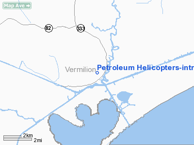
Petroleum Helicopters-intracoastal City Heliport |
|
|
Location &
QuickFacts
|
FAA
Information Effective: |
2008-09-25 |
|
Airport
Identifier: |
7LS4 |
|
Airport
Status: |
Operational |
|
Longitude/Latitude: |
092-09-00.4580W/29-47-45.7560N
-92.150127/29.796043 (Estimated) |
|
Elevation: |
3 ft / 0.91 m (Estimated) |
|
Land: |
19 acres |
|
From
nearest city: |
1 nautical miles N of Intracoastal City, LA |
|
Location: |
Vermilion Parish, LA |
|
Magnetic Variation: |
03E (2000) |
Owner & Manager
|
Ownership: |
Privately owned |
|
Owner: |
Phi, Inc. |
|
Address: |
Po Box 90808
Lafayette, LA 70509 |
|
Manager: |
Base Supervisor Phi |
|
Address: |
24836 Hwy 333
Abbeville, LA 70510 |
|
Phone number: |
337-893-1882
LFT OFFICE 337-235-2453. |
Airport Operations and Facilities
|
Airport Use: |
Private |
|
Wind indicator: |
Yes |
|
Segmented Circle: |
No |
|
Control Tower: |
No |
|
Landing fee charge: |
No |
|
Sectional chart: |
Houston |
|
Region: |
ASW - Southwest |
|
Boundary ARTCC: |
ZHU - Houston |
|
Tie-in FSS: |
DRI - De Ridder |
|
FSS on Airport: |
No |
|
FSS Toll Free: |
1-800-WX-BRIEF |
Airport Services
|
Airframe
Repair: |
NONE |
|
Power
Plant Repair: |
NONE |
|
Runway Information
Helipad H1
|
Dimension: |
400 x 400 ft / 121.9 x 121.9 m |
|
Surface: |
CONC-TURF, |
|
|
Runway H1
|
Runway
|
|
Traffic
Pattern: |
Right |
Left |
|
Radio Navigation Aids
|
ID |
Type |
Name |
Ch |
Freq |
Var |
Dist |
|
AR |
NDB |
Acadi |
|
269.00 |
03E |
17.8 nm |
|
PTN |
NDB |
Patterson |
|
245.00 |
01E |
42.7 nm |
|
ECY |
NDB |
Eunice |
|
263.00 |
02E |
48.4 nm |
|
LLA |
VOR/DME |
White Lake |
041X |
110.40 |
04E |
14.1 nm |
|
LFT |
VORTAC |
Lafayette |
035X |
109.80 |
03E |
25.3 nm |
Based Aircraft
|
Aircraft based
on field: |
3 |
|
Helicopters: |
3 |
Petroleum Helicopters-intracoastal City
Heliport
Address:
Vermilion Parish, LA
Tel:
337-893-1882, 337-235-2453
Images
and information placed above are from
http://www.airport-data.com/airport/7LS4/
We
thank them for the data!
|
General Info |
| Country |
United
States |
| State |
LOUISIANA |
| FAA ID |
7LS4
|
| Latitude |
29-47-45.756N |
|
Longitude |
092-09-00.458W |
|
Elevation |
3 feet
|
| Near
City |
INTRACOASTAL CITY |
We don't guarantee the information is fresh and accurate. The data may
be wrong or outdated.
For more up-to-date information please refer to other sources.
|
|


