 |
|
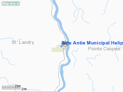
Pete Antie Municipal Heliport |
|
|
Location &
QuickFacts
|
FAA
Information Effective: |
2008-09-25 |
|
Airport
Identifier: |
7L9 |
|
Airport
Status: |
Operational |
|
Longitude/Latitude: |
091-44-46.9100W/30-41-39.6100N
-91.746364/30.694336 (Estimated) |
|
Elevation: |
30 ft / 9.14 m (Estimated) |
|
Land: |
0 acres |
|
From
nearest city: |
0 nautical miles N of Melville, LA |
|
Location: |
St Landry Parish, LA |
|
Magnetic Variation: |
03E (1995) |
Owner & Manager
|
Ownership: |
Publicly owned |
|
Owner: |
Town Of Melville |
|
Address: |
Po Box 268
Melville, LA 71353 |
|
Phone number: |
318-623-4226 |
|
Manager: |
Ms. Pam Cannatella |
|
Address: |
Po Box 268
Melville, LA 71353 |
|
Phone number: |
337-623-4226 |
Airport
Operations and Facilities
|
Airport
Use: |
Open to public |
|
Segmented Circle: |
No |
|
Control
Tower: |
No |
|
Lighting
Schedule: |
PHONE REQ
FOR PERIMETER LGTS CALL 337-623-4226. |
|
Sectional chart: |
Houston |
|
Region: |
ASW - Southwest |
|
Boundary
ARTCC: |
ZHU - Houston |
|
Tie-in
FSS: |
DRI - De Ridder |
|
FSS on
Airport: |
No |
|
FSS Toll
Free: |
1-800-WX-BRIEF |
|
NOTAMs
Facility: |
DRI (NOTAM-d service avaliable) |
Airport
Communications
|
Runway Information
Helipad H1
|
Dimension: |
40 x 30 ft / 12.2 x 9.1 m |
|
Surface: |
CONC, |
|
|
Runway H1
|
Runway
|
|
Traffic
Pattern: |
Left |
Left |
|
Radio Navigation Aids
|
ID |
Type |
Name |
Ch |
Freq |
Var |
Dist |
|
HZ |
NDB |
Hazer |
|
356.00 |
04E |
13.8 nm |
|
OPL |
NDB |
St Landry |
|
335.00 |
04E |
18.4 nm |
|
BWK |
NDB |
Bunkie |
|
397.00 |
03E |
27.2 nm |
|
MKV |
NDB |
Marksville |
|
347.00 |
02E |
29.4 nm |
|
ECY |
NDB |
Eunice |
|
263.00 |
02E |
37.2 nm |
|
AR |
NDB |
Acadi |
|
269.00 |
03E |
44.8 nm |
|
LRR |
NDB |
Allen Parish |
|
379.00 |
03E |
48.8 nm |
|
BTR |
VORTAC |
Baton Rouge |
112X |
116.50 |
06E |
26.6 nm |
|
LFT |
VORTAC |
Lafayette |
035X |
109.80 |
03E |
32.7 nm |
Pete Antie Municipal Heliport
Address:
St Landry Parish, LA
Tel:
318-623-4226
Images
and information placed above are from
http://www.airport-data.com/airport/7L9/
We
thank them for the data!
|
General Info |
| Country |
United
States |
| State |
LOUISIANA |
| FAA ID |
7L9
|
| Latitude |
30-41-39.610N |
|
Longitude |
091-44-46.910W |
|
Elevation |
30 feet
|
| Near
City |
MELVILLE
|
We don't guarantee the information is fresh and accurate. The data may
be wrong or outdated.
For more up-to-date information please refer to other sources.
|
|


