 |
|
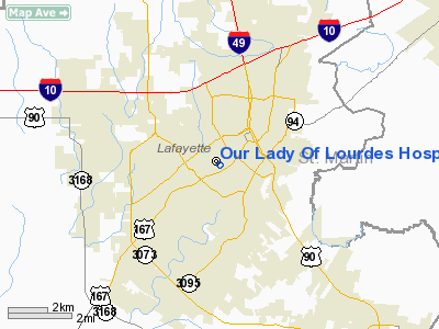
Our Lady Of Lourdes Hospital Heliport |
Location &
QuickFacts
|
FAA
Information Effective: |
2008-09-25 |
|
Airport
Identifier: |
69LA |
|
Airport
Status: |
Operational |
|
Longitude/Latitude: |
092-01-42.4340W/30-12-48.7230N
-92.028454/30.213534 (Estimated) |
|
Elevation: |
90 ft / 27.43 m (Estimated) |
|
Land: |
0 acres |
|
From
nearest city: |
0 nautical miles N of Lafayette, LA |
|
Location: |
Lafayette Parish, LA |
|
Magnetic Variation: |
04E (1985) |
Owner & Manager
|
Ownership: |
Privately owned |
|
Owner: |
Our Lady Of Lourdes
REG MED CTR. |
|
Address: |
611 St Landry St
Lafayette, LA 70502 |
|
Phone
number: |
337-289-2000 |
|
Manager: |
Paula Jenkins
CHIEF EXEC OFFICER |
|
Address: |
611 St Landry St
Lafayette, LA 70502 |
|
Phone number: |
337-289-2775 |
Airport Operations and Facilities
|
Airport
Use: |
Private
MEDICAL. |
|
Wind
indicator: |
Yes |
|
Segmented Circle: |
No |
|
Control
Tower: |
No |
|
Lighting
Schedule: |
DUSK-DAWN |
|
Sectional chart: |
Houston |
|
Region: |
ASW - Southwest |
|
Boundary
ARTCC: |
ZHU - Houston |
|
Tie-in
FSS: |
DRI - De Ridder |
|
FSS Toll
Free: |
1-800-WX-BRIEF |
|
Runway Information
Helipad H1
|
Dimension: |
48 x 48 ft / 14.6 x 14.6 m |
|
Surface: |
CONC,
ROOFTOP. |
|
|
Runway H1
|
Runway
|
|
Traffic
Pattern: |
Left |
Left |
|
Radio Navigation Aids
|
ID |
Type |
Name |
Ch |
Freq |
Var |
Dist |
|
AR |
NDB |
Acadi |
|
269.00 |
03E |
17.7 nm |
|
OPL |
NDB |
St Landry |
|
335.00 |
04E |
26.8 nm |
|
ECY |
NDB |
Eunice |
|
263.00 |
02E |
30.1 nm |
|
HZ |
NDB |
Hazer |
|
356.00 |
04E |
37.6 nm |
|
BWK |
NDB |
Bunkie |
|
397.00 |
03E |
40.6 nm |
|
LRR |
NDB |
Allen Parish |
|
379.00 |
03E |
42.8 nm |
|
PTN |
NDB |
Patterson |
|
245.00 |
01E |
46.9 nm |
|
LLA |
VOR/DME |
White Lake |
041X |
110.40 |
04E |
37.6 nm |
|
LFT |
VORTAC |
Lafayette |
035X |
109.80 |
03E |
2.2 nm |
|
BTR |
VORTAC |
Baton Rouge |
112X |
116.50 |
06E |
41.4 nm |
Remarks
-
PRVDD ONLY
MEDICAL EMERG OPERS ARE CONDUCTED; LETTER OF AGREEMENT WITH LAFAYETTE REGIONAL
ARPT ATCT IS COMPLIED WITH.
Our Lady Of Lourdes Hospital Heliport
Address:
Lafayette Parish, LA
Tel:
337-289-2000,
337-289-2775
Images
and information placed above are from
http://www.airport-data.com/airport/69LA/
We
thank them for the data!
|
General Info |
| Country |
United
States |
| State |
LOUISIANA |
| FAA ID |
69LA
|
| Latitude |
30-12-48.723N |
|
Longitude |
092-01-42.434W |
|
Elevation |
90 feet
|
| Near
City |
LAFAYETTE |
We don't guarantee the information is fresh and accurate. The data may
be wrong or outdated.
For more up-to-date information please refer to other sources.
|
|


