 |
|
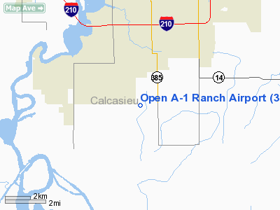
Location &
QuickFacts
|
FAA
Information Effective: |
2008-09-25 |
|
Airport
Identifier: |
3LA8 |
|
Airport
Status: |
Operational |
|
Longitude/Latitude: |
093-13-40.5530W/30-08-18.7500N
-93.227931/30.138542 (Estimated) |
|
Elevation: |
16 ft / 4.88 m (Estimated) |
|
Land: |
0 acres |
|
From
nearest city: |
6 nautical miles SE of Lake Charles, LA |
|
Location: |
Calcasieu Parish, LA |
|
Magnetic Variation: |
05E (1985) |
Owner & Manager
|
Ownership: |
Privately owned |
|
Owner: |
Open A-1 Ranch Inc |
|
Address: |
P.o. Box 378
Lake Charles, LA 70601 |
|
Manager: |
Thomas H Gayle |
|
Address: |
P.o. Box 378
Lake Charles, LA 70601 |
|
Phone number: |
337-433-4489 |
Airport Operations and Facilities
|
Airport Use: |
Private |
|
Wind indicator: |
No |
|
Segmented Circle: |
No |
|
Control Tower: |
No |
|
Landing fee charge: |
No |
|
Sectional chart: |
Houston |
|
Region: |
ASW - Southwest |
|
Boundary ARTCC: |
ZHU - Houston |
|
Tie-in FSS: |
DRI - De Ridder |
|
FSS on Airport: |
No |
|
FSS Toll Free: |
1-800-WX-BRIEF |
Airport Services
|
Airframe
Repair: |
NONE |
|
Power
Plant Repair: |
NONE |
|
Runway Information
Runway 16/34
|
Dimension: |
2250 x 75 ft / 685.8 x 22.9 m |
|
Surface: |
TURF, |
|
|
Runway 16
|
Runway 34
|
|
Traffic
Pattern: |
Left |
Left |
|
Radio Navigation Aids
|
ID |
Type |
Name |
Ch |
Freq |
Var |
Dist |
|
UX |
NDB |
Sulfy |
|
278.00 |
04E |
10.6 nm |
|
DQU |
NDB |
De Quincy |
|
410.00 |
05E |
21.7 nm |
|
ORG |
NDB |
Orange |
|
211.00 |
05E |
29.8 nm |
|
DR |
NDB |
Idder |
|
385.00 |
04E |
37.3 nm |
|
LRR |
NDB |
Allen Parish |
|
379.00 |
03E |
41.1 nm |
|
ECY |
NDB |
Eunice |
|
263.00 |
02E |
47.7 nm |
|
BPT |
VOR/DME |
Beaumont |
092X |
114.50 |
07E |
42.6 nm |
|
LCH |
VORTAC |
Lake Charles |
081X |
113.40 |
07E |
6.4 nm |
Remarks
-
MAY BE EXEMPT
UNDER GRANDFATHER CLAUSE.
Open A-1 Ranch Airport
Address:
Calcasieu Parish, LA
Tel:
Images
and information placed above are from
http://www.airport-data.com/airport/3LA8/
We
thank them for the data!
|
General Info |
| Country |
United
States |
| State |
LOUISIANA |
| FAA ID |
3LA8
|
| Latitude |
30-08-18.750N |
|
Longitude |
093-13-40.553W |
|
Elevation |
16 feet
|
| Near
City |
LAKE
CHARLES |
We don't guarantee the information is fresh and accurate. The data may
be wrong or outdated.
For more up-to-date information please refer to other sources.
|
|


