 |
|
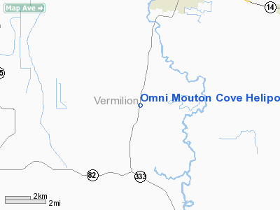
Omni Mouton Cove Heliport |
Location &
QuickFacts
|
FAA
Information Effective: |
2008-09-25 |
|
Airport
Identifier: |
18LS |
|
Airport
Status: |
Operational |
|
Longitude/Latitude: |
092-10-06.0000W/29-53-31.0000N
-92.168333/29.891944 (Estimated) |
|
Elevation: |
10 ft / 3.05 m (Estimated) |
|
Land: |
15 acres |
|
From
nearest city: |
11 nautical miles S of Abbeville, LA |
|
Location: |
Vermilion Parish, LA |
|
Magnetic Variation: |
() |
Owner & Manager
|
Ownership: |
Privately owned |
|
Owner: |
Omni Aviation Services |
|
Address: |
4500 Ne Evangeline Thruway
Carencro, LA 70520 |
|
Phone number: |
800-319-5347 |
|
Manager: |
John Ross |
|
Address: |
Po Box 3761
Lafayette, LA 70502 |
|
Phone number: |
337-898-2745 |
Airport Operations and Facilities
|
Airport Use: |
Private |
|
Wind indicator: |
Yes |
|
Control Tower: |
No |
|
Sectional chart: |
Houston |
|
Region: |
ASW - Southwest |
|
Boundary ARTCC: |
ZHU - Houston |
|
Tie-in FSS: |
DRI - De Ridder |
|
FSS Toll Free: |
1-800-WX-BRIEF |
Airport Services
|
Runway Information
Helipad H1
|
Dimension: |
100 x 100 ft / 30.5 x 30.5 m |
|
Surface: |
TURF, |
|
|
Runway H1
|
Runway
|
|
Traffic
Pattern: |
Left |
Left |
|
Radio Navigation Aids
|
ID |
Type |
Name |
Ch |
Freq |
Var |
Dist |
|
AR |
NDB |
Acadi |
|
269.00 |
03E |
16.4 nm |
|
ECY |
NDB |
Eunice |
|
263.00 |
02E |
42.7 nm |
|
PTN |
NDB |
Patterson |
|
245.00 |
01E |
44.7 nm |
|
OPL |
NDB |
St Landry |
|
335.00 |
04E |
46.0 nm |
|
LLA |
VOR/DME |
White Lake |
041X |
110.40 |
04E |
17.4 nm |
|
LFT |
VORTAC |
Lafayette |
035X |
109.80 |
03E |
20.3 nm |
Based Aircraft
|
Aircraft based
on field: |
10 |
|
Helicopters: |
10 |
Omni Mouton Cove Heliport
Address:
Vermilion Parish, LA
Tel:
800-319-5347, 337-898-2745
Images
and information placed above are from
http://www.airport-data.com/airport/18LS/
We
thank them for the data!
We don't guarantee the information is fresh and accurate. The data may
be wrong or outdated.
For more up-to-date information please refer to other sources.
|
|


