 |
|
|
|
|
|
Location &
QuickFacts
|
FAA
Information Effective: |
2008-09-25 |
|
Airport
Identifier: |
L47 |
|
Airport
Status: |
Operational |
|
Longitude/Latitude: |
092-13-04.3800W/31-53-45.9500N
-92.217883/31.896097 (Estimated) |
|
Elevation: |
130 ft / 39.62 m (Estimated) |
|
Land: |
55 acres |
|
From
nearest city: |
1 nautical miles E of Olla, LA |
|
Location: |
La Salle Parish, LA |
|
Magnetic Variation: |
04E (1985) |
Owner & Manager
|
Ownership: |
Publicly owned |
|
Owner: |
La Salle Parish Police Jury |
|
Address: |
Po Box 57
Jena, LA 71342 |
|
Phone number: |
318-992-2101 |
|
Manager: |
Kary Howe |
|
Address: |
Po Box 3181
Ruston, LA 71272 |
|
Phone number: |
318-257-5478 |
Airport
Operations and Facilities
|
Airport
Use: |
Open to public |
|
Wind
indicator: |
Yes |
|
Segmented Circle: |
No |
|
Control
Tower: |
No |
|
Lighting
Schedule: |
DUSK-DAWN |
|
Beacon
Color: |
Clear-Green (lighted land airport)
ROTG BCN OTS INDEFLY. |
|
Landing
fee charge: |
No |
|
Sectional chart: |
Houston |
|
Region: |
ASW - Southwest |
|
Boundary
ARTCC: |
ZHU - Houston |
|
Tie-in
FSS: |
DRI - De Ridder |
|
FSS on
Airport: |
No |
|
FSS Toll
Free: |
1-800-WX-BRIEF |
|
NOTAMs
Facility: |
DRI (NOTAM-d service avaliable) |
Airport Communications
Airport Services
|
Airframe
Repair: |
NONE |
|
Power
Plant Repair: |
NONE |
|
Bottled
Oxygen: |
NONE |
|
Bulk
Oxygen: |
NONE |
|
Runway Information
Runway 03/21
|
Dimension: |
3010 x 75 ft / 917.4 x 22.9 m |
|
Surface: |
ASPH, Poor Condition
RY SFC CRACKED; DIP IN RUNWAY NEAR RY 03 END. |
|
Weight Limit: |
Single wheel: 9000 lbs. |
|
|
Runway 03
|
Runway 21
|
|
Longitude: |
092-13-13.3900W |
092-12-55.3700W |
|
Latitude: |
31-53-33.1900N |
31-53-58.7100N |
|
Traffic
Pattern: |
Left |
Left |
|
Markings: |
Basic, Good Condition |
Basic, Good Condition
DSPLCD THLD MARKINGS NON-STANDARD; NO CHEVRONS, ARROWS OR THLD BAR. |
|
Displaced
threshold: |
0.00 ft |
190.00 ft |
|
Obstruction: |
50 ft trees, 1200.0 ft from runway, 20:1 slope to clear |
50 ft trees, 250.0 ft from runway, 150 ft left of
centerline, 1:1 slope to clear
APCH SLOPE TO DSPLCD THLD 20:1.
15 FT ROAD 150 FT FM THLD; ALSO 4 FT FENCE. |
|
Radio Navigation Aids
|
ID |
Type |
Name |
Ch |
Freq |
Var |
Dist |
|
IFJ |
NDB |
Winnfield |
|
402.00 |
04E |
22.8 nm |
|
JBL |
NDB |
Hodge |
|
256.00 |
04E |
31.7 nm |
|
TUF |
NDB |
Stuckey |
|
350.00 |
03E |
36.2 nm |
|
MRK |
NDB |
Molly Ridge |
|
338.00 |
02E |
38.2 nm |
|
IE |
NDB |
Campi |
|
407.00 |
04E |
46.2 nm |
|
ROQ |
NDB |
Ruston |
|
368.00 |
03E |
46.8 nm |
|
MKV |
NDB |
Marksville |
|
347.00 |
02E |
48.7 nm |
|
HAH |
NDB |
Natchez-adams County |
|
388.00 |
03E |
48.8 nm |
|
SWB |
VOR/DME |
Sawmill |
84Y |
113.75 |
02E |
23.9 nm |
|
HEZ |
VOR/DME |
Natchez |
037X |
110.00 |
03E |
49.8 nm |
|
MLU |
VORTAC |
Monroe |
119X |
117.20 |
03E |
38.4 nm |
|
AEX |
VORTAC |
Alexandria |
108X |
116.10 |
03E |
41.1 nm |
Remarks
-
APRON COND POOR.
-
PONDING ON RY &
TWYS DURG HEAVY RAINS.
-
RY 03/21 40-50 FT
TREES ALONG BOTH SIDES OF RY PENETRATE TRANSITION SLOPE.
-
ARPT CLSD NIGHTS.
-
RY 03 HAS A DIP
450 FT FM APCH END OF RY.
Based Aircraft
|
Aircraft based
on field: |
3 |
|
Single Engine
Airplanes: |
1 |
|
Ultralights: |
2 |
Operational Statistics
Time Period: 2007-02-21 - 2008-02-20
|
Aircraft
Operations: |
72/Week |
|
General
Aviation Local: |
67.6% |
|
General
Aviation Itinerant: |
32.4% |
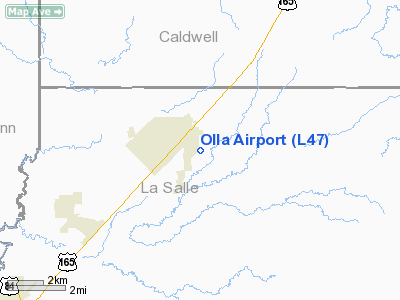
Olla Airport
Address:
La Salle Parish, LA
Tel:
318-992-2101, 318-257-5478
Images
and information placed above are from
http://www.airport-data.com/airport/L47/
We
thank them for the data!
|
General Info |
| Country |
United
States |
| State |
LOUISIANA |
| FAA ID |
L47
|
| Latitude |
31-53-43.593N |
|
Longitude |
092-13-04.495W |
|
Elevation |
130 feet
|
| Near
City |
OLLA
|
We don't guarantee the information is fresh and accurate. The data may
be wrong or outdated.
For more up-to-date information please refer to other sources.
|
|


