 |
|
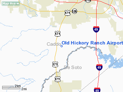
Old Hickory Ranch Airport |
Location &
QuickFacts
|
FAA
Information Effective: |
2008-09-25 |
|
Airport
Identifier: |
56LA |
|
Airport
Status: |
Operational |
|
Longitude/Latitude: |
093-49-05.6510W/32-20-42.5640N
-93.818236/32.345157 (Estimated) |
|
Elevation: |
180 ft / 54.86 m (Estimated) |
|
Land: |
0 acres |
|
From
nearest city: |
1 nautical miles NE of Keithville, LA |
|
Location: |
Caddo Parish, LA |
|
Magnetic Variation: |
05E (1985) |
Owner & Manager
|
Ownership: |
Privately owned |
|
Owner: |
David L. Billingsley |
|
Address: |
3391 Barron Road
Keithville, LA 71047 |
|
Phone number: |
318-925-9501 |
|
Manager: |
David L. Billingsley |
|
Address: |
3391 Barron Road
Keithville, LA 71047 |
|
Phone number: |
318-925-9501 |
Airport
Operations and Facilities
|
Airport
Use: |
Private |
|
Wind
indicator: |
Yes |
|
Segmented Circle: |
Yes |
|
Control
Tower: |
No |
|
Landing
fee charge: |
No |
|
Sectional chart: |
Memphis |
|
Region: |
ASW - Southwest |
|
Boundary
ARTCC: |
ZFW - Fort Worth |
|
Tie-in
FSS: |
DRI - De Ridder |
|
FSS on
Airport: |
No |
|
FSS Toll
Free: |
1-800-WX-BRIEF |
|
Runway Information
Runway 18/36
|
Dimension: |
3500 x 100 ft / 1066.8 x 30.5 m |
|
Surface: |
ASPH-TURF,
50' CNTR OF RWY ASPH. |
|
|
Runway 18
|
Runway 36
|
|
Traffic
Pattern: |
Right |
Left |
|
Obstruction: |
50 ft trees, 50.0 ft from runway |
50 ft trees, 50.0 ft from runway |
|
Radio Navigation Aids
|
ID |
Type |
Name |
Ch |
Freq |
Var |
Dist |
|
MSD |
NDB |
Mansfield |
|
414.00 |
04E |
17.1 nm |
|
RPF |
NDB |
Carthage |
|
332.00 |
04E |
26.2 nm |
|
MNE |
NDB |
Minden |
|
201.00 |
04E |
31.6 nm |
|
VIV |
NDB |
Vivian |
|
284.00 |
06E |
32.4 nm |
|
CZJ |
NDB |
Amason |
|
341.00 |
04E |
35.2 nm |
|
SPH |
NDB |
Springhill |
|
375.00 |
05E |
40.3 nm |
|
MMY |
NDB |
Many |
|
272.00 |
04E |
48.6 nm |
|
HMQ |
NDB |
Homer |
|
212.00 |
02E |
49.3 nm |
|
ATA |
NDB |
Atlanta |
|
347.00 |
04E |
49.3 nm |
|
BAD |
TACAN |
Barksdale |
105X |
|
05E |
12.2 nm |
|
DTN |
VOR |
Downtown |
|
108.60 |
07E |
12.3 nm |
|
EMG |
VORTAC |
Elm Grove |
049X |
111.20 |
07E |
11.8 nm |
|
EIC |
VORTAC |
Belcher |
121X |
117.40 |
07E |
25.6 nm |
|
GGG |
VORTAC |
Gregg County |
070X |
112.30 |
07E |
47.7 nm |
|
SHV |
VOT |
Shreveport Regional |
|
108.20 |
|
16.2 nm |
Remarks
-
CONLD--PRVDD ALL
TFC PATTERN OPNS ARE CONDUCTED ON THE WEST SIDE OF ARPT (I.E., ALL TURNS TO
LEFT WHEN TAKING OFF OR LNDG NORTH & ALL TURNS TO RIGHT WHEN TAKING OFF OR
LNDG SOUTH).
Old Hickory Ranch Airport
Address:
Caddo Parish, LA
Tel:
318-925-9501
Images
and information placed above are from
http://www.airport-data.com/airport/56LA/
We
thank them for the data!
|
General Info |
| Country |
United
States |
| State |
LOUISIANA |
| FAA ID |
56LA
|
| Latitude |
32-20-42.564N |
|
Longitude |
093-49-05.651W |
|
Elevation |
180 feet
|
| Near
City |
KEITHVILLE |
We don't guarantee the information is fresh and accurate. The data may
be wrong or outdated.
For more up-to-date information please refer to other sources.
|
|


