 |
|
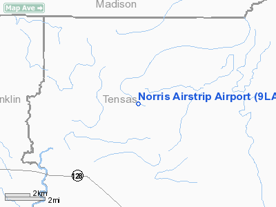
Location &
QuickFacts
|
FAA
Information Effective: |
2008-09-25 |
|
Airport
Identifier: |
9LA2 |
|
Airport
Status: |
Operational |
|
Longitude/Latitude: |
091-24-40.4210W/32-08-25.5480N
-91.411228/32.140430 (Estimated) |
|
Elevation: |
70 ft / 21.34 m (Estimated) |
|
Land: |
0 acres |
|
From
nearest city: |
10 nautical miles NW of Newellton, LA |
|
Location: |
Tensas Parish, LA |
|
Magnetic Variation: |
03E (1985) |
Owner & Manager
|
Ownership: |
Privately owned |
|
Owner: |
T. P. Norris |
|
Address: |
2500 Wellerman Road
West Monroe, LA 71291 |
|
Manager: |
T. P. Norris |
|
Address: |
2500 Wellerman Road
West Monroe, LA 71291 |
Airport
Operations and Facilities
|
Airport
Use: |
Private |
|
Wind
indicator: |
Yes |
|
Segmented Circle: |
No |
|
Control
Tower: |
No |
|
Landing
fee charge: |
No |
|
Sectional chart: |
New Orleans |
|
Region: |
ASW - Southwest |
|
Boundary
ARTCC: |
ZME - Memphis |
|
Tie-in
FSS: |
DRI - De Ridder |
|
FSS on
Airport: |
No |
|
FSS Toll
Free: |
1-800-WX-BRIEF |
|
Runway Information
Runway 12/30
|
Dimension: |
3200 x 75 ft / 975.4 x 22.9 m |
|
Surface: |
TURF, |
|
|
Runway 12
|
Runway 30
|
|
Traffic
Pattern: |
Left |
Left |
|
Obstruction: |
|
75 ft trees, 0.0 ft from runway |
|
Radio Navigation Aids
|
ID |
Type |
Name |
Ch |
Freq |
Var |
Dist |
|
TV |
NDB |
Savry |
|
344.00 |
02E |
20.6 nm |
|
MRK |
NDB |
Molly Ridge |
|
338.00 |
02E |
24.4 nm |
|
VKS |
NDB |
Vicksburg |
|
382.00 |
03E |
25.3 nm |
|
HAH |
NDB |
Natchez-adams County |
|
388.00 |
03E |
27.7 nm |
|
BLE |
NDB |
Lake Providence |
|
278.00 |
03E |
43.0 nm |
|
BQP |
NDB |
Bastrop |
|
329.00 |
03E |
44.0 nm |
|
HEZ |
VOR/DME |
Natchez |
037X |
110.00 |
03E |
31.9 nm |
|
MLU |
VORTAC |
Monroe |
119X |
117.20 |
03E |
39.0 nm |
Remarks
-
PRVDD A 20:1 APCH
RATIO MAINTD FOR EACH RWY END.
Norris Airstrip Airport
Address:
Tensas Parish, LA
Tel:
Images
and information placed above are from
http://www.airport-data.com/airport/9LA2/
We
thank them for the data!
|
General Info |
| Country |
United
States |
| State |
LOUISIANA |
| FAA ID |
9LA2
|
| Latitude |
32-08-25.548N |
|
Longitude |
091-24-40.421W |
|
Elevation |
70 feet
|
| Near
City |
NEWELLTON |
We don't guarantee the information is fresh and accurate. The data may
be wrong or outdated.
For more up-to-date information please refer to other sources.
|
|


