 |
|
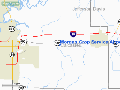
Morgan Crop Service Airport |
Location &
QuickFacts
|
FAA
Information Effective: |
2008-09-25 |
|
Airport
Identifier: |
3LA9 |
|
Airport
Status: |
Operational |
|
Longitude/Latitude: |
093-05-18.5450W/30-13-45.7440N
-93.088485/30.229373 (Estimated) |
|
Elevation: |
12 ft / 3.66 m (Estimated) |
|
Land: |
0 acres |
|
From
nearest city: |
6 nautical miles E of Lake Charles, LA |
|
Location: |
Calcasieu Parish, LA |
|
Magnetic Variation: |
05E (1985) |
Owner & Manager
|
Ownership: |
Privately owned |
|
Owner: |
Lastie P. Vincent |
|
Address: |
220 Wilson St.
Lake Charles, LA 70601 |
|
Manager: |
James Bacciagolop |
|
Address: |
Po Box 1137
Iowa, LA 70647 |
|
Phone number: |
318-439-8970 |
Airport Operations and Facilities
|
Airport Use: |
Private |
|
Wind indicator: |
Yes |
|
Segmented Circle: |
No |
|
Control Tower: |
No |
|
Landing fee charge: |
No |
|
Sectional chart: |
Houston |
|
Region: |
ASW - Southwest |
|
Boundary ARTCC: |
ZHU - Houston |
|
Tie-in FSS: |
DRI - De Ridder |
|
FSS on Airport: |
No |
|
FSS Toll Free: |
1-800-WX-BRIEF |
Airport Services
|
Fuel
available: |
80 |
|
Airframe
Repair: |
NONE |
|
Power
Plant Repair: |
NONE |
|
Runway Information
Runway 17/35
|
Dimension: |
1900 x 208 ft / 579.1 x 63.4 m |
|
Surface: |
TURF, |
|
|
Runway 17
|
Runway 35
|
|
Traffic
Pattern: |
Left |
Left |
|
Obstruction: |
80 ft pline, 20.0 ft from runway |
|
|
Radio Navigation Aids
|
ID |
Type |
Name |
Ch |
Freq |
Var |
Dist |
|
POE |
FAN MARKER |
South |
|
|
07E |
45.2 nm |
|
UX |
NDB |
Sulfy |
|
278.00 |
04E |
17.4 nm |
|
DQU |
NDB |
De Quincy |
|
410.00 |
05E |
23.2 nm |
|
LRR |
NDB |
Allen Parish |
|
379.00 |
03E |
32.3 nm |
|
DR |
NDB |
Idder |
|
385.00 |
04E |
33.9 nm |
|
ORG |
NDB |
Orange |
|
211.00 |
05E |
37.9 nm |
|
ECY |
NDB |
Eunice |
|
263.00 |
02E |
38.7 nm |
|
GUV |
NDB |
Gator |
|
359.00 |
05E |
48.3 nm |
|
LCH |
VORTAC |
Lake Charles |
081X |
113.40 |
07E |
5.4 nm |
Remarks
Based Aircraft
|
Aircraft based
on field: |
3 |
|
Single Engine
Airplanes: |
3 |
Morgan Crop Service Airport
Address:
Calcasieu Parish, LA
Tel:
318-439-8970
Images
and information placed above are from
http://www.airport-data.com/airport/3LA9/
We
thank them for the data!
|
General Info |
| Country |
United
States |
| State |
LOUISIANA |
| FAA ID |
3LA9
|
| Latitude |
30-13-45.744N |
|
Longitude |
093-05-18.545W |
|
Elevation |
12 feet
|
| Near
City |
LAKE
CHARLES |
We don't guarantee the information is fresh and accurate. The data may
be wrong or outdated.
For more up-to-date information please refer to other sources.
|
|


