 |
|
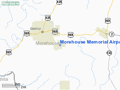
Morehouse Memorial Airport |
|
|
Location &
QuickFacts
|
FAA
Information Effective: |
2008-09-25 |
|
Airport
Identifier: |
BQP |
|
Airport
Status: |
Operational |
|
Longitude/Latitude: |
091-52-50.1000W/32-45-21.9000N
-91.880583/32.756083 (Estimated) |
|
Elevation: |
168 ft / 51.21 m (Surveyed) |
|
Land: |
440 acres |
|
From
nearest city: |
2 nautical miles SE of Bastrop, LA |
|
Location: |
Morehouse Parish, LA |
|
Magnetic Variation: |
03E (1990) |
Owner & Manager
|
Ownership: |
Publicly owned |
|
Owner: |
City Of Bastrop |
|
Address: |
Po Box 431
Bastrop, LA 71221 |
|
Phone number: |
318-283-0250 |
|
Manager: |
Steve Litchfield |
|
Address: |
6336 Holland Drive
Bastrop, LA 71220 |
|
Phone number: |
318-281-2018 |
Airport
Operations and Facilities
|
Airport
Use: |
Open to public |
|
Wind
indicator: |
Yes |
|
Segmented Circle: |
No |
|
Control
Tower: |
No |
|
Lighting
Schedule: |
DUSK-DAWN
MIRL RY 16/34 PRESET LOW INTST; TO INCR INTST ACTVT - CTAF. |
|
Beacon
Color: |
Clear-Green (lighted land airport) |
|
Landing
fee charge: |
No |
|
Sectional chart: |
Memphis |
|
Region: |
ASW - Southwest |
|
Traffic
Pattern Alt: |
1033 ft |
|
Boundary
ARTCC: |
ZFW - Fort Worth |
|
Tie-in
FSS: |
DRI - De Ridder |
|
FSS on
Airport: |
No |
|
FSS Toll
Free: |
1-800-WX-BRIEF |
|
NOTAMs
Facility: |
DRI (NOTAM-d service avaliable) |
|
Federal Agreements: |
NGY |
Airport Communications
|
CTAF: |
122.800 |
|
Unicom: |
122.800 |
Airport Services
|
Fuel
available: |
100LLA
SELF SERVE FUEL AVBL 24 HRS WITH CREDIT CARD. |
|
Airframe
Repair: |
MAJOR |
|
Power
Plant Repair: |
MAJOR |
|
Bottled
Oxygen: |
NONE |
|
Bulk
Oxygen: |
NONE |
|
Runway Information
Runway 16/34
|
Dimension: |
4002 x 100 ft / 1219.8 x 30.5 m |
|
Surface: |
ASPH, Good Condition |
|
Weight Limit: |
Single wheel: 15500 lbs. |
|
Edge Lights: |
Medium |
|
|
Runway 16 |
Runway 34 |
|
Longitude: |
091-52-56.6290W |
091-52-43.4412W |
|
Latitude: |
32-45-40.9051N |
32-45-02.9123N |
|
Elevation: |
159.00 ft |
162.00 ft |
|
Alignment: |
127 |
127 |
|
Traffic
Pattern: |
Left |
Left |
|
Markings: |
Non-precision instrument, Good Condition
NO FIXED DISTANCE MARKERS. |
Non-precision instrument, Good Condition
NO FIXED DISTANCE MARKERS. |
|
Crossing
Height: |
50.00 ft |
50.00 ft |
|
VASI: |
2-light PAPI on left side |
2-light PAPI on left side |
|
Visual
Glide Angle: |
3.00° |
3.00° |
|
Runway End
Identifier: |
Yes |
Yes |
|
Obstruction: |
60 ft trees, 1800.0 ft from runway, 26:1 slope to clear |
15 ft trees, 600.0 ft from runway, 26:1 slope to clear |
|
Radio Navigation Aids
|
ID |
Type |
Name |
Ch |
Freq |
Var |
Dist |
|
BQP |
NDB |
Bastrop |
|
329.00 |
03E |
0.2 nm |
|
MRK |
NDB |
Molly Ridge |
|
338.00 |
02E |
21.7 nm |
|
BLE |
NDB |
Lake Providence |
|
278.00 |
03E |
35.2 nm |
|
ROQ |
NDB |
Ruston |
|
368.00 |
03E |
36.9 nm |
|
TUF |
NDB |
Stuckey |
|
350.00 |
03E |
41.5 nm |
|
REN |
NDB |
Warren |
|
226.00 |
04E |
48.8 nm |
|
MON |
VOR/DME |
Monticello |
053X |
111.60 |
04E |
49.2 nm |
|
MLU |
VORTAC |
Monroe |
119X |
117.20 |
03E |
16.4 nm |
Remarks
-
DEER ON & INVOF RY.
-
GCO AVBL ON FREQ
135.075 THRU DRI AFSS.
-
PRE DATES THE ACT.
Based Aircraft
|
Aircraft based
on field: |
16 |
|
Single Engine
Airplanes: |
15 |
|
Multi Engine
Airplanes: |
1 |
Operational Statistics
Time Period: 2006-10-18 - 2007-10-17
|
Aircraft
Operations: |
83/Day |
|
General
Aviation Local: |
66.2% |
|
General
Aviation Itinerant: |
33.1% |
|
Military: |
0.7% |
Morehouse Memorial Airport
Address:
Morehouse Parish, LA
Tel:
318-283-0250, 318-281-2018
Images
and information placed above are from
http://www.airport-data.com/airport/BQP/
We
thank them for the data!
|
General Info |
| Country |
United
States |
| State |
LOUISIANA |
| FAA ID |
BQP
|
| Time |
UTC-6(-5DT) |
| Latitude |
32.755056
32° 45' 18.20" N |
|
Longitude |
-91.881944
091° 52' 55.00" W |
|
Elevation |
167 feet
51 meters |
| Type |
Civil
|
| Magnetic
Variation |
001° E
(06/06) |
| Beacon |
Yes
|
|
Operating Agency |
MUNICIPAL |
| Near
City |
Bastrop
|
|
Operating Hours |
24 HOUR
OPERATIONS |
| Daylight
Saving Time |
Second
Sunday in March at 0200 to first Sunday in November at 0200 local time
(Exception Arizona and that portion of Indiana in the Eastern Time
Zone) |
We don't guarantee the information is fresh and accurate. The data may
be wrong or outdated.
For more up-to-date information please refer to other sources.
|
|


