 |
|
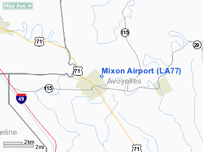
Location &
QuickFacts
|
FAA
Information Effective: |
2008-09-25 |
|
Airport
Identifier: |
LA77 |
|
Airport
Status: |
Operational |
|
Longitude/Latitude: |
092-10-28.4520W/30-57-47.6880N
-92.174570/30.963247 (Estimated) |
|
Elevation: |
60 ft / 18.29 m (Estimated) |
|
Land: |
0 acres |
|
From
nearest city: |
0 nautical miles NE of Bunkie, LA |
|
Location: |
Avoyelles Parish, LA |
|
Magnetic Variation: |
04E (1985) |
Owner & Manager
|
Ownership: |
Privately owned |
|
Owner: |
Charles C. Mixon |
|
Address: |
Box 569
Bunkie, LA 71322 |
|
Phone
number: |
318-746-2657 |
|
Manager: |
Charles Mixon |
|
Address: |
1103 West Marshall Box 569
Bunkie, LA 71322 |
|
Phone number: |
318-346-2904 |
Airport Operations and Facilities
|
Airport Use: |
Private |
|
Wind indicator: |
Yes |
|
Segmented Circle: |
No |
|
Control Tower: |
No |
|
Landing fee charge: |
No |
|
Sectional chart: |
Houston |
|
Region: |
ASW - Southwest |
|
Boundary ARTCC: |
ZHU - Houston |
|
Tie-in FSS: |
DRI - De Ridder |
|
FSS on Airport: |
No |
|
FSS Toll Free: |
1-800-WX-BRIEF |
Airport Services
|
Airframe
Repair: |
NONE |
|
Power
Plant Repair: |
NONE |
|
Runway Information
Runway 17/35
|
Dimension: |
3400 x 75 ft / 1036.3 x 22.9 m |
|
Surface: |
TURF, |
|
|
Runway 17
|
Runway 35
|
|
Traffic
Pattern: |
Left |
Left |
|
Obstruction: |
|
75 ft bldg, 1200.0 ft from runway |
|
Radio Navigation Aids
|
ID |
Type |
Name |
Ch |
Freq |
Var |
Dist |
|
BWK |
NDB |
Bunkie |
|
397.00 |
03E |
6.6 nm |
|
MKV |
NDB |
Marksville |
|
347.00 |
02E |
9.5 nm |
|
OPL |
NDB |
St Landry |
|
335.00 |
04E |
18.9 nm |
|
ECY |
NDB |
Eunice |
|
263.00 |
02E |
28.1 nm |
|
LRR |
NDB |
Allen Parish |
|
379.00 |
03E |
32.9 nm |
|
HZ |
NDB |
Hazer |
|
356.00 |
04E |
40.6 nm |
|
AEX |
VORTAC |
Alexandria |
108X |
116.10 |
03E |
24.4 nm |
|
LFT |
VORTAC |
Lafayette |
035X |
109.80 |
03E |
47.2 nm |
Based Aircraft
|
Aircraft based
on field: |
1 |
|
Single Engine
Airplanes: |
1 |
Mixon Airport
Address:
Avoyelles Parish, LA
Tel:
318-746-2657,
318-346-2904
Images
and information placed above are from
http://www.airport-data.com/airport/LA77/
We
thank them for the data!
|
General Info |
| Country |
United
States |
| State |
LOUISIANA |
| FAA ID |
LA77
|
| Latitude |
30-57-47.688N |
|
Longitude |
092-10-28.452W |
|
Elevation |
60 feet
|
| Near
City |
BUNKIE
|
We don't guarantee the information is fresh and accurate. The data may
be wrong or outdated.
For more up-to-date information please refer to other sources.
|
|


