 |
|
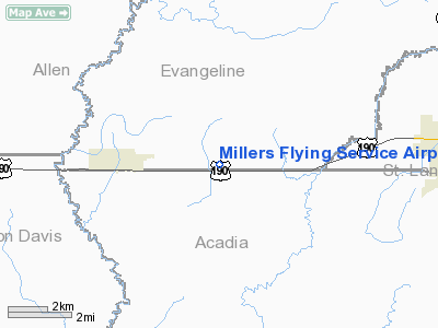
Millers Flying Service Airport |
Location &
QuickFacts
|
FAA
Information Effective: |
2008-09-25 |
|
Airport
Identifier: |
LA01 |
|
Airport
Status: |
Operational |
|
Longitude/Latitude: |
092-32-48.4930W/30-29-00.7230N
-92.546804/30.483534 (Estimated) |
|
Elevation: |
44 ft / 13.41 m (Surveyed) |
|
Land: |
8 acres |
|
From
nearest city: |
3 nautical miles E of Basile, LA |
|
Location: |
Evangeline Parish, LA |
|
Magnetic Variation: |
04E (1985) |
Owner & Manager
|
Ownership: |
Privately owned |
|
Owner: |
Robbie Miller |
|
Address: |
P.o. Box 726
Eunice, LA 70535 |
|
Phone
number: |
318-432-5581 |
|
Manager: |
Robbie Miller |
|
Address: |
P.o. Box 726
Eunice, LA 70535 |
|
Phone number: |
318-432-5581 |
Airport Operations and Facilities
|
Airport
Use: |
Private |
|
Wind
indicator: |
Yes
WIND INDICATOR OTS INDEFLY. |
|
Segmented Circle: |
No |
|
Control Tower: |
No |
|
Landing fee charge: |
No |
|
Sectional chart: |
Houston |
|
Region: |
ASW - Southwest |
|
Boundary ARTCC: |
ZHU - Houston |
|
Tie-in FSS: |
DRI - De Ridder |
|
FSS on Airport: |
No |
|
FSS Toll Free: |
1-800-WX-BRIEF |
Airport Services
|
Airframe
Repair: |
MAJOR |
|
Power
Plant Repair: |
MAJOR |
|
Runway Information
Runway 18/36
|
Dimension: |
1800 x 30 ft / 548.6 x 9.1 m |
|
Surface: |
ASPH, Poor Condition
RY COND & MKG POOR DUE TO CRACKING & GRASS ENCROACHMENT. |
|
Weight Limit: |
Single wheel: 8000 lbs. |
|
|
Runway 18 |
Runway 36 |
|
Traffic
Pattern: |
Left |
Left |
|
Markings: |
Nonstandard, Poor Condition
18/36 NRS TOO SMALL. |
Nonstandard, Poor Condition |
|
Obstruction: |
, 50:1 slope to clear |
40 ft pline, 500.0 ft from runway, 7:1 slope to clear
ACCESS RD, 4' FENCE, AND MARKED 20' PLINES SW OF APCH. |
|
Radio Navigation Aids
|
ID |
Type |
Name |
Ch |
Freq |
Var |
Dist |
|
POE |
FAN MARKER |
South |
|
|
07E |
43.6 nm |
|
ECY |
NDB |
Eunice |
|
263.00 |
02E |
6.9 nm |
|
LRR |
NDB |
Allen Parish |
|
379.00 |
03E |
12.0 nm |
|
OPL |
NDB |
St Landry |
|
335.00 |
04E |
25.4 nm |
|
BWK |
NDB |
Bunkie |
|
397.00 |
03E |
28.1 nm |
|
DR |
NDB |
Idder |
|
385.00 |
04E |
43.8 nm |
|
MKV |
NDB |
Marksville |
|
347.00 |
02E |
44.2 nm |
|
GUV |
NDB |
Gator |
|
359.00 |
05E |
46.5 nm |
|
AR |
NDB |
Acadi |
|
269.00 |
03E |
47.6 nm |
|
DQU |
NDB |
De Quincy |
|
410.00 |
05E |
47.8 nm |
|
UX |
NDB |
Sulfy |
|
278.00 |
04E |
48.5 nm |
|
LFT |
VORTAC |
Lafayette |
035X |
109.80 |
03E |
33.6 nm |
|
LCH |
VORTAC |
Lake Charles |
081X |
113.40 |
07E |
35.5 nm |
|
AEX |
VORTAC |
Alexandria |
108X |
116.10 |
03E |
46.5 nm |
Remarks
-
80' ANTENNA LCTD
AT HANGAR.
-
ACFT PARKED NEAR
RY DURG CROP DUSTING SEASON.
Based Aircraft
|
Aircraft based
on field: |
2 |
|
Single Engine
Airplanes: |
1 |
|
Ultralights: |
1 |
Operational Statistics
Time Period: 1990-12-12 - 1991-12-11
|
Aircraft
Operations: |
29/Week |
|
General
Aviation Local: |
60.0% |
|
General
Aviation Itinerant: |
40.0% |
Millers Flying Service Airport
Address:
Evangeline Parish, LA
Tel:
318-432-5581
Images
and information placed above are from
http://www.airport-data.com/airport/LA01/
We
thank them for the data!
|
General Info |
| Country |
United
States |
| State |
LOUISIANA |
| FAA ID |
LA01
|
| Latitude |
30-29-00.723N |
|
Longitude |
092-32-48.493W |
|
Elevation |
44 feet
|
| Near
City |
BASILE
|
We don't guarantee the information is fresh and accurate. The data may
be wrong or outdated.
For more up-to-date information please refer to other sources.
|
|


