 |
|
Location &
QuickFacts
|
FAA
Information Effective: |
2008-09-25 |
|
Airport
Identifier: |
80LA |
|
Airport
Status: |
Operational |
|
Longitude/Latitude: |
092-19-05.4600W/30-25-34.7200N
-92.318183/30.426311 (Estimated) |
|
Elevation: |
42 ft / 12.80 m (Estimated) |
|
Land: |
0 acres |
|
From
nearest city: |
8 nautical miles E of Eunice, LA |
|
Location: |
Acadia Parish, LA |
|
Magnetic Variation: |
03E (2000) |
Owner & Manager
|
Ownership: |
Privately owned |
|
Owner: |
Allen R. Daigle |
|
Address: |
1654 Bayow Mallett Highway
Eunice, LA 70535 |
|
Phone
number: |
337-457-0836 |
|
Manager: |
Allen R. Daigle |
|
Address: |
1654 Bayow Mallett Highway
Eunice, LA 70535 |
|
Phone number: |
337-457-0836 |
Airport Operations and Facilities
|
Airport
Use: |
Private |
|
Segmented Circle: |
No |
|
Control
Tower: |
No |
|
Sectional chart: |
Houston |
|
Region: |
ASW - Southwest |
|
Boundary
ARTCC: |
ZHU - Houston |
|
Tie-in
FSS: |
DRI - De Ridder |
|
FSS Toll
Free: |
1-800-WX-BRIEF |
|
Runway Information
Runway 18/36
|
Dimension: |
1600 x 50 ft / 487.7 x 15.2 m |
|
Surface: |
TURF, |
|
|
Runway 18
|
Runway 36
|
|
Traffic
Pattern: |
Left |
Left |
|
Radio Navigation Aids
|
ID |
Type |
Name |
Ch |
Freq |
Var |
Dist |
|
ECY |
NDB |
Eunice |
|
263.00 |
02E |
10.5 nm |
|
OPL |
NDB |
St Landry |
|
335.00 |
04E |
17.9 nm |
|
LRR |
NDB |
Allen Parish |
|
379.00 |
03E |
23.1 nm |
|
BWK |
NDB |
Bunkie |
|
397.00 |
03E |
26.7 nm |
|
AR |
NDB |
Acadi |
|
269.00 |
03E |
36.8 nm |
|
MKV |
NDB |
Marksville |
|
347.00 |
02E |
42.2 nm |
|
HZ |
NDB |
Hazer |
|
356.00 |
04E |
44.7 nm |
|
LLA |
VOR/DME |
White Lake |
041X |
110.40 |
04E |
46.0 nm |
|
LFT |
VORTAC |
Lafayette |
035X |
109.80 |
03E |
21.9 nm |
|
LCH |
VORTAC |
Lake Charles |
081X |
113.40 |
07E |
44.3 nm |
Remarks
-
PRVDD THLD TO RY
18 PROVIDES AN APCH SLOPE OF NO LESS THAN 15 FT OVER ANY PORTION OF HWY 370
BASED ON APCH SLOPE OF 20:1.
Based Aircraft
|
Aircraft based
on field: |
1 |
|
Single Engine
Airplanes: |
1 |
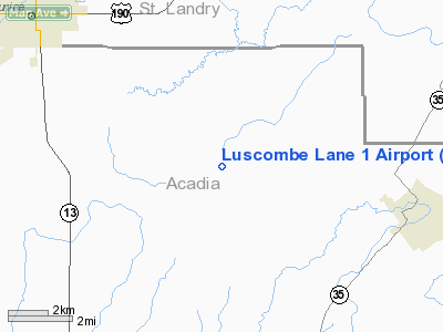
Luscombe Lane 1 Airport
Address:
Acadia Parish, LA
Tel:
337-457-0836
Images
and information placed above are from
http://www.airport-data.com/airport/80LA/
We
thank them for the data!
|
General Info |
| Country |
United
States |
| State |
LOUISIANA |
| FAA ID |
80LA
|
| Latitude |
30-25-34.720N |
|
Longitude |
092-19-05.460W |
|
Elevation |
42 feet
|
| Near
City |
EUNICE
|
We don't guarantee the information is fresh and accurate. The data may
be wrong or outdated.
For more up-to-date information please refer to other sources.
|
|


