 |
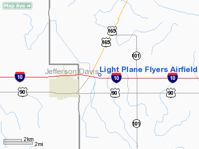
|
Light Plane Flyers Airfield Airport |
Location &
QuickFacts
|
FAA
Information Effective: |
2008-09-25 |
|
Airport
Identifier: |
LS36 |
|
Airport
Status: |
Operational |
|
Longitude/Latitude: |
092-58-19.1400W/30-15-00.7500N
-92.971983/30.250208 (Estimated) |
|
Elevation: |
25 ft / 7.62 m (Estimated) |
|
Land: |
13 acres |
|
From
nearest city: |
1 nautical miles NE of Iowa, LA |
|
Location: |
Calcasieu Parish, LA |
|
Magnetic Variation: |
04E (1990) |
Owner & Manager
|
Ownership: |
Privately owned |
|
Owner: |
Light Plane Flyers Inc |
|
Address: |
2603 Hwy 14
Lake Charles, LA 70601 |
|
Phone number: |
337-479-2603 |
|
Manager: |
Mark Dwayne Perkins |
|
Address: |
2603 Hwy 14
Lake Charles, LA 70601 |
|
Phone number: |
337-479-2603 |
Airport
Operations and Facilities
|
Airport
Use: |
Private |
|
Wind
indicator: |
Yes |
|
Segmented Circle: |
No |
|
Control
Tower: |
No |
|
Sectional chart: |
Houston |
|
Region: |
ASW - Southwest |
|
Boundary
ARTCC: |
ZHU - Houston |
|
Tie-in
FSS: |
DRI - De Ridder |
|
FSS on
Airport: |
No |
|
FSS Toll
Free: |
1-800-WX-BRIEF |
|
Runway Information
Runway 18/36
|
Dimension: |
1335 x 75 ft / 406.9 x 22.9 m |
|
Surface: |
TURF, |
|
|
Runway 18
|
Runway 36
|
|
Traffic
Pattern: |
Left |
Left |
|
Obstruction: |
|
32 ft pline, 460.0 ft from runway |
|
Radio Navigation Aids
|
ID |
Type |
Name |
Ch |
Freq |
Var |
Dist |
|
POE |
FAN MARKER |
South |
|
|
07E |
44.9 nm |
|
UX |
NDB |
Sulfy |
|
278.00 |
04E |
23.5 nm |
|
LRR |
NDB |
Allen Parish |
|
379.00 |
03E |
27.7 nm |
|
DQU |
NDB |
De Quincy |
|
410.00 |
05E |
28.0 nm |
|
ECY |
NDB |
Eunice |
|
263.00 |
02E |
32.9 nm |
|
DR |
NDB |
Idder |
|
385.00 |
04E |
35.5 nm |
|
ORG |
NDB |
Orange |
|
211.00 |
05E |
44.1 nm |
|
GUV |
NDB |
Gator |
|
359.00 |
05E |
48.0 nm |
|
LLA |
VOR/DME |
White Lake |
041X |
110.40 |
04E |
47.1 nm |
|
LCH |
VORTAC |
Lake Charles |
081X |
113.40 |
07E |
9.5 nm |
Based Aircraft
|
Aircraft based
on field: |
6 |
|
Ultralights: |
6 |
Light Plane Flyers Airfield Airport
Address:
Calcasieu Parish, LA
Tel:
337-479-2603
Images
and information placed above are from
http://www.airport-data.com/airport/LS36/
We
thank them for the data!
|
General Info |
| Country |
United
States |
| State |
LOUISIANA |
| FAA ID |
LS36
|
| Latitude |
30-15-00.750N |
|
Longitude |
092-58-19.140W |
|
Elevation |
25 feet
|
| Near
City |
IOWA
|
We don't guarantee the information is fresh and accurate. The data may
be wrong or outdated.
For more up-to-date information please refer to other sources.
|
|


