 |
|
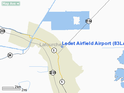
Location &
QuickFacts
|
FAA
Information Effective: |
2008-09-25 |
|
Airport
Identifier: |
83LA |
|
Airport
Status: |
Operational |
|
Longitude/Latitude: |
090-19-46.2880W/29-33-19.7790N
-90.329524/29.555494 (Estimated) |
|
Elevation: |
0 ft / 0.00 m (Estimated) |
|
Land: |
6 acres |
|
From
nearest city: |
2 nautical miles NW of Cut Off, LA |
|
Location: |
Lafourche Parish, LA |
|
Magnetic Variation: |
03E (1985) |
Owner & Manager
|
Ownership: |
Privately owned |
|
Owner: |
Jerry C. Ledet |
|
Address: |
Po Box 1057
Larose, LA 70373 |
|
Phone
number: |
504-693-7098 |
|
Manager: |
Jerry C. Ledet |
|
Address: |
Po Box 1057
Larose, LA 70373 |
|
Phone number: |
504-693-7098 |
Airport
Operations and Facilities
|
Airport
Use: |
Private |
|
Wind
indicator: |
Yes |
|
Segmented Circle: |
No |
|
Control
Tower: |
No |
|
Sectional chart: |
Houston |
|
Region: |
ASW - Southwest |
|
Boundary
ARTCC: |
ZHU - Houston |
|
Tie-in
FSS: |
DRI - De Ridder |
|
FSS Toll
Free: |
1-800-WX-BRIEF |
|
Runway Information
Runway 05/23
|
Dimension: |
2700 x 100 ft / 823.0 x 30.5 m |
|
Surface: |
TURF, |
|
|
Runway 05
|
Runway 23
|
|
Traffic
Pattern: |
Left |
Left |
|
Obstruction: |
50 ft trees |
50 ft trees |
|
Radio Navigation Aids
|
ID |
Type |
Name |
Ch |
Freq |
Var |
Dist |
|
MS |
NDB |
Kinte |
|
338.00 |
03E |
28.5 nm |
|
RQR |
VOR/DME |
Reserve |
045X |
110.80 |
02E |
34.7 nm |
|
HRV |
VORTAC |
Harvey |
088X |
114.10 |
02E |
24.6 nm |
|
LEV |
VORTAC |
Leeville |
082X |
113.50 |
02E |
25.7 nm |
|
TBD |
VORTAC |
Tibby |
057X |
112.00 |
02E |
26.9 nm |
|
NEW |
VOT |
New Orleans Lakefront |
|
111.00 |
|
33.1 nm |
Remarks
-
PRVDD OPERATIONS
ARE CONDUCTED ON NW SIDE OF RWY.
Based Aircraft
|
Aircraft based
on field: |
2 |
|
Single Engine
Airplanes: |
1 |
|
Ultralights: |
1 |
Ledet Airfield Airport
Address:
Lafourche Parish, LA
Tel:
504-693-7098
Images
and information placed above are from
http://www.airport-data.com/airport/83LA/
We
thank them for the data!
|
General Info |
| Country |
United
States |
| State |
LOUISIANA |
| FAA ID |
83LA
|
| Latitude |
29-33-19.779N |
|
Longitude |
090-19-46.288W |
|
Elevation |
0 feet
|
| Near
City |
CUT OFF
|
We don't guarantee the information is fresh and accurate. The data may
be wrong or outdated.
For more up-to-date information please refer to other sources.
|
|


