 |
|
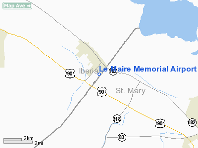
Le Maire Memorial Airport |
|
|
Location &
QuickFacts
|
FAA
Information Effective: |
2008-09-25 |
|
Airport
Identifier: |
2R1 |
|
Airport
Status: |
Operational |
|
Longitude/Latitude: |
091-39-57.6000W/29-53-56.6500N
-91.666000/29.899069 (Estimated) |
|
Elevation: |
14 ft / 4.27 m (Estimated) |
|
Land: |
59 acres |
|
From
nearest city: |
1 nautical miles S of Jeanerette, LA |
|
Location: |
Iberia Parish, LA |
|
Magnetic Variation: |
04E (1985) |
Owner & Manager
|
Ownership: |
Publicly owned |
|
Owner: |
Iberia Parish |
|
Address: |
1404 Hanger Dr.
New Iberia, LA 70560 |
|
Phone
number: |
337-365-7202 |
|
Manager: |
Jason Devillier |
|
Address: |
1404 Hanger Dr.
New Iberia, LA 70560 |
|
Phone number: |
337-365-7202 |
Airport Operations and Facilities
|
Airport
Use: |
Open to public |
|
Wind
indicator: |
Yes |
|
Segmented Circle: |
No |
|
Control
Tower: |
No |
|
Lighting
Schedule: |
DUSK-DAWN |
|
Beacon
Color: |
Clear-Green (lighted land airport) |
|
Landing
fee charge: |
No |
|
Sectional chart: |
Houston |
|
Region: |
ASW - Southwest |
|
Boundary
ARTCC: |
ZHU - Houston |
|
Tie-in
FSS: |
DRI - De Ridder |
|
FSS on
Airport: |
No |
|
FSS Toll
Free: |
1-800-WX-BRIEF |
|
NOTAMs
Facility: |
DRI (NOTAM-d service avaliable) |
|
Federal Agreements: |
1 |
Airport Communications
Airport Services
|
Airframe
Repair: |
NONE |
|
Power
Plant Repair: |
NONE |
|
Bottled
Oxygen: |
NONE |
|
Bulk
Oxygen: |
NONE |
|
Runway Information
Runway 04/22
|
Dimension: |
3000 x 75 ft / 914.4 x 22.9 m |
|
Surface: |
ASPH, Fair Condition |
|
Weight Limit: |
Single wheel: 6000 lbs. |
|
Edge Lights: |
Medium |
|
|
Runway 04
|
Runway 22
|
|
Longitude: |
091-40-07.9000W |
091-39-47.3000W |
|
Latitude: |
29-53-44.8000N |
29-54-08.5000N |
|
Alignment: |
37 |
127 |
|
Traffic
Pattern: |
Left |
Left |
|
Markings: |
Basic, Good Condition |
Basic, Good Condition |
|
Displaced
threshold: |
0.00 ft |
603.00 ft |
|
Obstruction: |
55 ft trees, 1040.0 ft from runway, 120 ft right of
centerline, 15:1 slope to clear |
60 ft trees, 700.0 ft from runway, 8:1 slope to clear
APCH SLOPE 18:1 TO DSPLCD THLD. |
|
Radio Navigation Aids
|
ID |
Type |
Name |
Ch |
Freq |
Var |
Dist |
|
AR |
NDB |
Acadi |
|
269.00 |
03E |
10.8 nm |
|
PTN |
NDB |
Patterson |
|
245.00 |
01E |
20.4 nm |
|
HZ |
NDB |
Hazer |
|
356.00 |
04E |
45.1 nm |
|
LLA |
VOR/DME |
White Lake |
041X |
110.40 |
04E |
39.5 nm |
|
LFT |
VORTAC |
Lafayette |
035X |
109.80 |
03E |
24.5 nm |
|
BTR |
VORTAC |
Baton Rouge |
112X |
116.50 |
06E |
40.2 nm |
|
TBD |
VORTAC |
Tibby |
057X |
112.00 |
02E |
45.9 nm |
Remarks
-
AIRPORT PHONE - 318-276-6514.
Based Aircraft
|
Aircraft based
on field: |
3 |
|
Single Engine
Airplanes: |
3 |
Operational Statistics
Time Period: 2007-06-27 - 2008-06-25
|
Aircraft
Operations: |
260/Week |
|
General
Aviation Local: |
59.3% |
|
General
Aviation Itinerant: |
40.7% |
Le Maire Memorial Airport
Address:
Iberia Parish, LA
Tel:
337-365-7202
Images
and information placed above are from
http://www.airport-data.com/airport/2R1/
We
thank them for the data!
|
General Info |
| Country |
United
States |
| State |
LOUISIANA |
| FAA ID |
2R1
|
| Latitude |
29-53-56.650N |
|
Longitude |
091-39-57.600W |
|
Elevation |
14 feet
|
| Near
City |
JEANERETTE |
We don't guarantee the information is fresh and accurate. The data may
be wrong or outdated.
For more up-to-date information please refer to other sources.
|
|


