 |
|
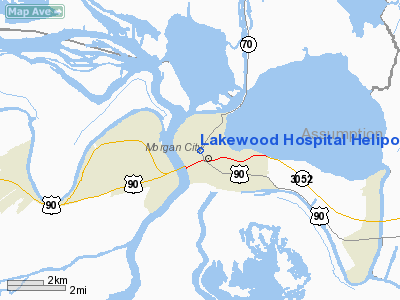
Lakewood Hospital Heliport |
|
|
Location &
QuickFacts
|
FAA
Information Effective: |
2008-09-25 |
|
Airport
Identifier: |
42LA |
|
Airport
Status: |
Operational |
|
Longitude/Latitude: |
091-12-09.3710W/29-42-19.7480N
-91.202603/29.705486 (Estimated) |
|
Elevation: |
102 ft / 31.09 m (Estimated) |
|
Land: |
0 acres |
|
From
nearest city: |
1 nautical miles NE of Morgan City, LA |
|
Location: |
St Mary Parish, LA |
|
Magnetic Variation: |
04E (1985) |
Owner & Manager
|
Ownership: |
Privately owned |
|
Owner: |
Teche Regional Medical Center |
|
Address: |
1125 Margurite St
Morgan City, LA 70380 |
|
Phone
number: |
504-384-2200 |
|
Manager: |
Ceo Joyce Hein |
|
Address: |
Lakewood Hosp, Po Drawer 2308
Morgan City, LA 70381 |
|
Phone number: |
504-384-2200 |
Airport Operations and Facilities
|
Airport Use: |
Private
MEDICAL. |
|
Wind indicator: |
Yes |
|
Segmented Circle: |
No |
|
Control Tower: |
No |
|
Lighting Schedule: |
DUSK-DAWN |
|
Beacon Color: |
Clear-Green-Yellow (heliport) |
|
Landing fee charge: |
No |
|
Sectional chart: |
New Orleans |
|
Region: |
ASW - Southwest |
|
Boundary ARTCC: |
ZHU - Houston |
|
Tie-in FSS: |
DRI - De Ridder |
|
FSS on Airport: |
No |
|
FSS Toll Free: |
1-800-WX-BRIEF |
Airport Services
|
Airframe
Repair: |
NONE |
|
Power
Plant Repair: |
NONE |
|
Runway Information
Helipad H1
|
Dimension: |
70 x 70 ft / 21.3 x 21.3 m |
|
Surface: |
CONC, Good Condition
HELIPAD ON ROOFTOP |
|
|
Runway H1
|
Runway
|
|
Traffic
Pattern: |
Left |
Left |
|
Radio Navigation Aids
|
ID |
Type |
Name |
Ch |
Freq |
Var |
Dist |
|
PTN |
NDB |
Patterson |
|
245.00 |
01E |
7.0 nm |
|
AR |
NDB |
Acadi |
|
269.00 |
03E |
37.6 nm |
|
MS |
NDB |
Kinte |
|
338.00 |
03E |
46.0 nm |
|
RQR |
VOR/DME |
Reserve |
045X |
110.80 |
02E |
39.4 nm |
|
TBD |
VORTAC |
Tibby |
057X |
112.00 |
02E |
19.7 nm |
|
BTR |
VORTAC |
Baton Rouge |
112X |
116.50 |
06E |
47.1 nm |
Remarks
-
PRVDD APCH SLOPES
TO LNDG AREA ARE MAINTD IAW PART 77 OF FAR.
Lakewood Hospital Heliport
Address:
St Mary Parish, LA
Tel:
504-384-2200
Images
and information placed above are from
http://www.airport-data.com/airport/42LA/
We
thank them for the data!
|
General Info |
| Country |
United
States |
| State |
LOUISIANA |
| FAA ID |
42LA
|
| Latitude |
29-42-19.748N |
|
Longitude |
091-12-09.371W |
|
Elevation |
102 feet
|
| Near
City |
MORGAN
CITY |
We don't guarantee the information is fresh and accurate. The data may
be wrong or outdated.
For more up-to-date information please refer to other sources.
|
|


