 |
|
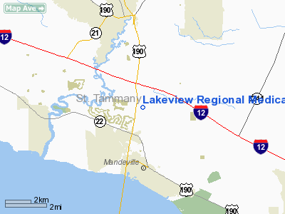
Lakeview Regional Medical Center Heliport |
Location &
QuickFacts
|
FAA
Information Effective: |
2008-09-25 |
|
Airport
Identifier: |
79LA |
|
Airport
Status: |
Operational |
|
Longitude/Latitude: |
090-04-45.0000W/30-24-44.0000N
-90.079167/30.412222 (Estimated) |
|
Elevation: |
20 ft / 6.10 m (Estimated) |
|
Land: |
0 acres |
|
From
nearest city: |
2 nautical miles SE of Covington, LA |
|
Location: |
St Tammany Parish, LA |
|
Magnetic Variation: |
02E (1995) |
Owner & Manager
|
Ownership: |
Privately owned |
|
Owner: |
Lakeview Rgnl Medical Center |
|
Address: |
96 Fairway Drive
Convington, LA 70433 |
|
Phone
number: |
985-867-3800 |
|
Manager: |
Kevin Landry
DIRECTOR OF PLANT OPNS. DARYL BLAYLOCK, CEO. |
|
Address: |
96 Fairway Drive
Convington, LA 70433 |
|
Phone number: |
985-867-4120 |
Airport
Operations and Facilities
|
Airport
Use: |
Private
MEDICAL. |
|
Segmented Circle: |
No |
|
Control
Tower: |
No |
|
Sectional chart: |
New Orleans |
|
Region: |
ASW - Southwest |
|
Boundary
ARTCC: |
ZHU - Houston |
|
Tie-in
FSS: |
DRI - De Ridder |
|
FSS on
Airport: |
No |
|
FSS Toll
Free: |
1-800-WX-BRIEF |
|
Runway Information
Helipad H1
|
Dimension: |
50 x 50 ft / 15.2 x 15.2 m |
|
Surface: |
CONC, |
|
|
Runway H1
|
Runway
|
|
Traffic
Pattern: |
Left |
Left |
|
Radio Navigation Aids
|
ID |
Type |
Name |
Ch |
Freq |
Var |
Dist |
|
FNA |
NDB |
Florenville |
|
371.00 |
03E |
13.4 nm |
|
DEF |
NDB |
Slidell |
|
256.00 |
03E |
14.5 nm |
|
MJD |
NDB |
Picayune |
|
276.00 |
01E |
22.6 nm |
|
MS |
NDB |
Kinte |
|
338.00 |
03E |
28.6 nm |
|
BX |
NDB |
Carma |
|
353.00 |
02E |
30.4 nm |
|
AYI |
NDB |
Hanco |
|
221.00 |
03E |
32.4 nm |
|
HS |
NDB |
Hanco |
|
221.00 |
01E |
32.4 nm |
|
HMU |
VOR |
Hammond |
|
109.60 |
03E |
18.7 nm |
|
PCU |
VOR/DME |
Picayune |
059X |
112.20 |
05E |
20.2 nm |
|
RQR |
VOR/DME |
Reserve |
045X |
110.80 |
02E |
32.9 nm |
|
HRV |
VORTAC |
Harvey |
088X |
114.10 |
02E |
34.0 nm |
|
NEW |
VOT |
New Orleans Lakefront |
|
111.00 |
|
22.6 nm |
Lakeview Regional Medical Center
Heliport
Address:
St Tammany Parish, LA
Tel:
985-867-3800,
985-867-4120
Images
and information placed above are from
http://www.airport-data.com/airport/79LA/
We
thank them for the data!
|
General Info |
| Country |
United
States |
| State |
LOUISIANA |
| FAA ID |
79LA
|
| Latitude |
30-24-44.000N |
|
Longitude |
090-04-45.000W |
|
Elevation |
20 feet
|
| Near
City |
COVINGTON |
We don't guarantee the information is fresh and accurate. The data may
be wrong or outdated.
For more up-to-date information please refer to other sources.
|
|


