 |
|
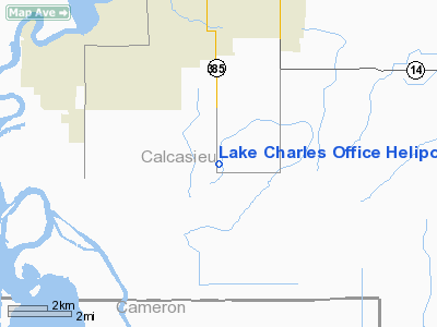
Lake Charles Office Heliport |
Location &
QuickFacts
|
FAA
Information Effective: |
2008-09-25 |
|
Airport
Identifier: |
LS81 |
|
Airport
Status: |
Operational |
|
Longitude/Latitude: |
093-12-43.5520W/30-06-51.7520N
-93.212098/30.114376 (Estimated) |
|
Elevation: |
15 ft / 4.57 m (Estimated) |
|
Land: |
0 acres |
|
From
nearest city: |
2 nautical miles SE of Lake Charles, LA |
|
Location: |
Calcasieu Parish, LA |
|
Magnetic Variation: |
05E (1985) |
Owner & Manager
|
Ownership: |
Privately owned |
|
Owner: |
Tennessee Gas Pipeline Co. |
|
Address: |
1115 Regal Row
Houma, LA 70360
SUGAR MILL POINT. |
|
Phone
number: |
504-868-6785 |
|
Manager: |
K. J. Cheramie
RIGHT OF WAY AGENT. |
|
Address: |
1115 Regal Row
Houma, LA 70360
SUGAR MILL POINT. |
|
Phone number: |
504-868-6785 |
Airport Operations and Facilities
|
Airport
Use: |
Private |
|
Segmented Circle: |
No |
|
Control
Tower: |
No |
|
Sectional chart: |
Houston |
|
Region: |
ASW - Southwest |
|
Boundary
ARTCC: |
ZHU - Houston |
|
Tie-in
FSS: |
DRI - De Ridder |
|
FSS on
Airport: |
No |
|
FSS Toll
Free: |
1-800-WX-BRIEF |
|
Runway Information
Helipad H1
|
Dimension: |
25 x 25 ft / 7.6 x 7.6 m |
|
Surface: |
CONC, |
|
|
Runway H1
|
Runway
|
|
Traffic
Pattern: |
Left |
Left |
|
Radio Navigation Aids
|
ID |
Type |
Name |
Ch |
Freq |
Var |
Dist |
|
UX |
NDB |
Sulfy |
|
278.00 |
04E |
12.0 nm |
|
DQU |
NDB |
De Quincy |
|
410.00 |
05E |
23.4 nm |
|
ORG |
NDB |
Orange |
|
211.00 |
05E |
30.4 nm |
|
DR |
NDB |
Idder |
|
385.00 |
04E |
38.9 nm |
|
LRR |
NDB |
Allen Parish |
|
379.00 |
03E |
41.7 nm |
|
ECY |
NDB |
Eunice |
|
263.00 |
02E |
47.8 nm |
|
BPT |
VOR/DME |
Beaumont |
092X |
114.50 |
07E |
43.1 nm |
|
LCH |
VORTAC |
Lake Charles |
081X |
113.40 |
07E |
5.8 nm |
Remarks
-
PRVDD VFR; A LGTD
WIND CONE OR SIMILAR DEVICE MAINTAINED; A SAFETY BARRIER IS INSTALLED; A SIGN
WARNING OF HELICOPTER OPNS AREA IS INSTALLED; AND INGRESS/EGRESS ROUTES ARE
DESIGNATED SO AS TO NOT OVERFLY POPULATED AREAS.
Lake Charles Office Heliport
Address:
Calcasieu Parish, LA
Tel:
504-868-6785
Images
and information placed above are from
http://www.airport-data.com/airport/LS81/
We
thank them for the data!
|
General Info |
| Country |
United
States |
| State |
LOUISIANA |
| FAA ID |
LS81
|
| Latitude |
30-06-51.752N |
|
Longitude |
093-12-43.552W |
|
Elevation |
15 feet
|
| Near
City |
LAKE
CHARLES |
We don't guarantee the information is fresh and accurate. The data may
be wrong or outdated.
For more up-to-date information please refer to other sources.
|
|


