 |
|
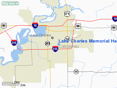
Lake Charles Memorial Heliport |
|
|
Location &
QuickFacts
|
FAA
Information Effective: |
2008-09-25 |
|
Airport
Identifier: |
LA55 |
|
Airport
Status: |
Operational |
|
Longitude/Latitude: |
093-11-50.5520W/30-12-17.7430N
-93.197376/30.204929 (Estimated) |
|
Elevation: |
15 ft / 4.57 m (Estimated) |
|
Land: |
0 acres |
|
From
nearest city: |
2 nautical miles SE of Lake Charles, LA |
|
Location: |
Calcasieu Parish, LA |
|
Magnetic Variation: |
05E (1985) |
Owner & Manager
|
Ownership: |
Privately owned |
|
Owner: |
Lake Charles Memorial Hosp. |
|
Address: |
1701 Oak Pk Blvd
Lake Charles, LA 70601 |
|
Phone
number: |
318-494-3200 |
|
Manager: |
Larry M. Graham, Pres. |
|
Address: |
1701 Oak Pk Blvd
Lake Charles, LA 70601 |
|
Phone number: |
318-494-3200 |
Airport Operations and Facilities
|
Airport
Use: |
Private
MEDICAL. |
|
Wind
indicator: |
Yes |
|
Segmented Circle: |
No |
|
Control
Tower: |
No |
|
Lighting
Schedule: |
PHONE REQ
FOR ROTG BCN AND PERIMETER LGTS CALL 318-494-3036. |
|
Beacon
Color: |
Clear-Green-Yellow (heliport) |
|
Sectional chart: |
Houston |
|
Region: |
ASW - Southwest |
|
Boundary
ARTCC: |
ZHU - Houston |
|
Tie-in
FSS: |
DRI - De Ridder |
|
FSS on
Airport: |
No |
|
FSS Toll
Free: |
1-800-WX-BRIEF |
|
Runway Information
Helipad H1
|
Dimension: |
50 x 50 ft / 15.2 x 15.2 m |
|
Surface: |
CONC, |
|
|
Runway H1
|
Runway
|
|
Traffic
Pattern: |
Left |
Left |
|
Radio Navigation Aids
|
ID |
Type |
Name |
Ch |
Freq |
Var |
Dist |
|
POE |
FAN MARKER |
South |
|
|
07E |
46.5 nm |
|
UX |
NDB |
Sulfy |
|
278.00 |
04E |
11.6 nm |
|
DQU |
NDB |
De Quincy |
|
410.00 |
05E |
19.7 nm |
|
ORG |
NDB |
Orange |
|
211.00 |
05E |
32.1 nm |
|
DR |
NDB |
Idder |
|
385.00 |
04E |
33.7 nm |
|
LRR |
NDB |
Allen Parish |
|
379.00 |
03E |
37.2 nm |
|
ECY |
NDB |
Eunice |
|
263.00 |
02E |
44.3 nm |
|
GUV |
NDB |
Gator |
|
359.00 |
05E |
49.5 nm |
|
BPT |
VOR/DME |
Beaumont |
092X |
114.50 |
07E |
45.3 nm |
|
LCH |
VORTAC |
Lake Charles |
081X |
113.40 |
07E |
6.1 nm |
Lake Charles Memorial Heliport
Address:
Calcasieu Parish, LA
Tel:
318-494-3200
Images
and information placed above are from
http://www.airport-data.com/airport/LA55/
We
thank them for the data!
|
General Info |
| Country |
United
States |
| State |
LOUISIANA |
| FAA ID |
LA55
|
| Latitude |
30-12-17.743N |
|
Longitude |
093-11-50.552W |
|
Elevation |
15 feet
|
| Near
City |
LAKE
CHARLES |
We don't guarantee the information is fresh and accurate. The data may
be wrong or outdated.
For more up-to-date information please refer to other sources.
|
|


