 |
|
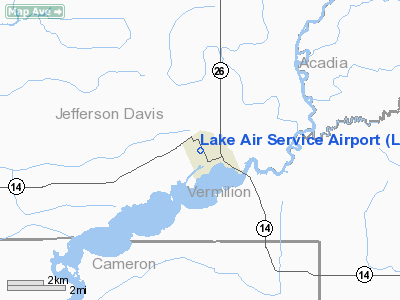
Location &
QuickFacts
|
FAA
Information Effective: |
2008-09-25 |
|
Airport
Identifier: |
LA32 |
|
Airport
Status: |
Operational |
|
Longitude/Latitude: |
092-41-00.8800W/30-05-00.6800N
-92.683578/30.083522 (Estimated) |
|
Elevation: |
11 ft / 3.35 m (Estimated) |
|
Land: |
7 acres |
|
From
nearest city: |
1 nautical miles NW of Lake Arthur, LA |
|
Location: |
Jefferson Davis Parish, LA |
|
Magnetic Variation: |
03E (2000) |
Owner & Manager
|
Ownership: |
Privately owned |
|
Owner: |
Sidney E. Theriot |
|
Address: |
5271 Hwy 14
Lake Arthur, LA 70549 |
|
Phone number: |
337-774-2603 |
|
Manager: |
Wendell Wayne Guillot |
|
Address: |
5445 Hwy 380
Lake Arthur, LA 70549 |
|
Phone number: |
337-774-5645 |
Airport Operations and Facilities
|
Airport Use: |
Private |
|
Wind indicator: |
Yes |
|
Segmented Circle: |
No |
|
Control Tower: |
No |
|
Sectional chart: |
Houston |
|
Region: |
ASW - Southwest |
|
Boundary ARTCC: |
ZHU - Houston |
|
Tie-in FSS: |
DRI - De Ridder |
|
FSS Toll Free: |
1-800-WX-BRIEF |
Airport Services
|
Runway Information
Runway 09/27
|
Dimension: |
3000 x 175 ft / 914.4 x 53.3 m |
|
Surface: |
CONC-TURF,
EAST 1900 FT CONC; REMAINDER TURF. |
|
|
Runway 09
|
Runway 27
|
|
Traffic
Pattern: |
Left |
Left |
|
Obstruction: |
|
22 ft ant, 5280.0 ft from runway |
|
Radio Navigation Aids
|
ID |
Type |
Name |
Ch |
Freq |
Var |
Dist |
|
ECY |
NDB |
Eunice |
|
263.00 |
02E |
31.1 nm |
|
LRR |
NDB |
Allen Parish |
|
379.00 |
03E |
33.5 nm |
|
UX |
NDB |
Sulfy |
|
278.00 |
04E |
38.9 nm |
|
AR |
NDB |
Acadi |
|
269.00 |
03E |
43.4 nm |
|
DQU |
NDB |
De Quincy |
|
410.00 |
05E |
45.8 nm |
|
OPL |
NDB |
St Landry |
|
335.00 |
04E |
45.9 nm |
|
LLA |
VOR/DME |
White Lake |
041X |
110.40 |
04E |
30.0 nm |
|
LCH |
VORTAC |
Lake Charles |
081X |
113.40 |
07E |
22.2 nm |
|
LFT |
VORTAC |
Lafayette |
035X |
109.80 |
03E |
36.5 nm |
Based Aircraft
|
Aircraft based
on field: |
1 |
|
Single Engine
Airplanes: |
1 |
Lake Air Service Airport
Address:
Jefferson Davis Parish, LA
Tel:
337-774-2603, 337-774-5645
Images
and information placed above are from
http://www.airport-data.com/airport/LA32/
We
thank them for the data!
|
General Info |
| Country |
United
States |
| State |
LOUISIANA |
| FAA ID |
LA32
|
| Latitude |
30-05-00.680N |
|
Longitude |
092-41-00.880W |
|
Elevation |
11 feet
|
| Near
City |
LAKE
ARTHUR |
We don't guarantee the information is fresh and accurate. The data may
be wrong or outdated.
For more up-to-date information please refer to other sources.
|
|


