 |
|
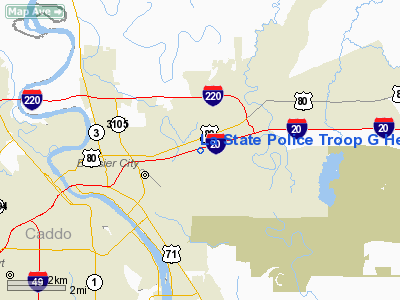
La State Police Troop G Heliport |
Location &
QuickFacts
|
FAA
Information Effective: |
2008-09-25 |
|
Airport
Identifier: |
02LA |
|
Airport
Status: |
Operational |
|
Longitude/Latitude: |
093-39-36.6370W/32-31-52.5440N
-93.660177/32.531262 (Estimated) |
|
Elevation: |
168 ft / 51.21 m (Estimated) |
|
Land: |
0 acres |
|
From
nearest city: |
3 nautical miles E of Bossier City, LA |
|
Location: |
Bossier Parish, LA |
|
Magnetic Variation: |
05E (1985) |
Owner & Manager
|
Ownership: |
Publicly owned |
|
Owner: |
La State Police |
|
Address: |
7919 Independence Blvd A-1
Baton Rouge, LA 70806 |
|
Phone
number: |
225-922-0380 |
|
Manager: |
Brett Mc Cloud |
|
Address: |
7919 Independence Blvd A-1
Baton Rouge, LA 70806 |
|
Phone number: |
225-922-0380 |
Airport Operations and Facilities
|
Airport
Use: |
Private |
|
Wind
indicator: |
No |
|
Segmented Circle: |
No |
|
Control
Tower: |
No |
|
Landing
fee charge: |
No |
|
Sectional chart: |
Houston |
|
Region: |
ASW - Southwest |
|
Boundary
ARTCC: |
ZFW - Fort Worth |
|
Tie-in
FSS: |
DRI - De Ridder |
|
FSS on
Airport: |
No |
|
FSS Toll
Free: |
1-800-WX-BRIEF |
|
Runway Information
Helipad H1
|
Dimension: |
20 x 20 ft / 6.1 x 6.1 m |
|
Surface: |
CONC, |
|
|
Runway H1
|
Runway
|
|
Traffic
Pattern: |
Left |
Left |
|
Radio Navigation Aids
|
ID |
Type |
Name |
Ch |
Freq |
Var |
Dist |
|
MNE |
NDB |
Minden |
|
201.00 |
04E |
19.3 nm |
|
VIV |
NDB |
Vivian |
|
284.00 |
06E |
26.5 nm |
|
SPH |
NDB |
Springhill |
|
375.00 |
05E |
26.6 nm |
|
MSD |
NDB |
Mansfield |
|
414.00 |
04E |
28.6 nm |
|
HMQ |
NDB |
Homer |
|
212.00 |
02E |
36.8 nm |
|
RPF |
NDB |
Carthage |
|
332.00 |
04E |
38.6 nm |
|
ATA |
NDB |
Atlanta |
|
347.00 |
04E |
43.6 nm |
|
AGO |
NDB |
Magnolia |
|
266.00 |
04E |
47.5 nm |
|
CZJ |
NDB |
Amason |
|
341.00 |
04E |
48.9 nm |
|
BAD |
TACAN |
Barksdale |
105X |
|
05E |
1.7 nm |
|
DTN |
VOR |
Downtown |
|
108.60 |
07E |
4.1 nm |
|
EMG |
VORTAC |
Elm Grove |
049X |
111.20 |
07E |
8.5 nm |
|
EIC |
VORTAC |
Belcher |
121X |
117.40 |
07E |
16.3 nm |
|
SHV |
VOT |
Shreveport Regional |
|
108.20 |
|
10.2 nm |
Remarks
-
PRVDD CHIEF SHV
RAPCOM/TOWER AND BAD AFB ARE CONTACTED AND LTR OF AGRMT MADE TO COVER AIR TFC
HANDLING OF HELS USING FAC.
La State Police Troop G Heliport
Address:
Bossier Parish, LA
Tel:
225-922-0380
Images
and information placed above are from
http://www.airport-data.com/airport/02LA/
We
thank them for the data!
|
General Info |
| Country |
United
States |
| State |
LOUISIANA |
| FAA ID |
02LA
|
| Latitude |
32-31-52.544N |
|
Longitude |
093-39-36.637W |
|
Elevation |
168 feet
|
| Near
City |
BOSSIER
CITY |
We don't guarantee the information is fresh and accurate. The data may
be wrong or outdated.
For more up-to-date information please refer to other sources.
|
|


