 |
|
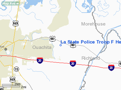
La State Police Troop F Heliport |
Location &
QuickFacts
|
FAA
Information Effective: |
2008-09-25 |
|
Airport
Identifier: |
07LS |
|
Airport
Status: |
Operational |
|
Longitude/Latitude: |
091-59-20.4000W/32-31-05.2000N
-91.989000/32.518111 (Estimated) |
|
Elevation: |
80 ft / 24.38 m (Estimated) |
|
Land: |
0 acres |
|
From
nearest city: |
2 nautical miles E of Monroe, LA |
|
Location: |
Ouachita Parish, LA |
|
Magnetic Variation: |
() |
Owner & Manager
|
Ownership: |
Publicly owned |
|
Owner: |
Louisiana State Police |
|
Address: |
7919 Independence Blvd A-1
Baton Rouge, LA 70806 |
|
Phone
number: |
225-922-0380 |
|
Manager: |
Brett Mc Cloud |
|
Address: |
7919 Independence Blvd A-1
Baton Rouge, LA 70806 |
|
Phone number: |
225-922-0380 |
Airport Operations and Facilities
|
Airport
Use: |
Private |
|
Control
Tower: |
No |
|
Sectional chart: |
Memphis |
|
Region: |
ASW - Southwest |
|
Boundary
ARTCC: |
ZFW - Fort Worth |
|
Tie-in
FSS: |
DRI - De Ridder |
|
FSS Toll
Free: |
1-800-WX-BRIEF |
|
Runway Information
Helipad H1
|
Dimension: |
50 x 50 ft / 15.2 x 15.2 m |
|
Surface: |
CONC, |
|
|
Runway H1
|
Runway
|
|
Traffic
Pattern: |
Left |
Left |
|
Radio Navigation Aids
|
ID |
Type |
Name |
Ch |
Freq |
Var |
Dist |
|
MRK |
NDB |
Molly Ridge |
|
338.00 |
02E |
12.9 nm |
|
BQP |
NDB |
Bastrop |
|
329.00 |
03E |
15.2 nm |
|
ROQ |
NDB |
Ruston |
|
368.00 |
03E |
30.8 nm |
|
TUF |
NDB |
Stuckey |
|
350.00 |
03E |
31.2 nm |
|
JBL |
NDB |
Hodge |
|
256.00 |
04E |
42.0 nm |
|
BLE |
NDB |
Lake Providence |
|
278.00 |
03E |
44.6 nm |
|
IFJ |
NDB |
Winnfield |
|
402.00 |
04E |
47.6 nm |
|
SWB |
VOR/DME |
Sawmill |
84Y |
113.75 |
02E |
47.9 nm |
|
MLU |
VORTAC |
Monroe |
119X |
117.20 |
03E |
2.4 nm |
La State Police Troop F Heliport
Address:
Ouachita Parish, LA
Tel:
225-922-0380
We don't guarantee the information is fresh and accurate. The data may
be wrong or outdated.
For more up-to-date information please refer to other sources.
|
|


