 |
|
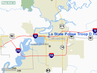
La State Police Troop D Heliport |
Location &
QuickFacts
|
FAA
Information Effective: |
2008-09-25 |
|
Airport
Identifier: |
5LA8 |
|
Airport
Status: |
Operational |
|
Longitude/Latitude: |
093-12-45.5520W/30-14-07.7400N
-93.212653/30.235483 (Estimated) |
|
Elevation: |
15 ft / 4.57 m (Estimated) |
|
Land: |
0 acres |
|
From
nearest city: |
1 nautical miles SE of Lake Charles, LA |
|
Location: |
Calcasieu Parish, LA |
|
Magnetic Variation: |
05E (1985) |
Owner & Manager
|
Ownership: |
Publicly owned |
|
Owner: |
La State Police |
|
Address: |
7919 Independence Blvd A-1
Baton Rouge, LA 70806 |
|
Phone
number: |
225-922-0380 |
|
Manager: |
Brett Mc Cloud |
|
Address: |
7919 Independence Blvd A-1
Baton Rouge, LA 70806 |
|
Phone number: |
225-922-0380 |
Airport Operations and Facilities
|
Airport
Use: |
Private |
|
Segmented Circle: |
No |
|
Control
Tower: |
No |
|
Sectional chart: |
Houston |
|
Region: |
ASW - Southwest |
|
Boundary
ARTCC: |
ZHU - Houston |
|
Tie-in
FSS: |
DRI - De Ridder |
|
FSS Toll
Free: |
1-800-WX-BRIEF |
|
Runway Information
Helipad H1
|
Dimension: |
12 x 12 ft / 3.7 x 3.7 m |
|
Surface: |
CONC, |
|
|
Runway H1
|
Runway
|
|
Traffic
Pattern: |
Left |
Left |
|
Radio Navigation Aids
|
ID |
Type |
Name |
Ch |
Freq |
Var |
Dist |
|
POE |
FAN MARKER |
South |
|
|
07E |
44.7 nm |
|
UX |
NDB |
Sulfy |
|
278.00 |
04E |
11.0 nm |
|
DQU |
NDB |
De Quincy |
|
410.00 |
05E |
17.8 nm |
|
DR |
NDB |
Idder |
|
385.00 |
04E |
31.7 nm |
|
ORG |
NDB |
Orange |
|
211.00 |
05E |
31.9 nm |
|
LRR |
NDB |
Allen Parish |
|
379.00 |
03E |
36.5 nm |
|
ECY |
NDB |
Eunice |
|
263.00 |
02E |
44.2 nm |
|
GUV |
NDB |
Gator |
|
359.00 |
05E |
47.7 nm |
|
BPT |
VOR/DME |
Beaumont |
092X |
114.50 |
07E |
45.3 nm |
|
LCH |
VORTAC |
Lake Charles |
081X |
113.40 |
07E |
7.9 nm |
La State Police Troop D Heliport
Address:
Calcasieu Parish, LA
Tel:
225-922-0380
We don't guarantee the information is fresh and accurate. The data may
be wrong or outdated.
For more up-to-date information please refer to other sources.
|
|


