 |
|
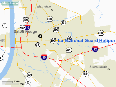
La National Guard Heliport |
Location &
QuickFacts
|
FAA
Information Effective: |
2008-09-25 |
|
Airport
Identifier: |
04LS |
|
Airport
Status: |
Operational |
|
Longitude/Latitude: |
091-06-19.0000W/30-26-46.0000N
-91.105278/30.446111 (Estimated) |
|
Elevation: |
52 ft / 15.85 m (Estimated) |
|
Land: |
0 acres |
|
From
nearest city: |
5 nautical miles E of Baton Rouge, LA |
|
Location: |
East Baton Rouge Parish, LA |
|
Magnetic
Variation: |
() |
Owner & Manager
|
Ownership: |
Privately owned |
|
Owner: |
Louisiana State Police |
|
Address: |
7919 Independence Blvd A-1
Baton Rouge, LA 70806 |
|
Phone
number: |
225-922-0380 |
|
Manager: |
Brett Mc Cloud |
|
Address: |
7919 Independence Blvd A-1
Baton Rouge, LA 70806 |
|
Phone number: |
225-922-0380 |
Airport Operations and Facilities
|
Airport
Use: |
Private |
|
Segmented Circle: |
No |
|
Control
Tower: |
No |
|
Sectional chart: |
Houston |
|
Region: |
ASW - Southwest |
|
Boundary
ARTCC: |
ZHU - Houston |
|
Tie-in
FSS: |
DRI - De Ridder |
|
FSS Toll
Free: |
1-800-WX-BRIEF |
|
Runway Information
Helipad H1
|
Dimension: |
60 x 60 ft / 18.3 x 18.3 m |
|
Surface: |
CONC, Good Condition |
|
|
Runway H1
|
Runway
|
|
Traffic
Pattern: |
Left |
Left |
|
Radio Navigation Aids
|
ID |
Type |
Name |
Ch |
Freq |
Var |
Dist |
|
HZ |
NDB |
Hazer |
|
356.00 |
04E |
22.8 nm |
|
MS |
NDB |
Kinte |
|
338.00 |
03E |
44.5 nm |
|
PTN |
NDB |
Patterson |
|
245.00 |
01E |
45.6 nm |
|
AR |
NDB |
Acadi |
|
269.00 |
03E |
49.2 nm |
|
HMU |
VOR |
Hammond |
|
109.60 |
03E |
35.9 nm |
|
RQR |
VOR/DME |
Reserve |
045X |
110.80 |
02E |
34.4 nm |
|
BTR |
VORTAC |
Baton Rouge |
112X |
116.50 |
06E |
10.1 nm |
|
LFT |
VORTAC |
Lafayette |
035X |
109.80 |
03E |
48.5 nm |
|
TBD |
VORTAC |
Tibby |
057X |
112.00 |
02E |
49.1 nm |
La National Guard Heliport
Address:
East Baton Rouge Parish, LA
Tel:
225-922-0380
We don't guarantee the information is fresh and accurate. The data may
be wrong or outdated.
For more up-to-date information please refer to other sources.
|
|


