 |
|
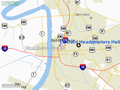
La Dotd Headquarters Heliport |
|
|
Location &
QuickFacts
|
FAA
Information Effective: |
2008-09-25 |
|
Airport
Identifier: |
27LS |
|
Airport
Status: |
Operational |
|
Longitude/Latitude: |
091-10-35.0000W/30-27-33.0000N
-91.176389/30.459167 (Estimated) |
|
Elevation: |
65 ft / 19.81 m (Estimated) |
|
Land: |
2 acres
EST. |
|
From
nearest city: |
1 nautical miles SW of Baton Rouge, LA |
|
Location: |
East Baton Rouge Parish, LA |
|
Magnetic Variation: |
04E (1985) |
Owner & Manager
|
Ownership: |
Publicly owned |
|
Owner: |
State Of Louisiana |
|
Address: |
P.o. Box 94245
Baton Rouge, LA 70804-9245 |
|
Phone
number: |
225-274-4125 |
|
Manager: |
David A Smith
OTHER POINT OF CONTACT: JAMES P JONES 225-274-4141 |
|
Address: |
P.o. Box 94245
Baton Rouge, LA 70804-9245 |
|
Phone number: |
504-358-9148 |
Airport Operations and Facilities
|
Airport
Use: |
Private |
|
Wind
indicator: |
Yes |
|
Segmented Circle: |
No |
|
Control
Tower: |
No |
|
Lighting
Schedule: |
RDO-CTL
ACTVT PERIMETER LGTS - 122.8. |
|
Sectional chart: |
Houston |
|
Region: |
ASW - Southwest |
|
Boundary
ARTCC: |
ZHU - Houston |
|
Tie-in
FSS: |
DRI - De Ridder |
|
FSS Toll
Free: |
1-800-WX-BRIEF |
|
Runway Information
Helipad H1
|
Dimension: |
50 x 50 ft / 15.2 x 15.2 m |
|
Surface: |
CONC, Good Condition |
|
|
Runway H1
|
Runway
|
|
Traffic
Pattern: |
Left |
Left |
|
Markings: |
Basic, Good Condition |
, |
|
Radio Navigation Aids
|
ID |
Type |
Name |
Ch |
Freq |
Var |
Dist |
|
HZ |
NDB |
Hazer |
|
356.00 |
04E |
19.3 nm |
|
PTN |
NDB |
Patterson |
|
245.00 |
01E |
45.5 nm |
|
AR |
NDB |
Acadi |
|
269.00 |
03E |
46.8 nm |
|
MS |
NDB |
Kinte |
|
338.00 |
03E |
48.0 nm |
|
OPL |
NDB |
St Landry |
|
335.00 |
04E |
49.2 nm |
|
HMU |
VOR |
Hammond |
|
109.60 |
03E |
39.5 nm |
|
RQR |
VOR/DME |
Reserve |
045X |
110.80 |
02E |
37.8 nm |
|
BTR |
VORTAC |
Baton Rouge |
112X |
116.50 |
06E |
6.3 nm |
|
LFT |
VORTAC |
Lafayette |
035X |
109.80 |
03E |
45.2 nm |
Remarks
-
CONTACT COMMANDER
PROTECTIVE SERVICES AT 225-342-5853 FOR PRIOR PERMISSION TO LAND.
-
PROCEDURE TO
RESTRICT PEDESTRIAN ACCESS DURING HELICOPTER OPERATIONS IN EFFECT.
La Dotd Headquarters Heliport
Address:
East Baton Rouge Parish, LA
Tel:
225-274-4125,
504-358-9148
Images
and information placed above are from
http://www.airport-data.com/airport/27LS/
We
thank them for the data!
|
General Info |
| Country |
United
States |
| State |
LOUISIANA |
| FAA ID |
27LS
|
| Latitude |
30-27-33.000N |
|
Longitude |
091-10-35.000W |
|
Elevation |
65 feet
|
| Near
City |
BATON
ROUGE |
We don't guarantee the information is fresh and accurate. The data may
be wrong or outdated.
For more up-to-date information please refer to other sources.
|
|


