 |
|
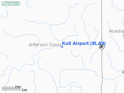
Location &
QuickFacts
|
FAA
Information Effective: |
2008-09-25 |
|
Airport
Identifier: |
8LA9 |
|
Airport
Status: |
Operational |
|
Longitude/Latitude: |
092-44-40.5170W/30-21-25.7350N
-92.744588/30.357149 (Estimated) |
|
Elevation: |
40 ft / 12.19 m (Surveyed) |
|
Land: |
0 acres |
|
From
nearest city: |
8 nautical miles NE of Welsh, LA |
|
Location: |
Jefferson Davis Parish, LA |
|
Magnetic Variation: |
04E (1985) |
Owner & Manager
|
Ownership: |
Privately owned |
|
Address: |
|
|
Manager: |
Cecil Compton |
|
Address: |
Rt 1, Box 411
Jennings, LA 70546 |
|
Phone number: |
318-584-2587 |
Airport Operations and Facilities
|
Airport Use: |
Private |
|
Wind indicator: |
No |
|
Segmented Circle: |
No |
|
Control Tower: |
No |
|
Landing fee charge: |
No |
|
Sectional chart: |
Houston |
|
Region: |
ASW - Southwest |
|
Boundary ARTCC: |
ZHU - Houston |
|
Tie-in FSS: |
DRI - De Ridder |
|
FSS on Airport: |
No |
|
FSS Toll Free: |
1-800-WX-BRIEF |
Airport Services
|
Airframe
Repair: |
NONE |
|
Power
Plant Repair: |
NONE |
|
Runway
Information
Runway E/W
|
Dimension: |
2600 x 185 ft / 792.5 x 56.4 m |
|
Surface: |
TURF, |
|
|
Runway E
|
Runway W
|
|
Traffic
Pattern: |
Left |
Left |
|
Radio Navigation Aids
|
ID |
Type |
Name |
Ch |
Freq |
Var |
Dist |
|
POE |
FAN MARKER |
South |
|
|
07E |
43.2 nm |
|
LRR |
NDB |
Allen Parish |
|
379.00 |
03E |
17.3 nm |
|
ECY |
NDB |
Eunice |
|
263.00 |
02E |
19.6 nm |
|
UX |
NDB |
Sulfy |
|
278.00 |
04E |
36.4 nm |
|
DQU |
NDB |
De Quincy |
|
410.00 |
05E |
37.7 nm |
|
OPL |
NDB |
St Landry |
|
335.00 |
04E |
38.0 nm |
|
DR |
NDB |
Idder |
|
385.00 |
04E |
38.7 nm |
|
BWK |
NDB |
Bunkie |
|
397.00 |
03E |
40.4 nm |
|
GUV |
NDB |
Gator |
|
359.00 |
05E |
46.3 nm |
|
LLA |
VOR/DME |
White Lake |
041X |
110.40 |
04E |
46.0 nm |
|
LCH |
VORTAC |
Lake Charles |
081X |
113.40 |
07E |
22.8 nm |
|
LFT |
VORTAC |
Lafayette |
035X |
109.80 |
03E |
40.3 nm |
Koll Airport
Address:
Jefferson Davis Parish, LA
Tel:
318-584-2587
Images
and information placed above are from
http://www.airport-data.com/airport/8LA9/
We
thank them for the data!
|
General Info |
| Country |
United
States |
| State |
LOUISIANA |
| FAA ID |
8LA9
|
| Latitude |
30-21-25.735N |
|
Longitude |
092-44-40.517W |
|
Elevation |
40 feet
|
| Near
City |
WELSH
|
We don't guarantee the information is fresh and accurate. The data may
be wrong or outdated.
For more up-to-date information please refer to other sources.
|
|


