 |
|
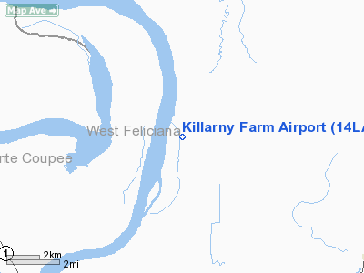
Location &
QuickFacts
|
FAA
Information Effective: |
2008-09-25 |
|
Airport
Identifier: |
14LA |
|
Airport
Status: |
Operational |
|
Longitude/Latitude: |
091-30-29.4170W/30-50-27.6510N
-91.508171/30.841014 (Estimated) |
|
Elevation: |
53 ft / 16.15 m (Estimated) |
|
Land: |
0 acres |
|
From
nearest city: |
8 nautical miles NW of St Francisville, LA |
|
Location: |
West Feliciana Parish, LA |
|
Magnetic Variation: |
04E (1985) |
Owner & Manager
|
Ownership: |
Privately owned |
|
Owner: |
Louisiana Land Investment, Nv |
|
Address: |
Po Box 607
Farmersville, TX 75442 |
|
Manager: |
Colleen Aycock |
|
Address: |
Po Box 607
Farmersville, TX 75442 |
Airport
Operations and Facilities
|
Airport
Use: |
Private |
|
Wind
indicator: |
No |
|
Segmented Circle: |
No |
|
Control
Tower: |
No |
|
Landing
fee charge: |
No |
|
Sectional chart: |
Houston |
|
Region: |
ASW - Southwest |
|
Boundary
ARTCC: |
ZHU - Houston |
|
Tie-in
FSS: |
DRI - De Ridder |
|
FSS on
Airport: |
No |
|
FSS Toll
Free: |
1-800-WX-BRIEF |
|
Runway
Information
Runway N/S
|
Dimension: |
2900 x 40 ft / 883.9 x 12.2 m |
|
Surface: |
TURF, |
|
|
Runway N
|
Runway S
|
|
Traffic
Pattern: |
Left |
Left |
|
Obstruction: |
40 ft trees, 2500.0 ft from runway |
40 ft trees, 1400.0 ft from runway |
|
Radio Navigation Aids
|
ID |
Type |
Name |
Ch |
Freq |
Var |
Dist |
|
HZ |
NDB |
Hazer |
|
356.00 |
04E |
12.5 nm |
|
OPL |
NDB |
St Landry |
|
335.00 |
04E |
32.5 nm |
|
MKV |
NDB |
Marksville |
|
347.00 |
02E |
32.9 nm |
|
BWK |
NDB |
Bunkie |
|
397.00 |
03E |
37.5 nm |
|
HEZ |
VOR/DME |
Natchez |
037X |
110.00 |
03E |
47.9 nm |
|
BTR |
VORTAC |
Baton Rouge |
112X |
116.50 |
06E |
24.1 nm |
|
LFT |
VORTAC |
Lafayette |
035X |
109.80 |
03E |
46.3 nm |
Remarks
-
E111 PRVDD APCH
SLOPES TO LNDG AREA ARE MAINTD IN ACCORDANCE WITH FAR PART 77.
Killarny Farm Airport
Address:
West Feliciana Parish, LA
Tel:
Images
and information placed above are from
http://www.airport-data.com/airport/14LA/
We
thank them for the data!
|
General Info |
| Country |
United
States |
| State |
LOUISIANA |
| FAA ID |
14LA
|
| Latitude |
30-50-27.651N |
|
Longitude |
091-30-29.417W |
|
Elevation |
53 feet
|
| Near
City |
ST
FRANCISVILLE |
We don't guarantee the information is fresh and accurate. The data may
be wrong or outdated.
For more up-to-date information please refer to other sources.
|
|


