 |
|
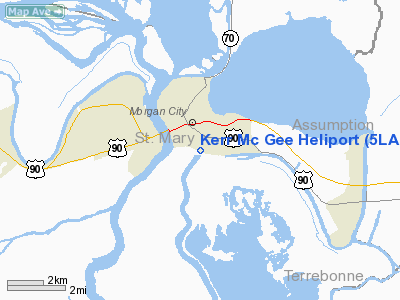
Location &
QuickFacts
|
FAA
Information Effective: |
2008-09-25 |
|
Airport
Identifier: |
5LA3 |
|
Airport
Status: |
Operational |
|
Longitude/Latitude: |
091-11-35.3700W/29-41-14.7500N
-91.193158/29.687431 (Estimated) |
|
Elevation: |
6 ft / 1.83 m (Estimated) |
|
Land: |
0 acres |
|
From
nearest city: |
0 nautical miles SE of Morgan City, LA |
|
Location: |
St Mary Parish, LA |
|
Magnetic Variation: |
04E (1985) |
Owner & Manager
|
Ownership: |
Privately owned |
|
Owner: |
Kerr Mcgee Morgan City |
|
Address: |
P.o.drawer 2149
Morgan City, LA 70380 |
|
Phone
number: |
504-380-8000 |
|
Manager: |
Transportation Manager |
|
Address: |
P.o.drawer 2149
Morgan City, LA 70380 |
|
Phone number: |
504-380-8000 |
Airport Operations and Facilities
|
Airport
Use: |
Private |
|
Wind
indicator: |
Yes |
|
Segmented Circle: |
No |
|
Control
Tower: |
No |
|
Lighting
Schedule: |
PHONE REQ
FOR PERIMETER LGTS CALL 504-380-8000. |
|
Sectional chart: |
Houston |
|
Region: |
ASW - Southwest |
|
Boundary ARTCC: |
ZHU - Houston |
|
Tie-in FSS: |
DRI - De Ridder |
|
FSS on Airport: |
No |
|
FSS Toll Free: |
1-800-WX-BRIEF |
Airport
Communications
|
Runway Information
Helipad H1
|
Dimension: |
40 x 40 ft / 12.2 x 12.2 m |
|
Surface: |
CONC, |
|
|
Runway H1
|
Runway
|
|
Traffic
Pattern: |
Left |
Left |
|
Helipad H2
|
Dimension: |
30 x 30 ft / 9.1 x 9.1 m |
|
Surface: |
CONC, |
|
|
Runway H2
|
Runway
|
|
Traffic
Pattern: |
Left |
Left |
|
Helipad H3
|
Dimension: |
30 x 30 ft / 9.1 x 9.1 m |
|
Surface: |
CONC, |
|
|
Runway H3
|
Runway
|
|
Traffic
Pattern: |
Left |
Left |
|
Helipad H4
|
Dimension: |
40 x 40 ft / 12.2 x 12.2 m |
|
Surface: |
CONC, |
|
|
Runway H4
|
Runway
|
|
Traffic
Pattern: |
Left |
Left |
|
Radio Navigation Aids
|
ID |
Type |
Name |
Ch |
Freq |
Var |
Dist |
|
PTN |
NDB |
Patterson |
|
245.00 |
01E |
7.7 nm |
|
AR |
NDB |
Acadi |
|
269.00 |
03E |
38.5 nm |
|
MS |
NDB |
Kinte |
|
338.00 |
03E |
46.1 nm |
|
RQR |
VOR/DME |
Reserve |
045X |
110.80 |
02E |
39.6 nm |
|
TBD |
VORTAC |
Tibby |
057X |
112.00 |
02E |
19.1 nm |
|
BTR |
VORTAC |
Baton Rouge |
112X |
116.50 |
06E |
48.2 nm |
Remarks
-
(A30-H1.)
INGRESS/EGRESS E/W/S.
Kerr Mc Gee Heliport
Address:
St Mary Parish, LA
Tel:
504-380-8000
Images
and information placed above are from
http://www.airport-data.com/airport/5LA3/
We
thank them for the data!
|
General Info |
| Country |
United
States |
| State |
LOUISIANA |
| FAA ID |
5LA3
|
| Latitude |
29-41-14.750N |
|
Longitude |
091-11-35.370W |
|
Elevation |
6 feet
|
| Near
City |
MORGAN
CITY |
We don't guarantee the information is fresh and accurate. The data may
be wrong or outdated.
For more up-to-date information please refer to other sources.
|
|


