 |
|
Location &
QuickFacts
|
FAA
Information Effective: |
2008-09-25 |
|
Airport
Identifier: |
62LA |
|
Airport
Status: |
Operational |
|
Longitude/Latitude: |
092-12-49.4570W/30-04-30.7360N
-92.213738/30.075204 (Estimated) |
|
Elevation: |
21 ft / 6.40 m (Surveyed) |
|
Land: |
0 acres |
|
From
nearest city: |
6 nautical miles SW of Maurice, LA |
|
Location: |
Vermilion Parish, LA |
|
Magnetic Variation: |
04E (1985) |
Owner & Manager
|
Ownership: |
Privately owned |
|
Owner: |
Ken L. Guidry |
|
Address: |
1006 Bernard St.
Abbeville, LA 70510 |
|
Phone number: |
318-893-4313 |
|
Manager: |
Ken L. Guidry |
|
Address: |
1006 Bernard St.
Abbeville, LA 70510 |
|
Phone number: |
318-893-4313 |
Airport
Operations and Facilities
|
Airport
Use: |
Private |
|
Wind
indicator: |
Yes |
|
Segmented Circle: |
No |
|
Control
Tower: |
No |
|
Landing
fee charge: |
No |
|
Sectional chart: |
Houston |
|
Region: |
ASW - Southwest |
|
Boundary
ARTCC: |
ZHU - Houston |
|
Tie-in
FSS: |
DRI - De Ridder |
|
FSS on Airport: |
No |
|
FSS Toll Free: |
1-800-WX-BRIEF |
Airport Services
|
Airframe
Repair: |
MAJOR |
|
Power
Plant Repair: |
MAJOR |
|
Runway Information
Runway 17/35
|
Dimension: |
2600 x 30 ft / 792.5 x 9.1 m |
|
Surface: |
ASPH, |
|
|
Runway 17 |
Runway 35 |
|
Traffic
Pattern: |
Left |
Left |
|
Obstruction: |
26 ft pline, 50.0 ft from runway |
|
|
Radio Navigation Aids
|
ID |
Type |
Name |
Ch |
Freq |
Var |
Dist |
|
AR |
NDB |
Acadi |
|
269.00 |
03E |
19.6 nm |
|
ECY |
NDB |
Eunice |
|
263.00 |
02E |
31.6 nm |
|
OPL |
NDB |
St Landry |
|
335.00 |
04E |
35.4 nm |
|
LRR |
NDB |
Allen Parish |
|
379.00 |
03E |
42.0 nm |
|
BWK |
NDB |
Bunkie |
|
397.00 |
03E |
47.5 nm |
|
LLA |
VOR/DME |
White Lake |
041X |
110.40 |
04E |
26.1 nm |
|
LFT |
VORTAC |
Lafayette |
035X |
109.80 |
03E |
13.5 nm |
|
LCH |
VORTAC |
Lake Charles |
081X |
113.40 |
07E |
46.5 nm |
Based Aircraft
|
Aircraft based
on field: |
17 |
|
Single Engine
Airplanes: |
12 |
|
Ultralights: |
5 |
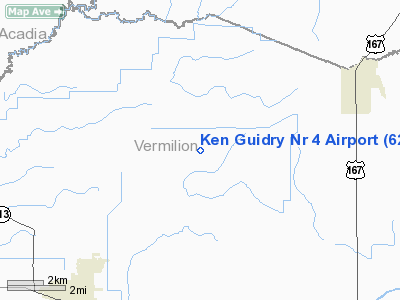
Ken Guidry Nr 4 Airport
Address:
Vermilion Parish, LA
Tel:
318-893-4313
Images
and information placed above are from
http://www.airport-data.com/airport/62LA/
We
thank them for the data!
|
General Info |
| Country |
United
States |
| State |
LOUISIANA |
| FAA ID |
62LA
|
| Latitude |
30-04-30.736N |
|
Longitude |
092-12-49.457W |
|
Elevation |
21 feet
|
| Near
City |
MAURICE
|
We don't guarantee the information is fresh and accurate. The data may
be wrong or outdated.
For more up-to-date information please refer to other sources.
|
|


