 |
|
|
|
|
|
Location &
QuickFacts
|
FAA
Information Effective: |
2008-09-25 |
|
Airport
Identifier: |
9M6 |
|
Airport
Status: |
Operational |
|
Longitude/Latitude: |
091-24-14.0620W/32-50-57.1690N
-91.403906/32.849214 (Estimated) |
|
Elevation: |
112 ft / 34.14 m (Surveyed) |
|
Land: |
28 acres |
|
From
nearest city: |
1 nautical miles SW of Oak Grove, LA |
|
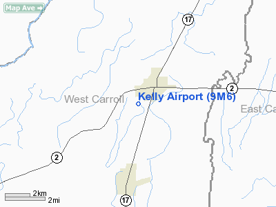
Location: |
West Carroll Parish, LA |
|
Magnetic Variation: |
03E (1985) |
Owner & Manager
|
Ownership: |
Publicly owned |
|
Owner: |
West Carroll Parish |
|
Address: |
W. Carroll Parish Police Jury
Oak Grove, LA 71263 |
|
Phone
number: |
318-428-3390 |
|
Manager: |
Dennis Bolton |
|
Address: |
P. O. Box 1473
Oak Grove, LA 71263 |
|
Phone number: |
318-428-3129 |
Airport Operations and Facilities
|
Airport
Use: |
Open to public |
|
Wind
indicator: |
Yes |
|
Segmented Circle: |
Yes |
|
Control
Tower: |
No |
|
Lighting
Schedule: |
DUSK-DAWN
MIRL RY 18/36 PRESET LOW INTST; TO INCR INTST & ACTVT REIL RYS 18 & 36
- CTAF. |
|
Beacon
Color: |
Clear-Green (lighted land airport) |
|
Landing
fee charge: |
No |
|
Sectional chart: |
Memphis |
|
Region: |
ASW - Southwest |
|
Boundary
ARTCC: |
ZME - Memphis |
|
Tie-in
FSS: |
DRI - De Ridder |
|
FSS on
Airport: |
No |
|
FSS Toll
Free: |
1-800-WX-BRIEF |
|
NOTAMs
Facility: |
DRI (NOTAM-d service avaliable) |
|
Federal Agreements: |
NGY |
Airport Communications
Airport Services
|
Fuel
available: |
100LLA
FUEL AVBL 24 HRS WITH CREDIT CARD. |
|
Airframe
Repair: |
MAJOR |
|
Power
Plant Repair: |
MAJOR |
|
Runway Information
Runway 18/36
|
Dimension: |
3000 x 60 ft / 914.4 x 18.3 m |
|
Surface: |
ASPH, Good Condition |
|
Weight Limit: |
Single wheel: 10000 lbs. |
|
Edge Lights: |
Medium |
|
|
Runway 18
|
Runway 36
|
|
Longitude: |
091-24-12.7160W |
091-24-15.4070W |
|
Latitude: |
32-51-11.9660N |
32-50-42.3710N |
|
Elevation: |
112.00 ft |
0.00 ft |
|
Alignment: |
127 |
4 |
|
Traffic
Pattern: |
Left |
Left |
|
Markings: |
Non-precision instrument, Fair Condition
MARKINGS SLIGHTLY FADED |
Non-precision instrument, Fair Condition
MARKINGS SLIGHTLY FADED |
|
Crossing
Height: |
47.00 ft |
50.00 ft |
|
Displaced
threshold: |
250.00 ft |
0.00 ft |
|
VASI: |
2-light PAPI on left side |
2-light PAPI on left side |
|
Visual
Glide Angle: |
3.75° |
3.00° |
|
Runway End
Identifier: |
Yes |
Yes |
|
Obstruction: |
40 ft trees, 809.0 ft from runway, 174 ft right of
centerline, 15:1 slope to clear
APCH SLOPE 26:1 TO DSPLCD THLD. |
70 ft trees, 3000.0 ft from runway, 40:1 slope to clear |
|
Radio Navigation Aids
|
ID |
Type |
Name |
Ch |
Freq |
Var |
Dist |
|
BLE |
NDB |
Lake Providence |
|
278.00 |
03E |
10.9 nm |
|
BQP |
NDB |
Bastrop |
|
329.00 |
03E |
24.9 nm |
|
MRK |
NDB |
Molly Ridge |
|
338.00 |
02E |
32.5 nm |
|
MTQ |
NDB |
Metcalf |
|
359.00 |
03E |
40.6 nm |
|
TV |
NDB |
Savry |
|
344.00 |
02E |
41.0 nm |
|
VKS |
NDB |
Vicksburg |
|
382.00 |
03E |
44.2 nm |
|
MON |
VOR/DME |
Monticello |
053X |
111.60 |
04E |
45.6 nm |
|
GLH |
VOR/DME |
Greenville |
039X |
110.20 |
04E |
45.7 nm |
|
MLU |
VORTAC |
Monroe |
119X |
117.20 |
03E |
37.7 nm |
Remarks
-
TWY OFF APCH END
OF RY 18.
Based Aircraft
|
Aircraft based
on field: |
7 |
|
Single Engine
Airplanes: |
5 |
|
Ultralights: |
2 |
Operational Statistics
Time Period: 2006-10-18 - 2007-10-17
|
Aircraft
Operations: |
154/Week |
|
General
Aviation Local: |
37.5% |
|
General
Aviation Itinerant: |
62.5% |
Kelly Airport
Address:
West Carroll Parish, LA
Tel:
318-428-3390,
318-428-3129
Images
and information placed above are from
http://www.airport-data.com/airport/9M6/
We
thank them for the data!
|
General Info |
| Country |
United
States |
| State |
LOUISIANA |
| FAA ID |
9M6
|
| Latitude |
32-50-57.169N |
|
Longitude |
091-24-14.062W |
|
Elevation |
112 feet
|
| Near
City |
OAK
GROVE |
We don't guarantee the information is fresh and accurate. The data may
be wrong or outdated.
For more up-to-date information please refer to other sources.
|
|


