 |
|
|
|
|
|
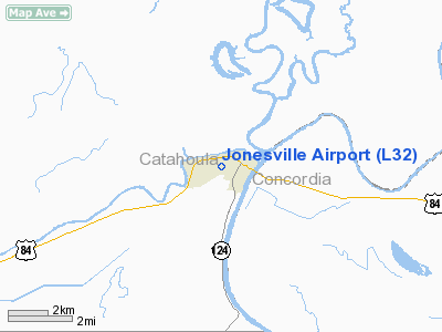
Location & QuickFacts
|
FAA Information Effective: |
2008-09-25 |
|
Airport Identifier: |
L32 |
|
Airport Status: |
Operational |
|
Longitude/Latitude: |
091-49-45.4580W/31-37-30.6140N
-91.829294/31.625171 (Estimated) |
|
Elevation: |
56 ft / 17.07 m (Surveyed) |
|
Land: |
36 acres |
|
From nearest city: |
0 nautical miles W of Jonesville, LA |
|
Location: |
Catahoula Parish, LA |
|
Magnetic Variation: |
04E (1985) |
Owner & Manager
|
Ownership: |
Publicly owned |
|
Owner: |
Town Of Jonesville |
|
Address: |
Box 428
Jonesville, LA 71343 |
|
Phone number: |
318-339-8596 |
|
Manager: |
Pat Mc Caughey |
|
Address: |
503 Airport Road, Po Box 116
Jonesville, LA 71343 |
|
Phone number: |
318-339-4747
OR 318-339-8298. |
Airport Operations and
Facilities
|
Airport Use: |
Open to public |
|
Wind indicator: |
Yes |
|
Segmented Circle: |
No |
|
Control Tower: |
No |
|
Lighting Schedule: |
DUSK-DAWN
ACTVT MIRL RY 06/24 - 122.8. |
|
Beacon Color: |
Clear-Green (lighted land airport) |
|
Landing fee charge: |
No |
|
Sectional chart: |
Houston |
|
Region: |
ASW - Southwest |
|
Boundary ARTCC: |
ZHU - Houston |
|
Tie-in FSS: |
DRI - De Ridder |
|
FSS on Airport: |
No |
|
FSS Toll Free: |
1-800-WX-BRIEF |
|
NOTAMs Facility: |
DRI (NOTAM-d service avaliable) |
|
Federal Agreements: |
N |
Airport Communications
Airport Services
|
Fuel available: |
100LL |
|
Bottled Oxygen: |
NONE |
|
Bulk Oxygen: |
NONE |
|
Runway Information
Runway 06/24
|
Dimension: |
3000 x 75 ft / 914.4 x 22.9 m |
|
Surface: |
ASPH, |
|
Weight Limit: |
Single wheel: 16000 lbs. |
|
Edge Lights: |
Medium |
|
|
Runway 06
|
Runway 24
|
|
Traffic
Pattern: |
Left |
Left |
|
Markings: |
Non-precision instrument, Good Condition |
Non-precision instrument, Good Condition |
|
Crossing
Height: |
20.00 ft |
20.00 ft |
|
VASI: |
2-box SAVASI on left side
SAVASI OTS INDEFLY. |
2-box SAVASI on left side
SAVASI OTS INDEFLY. |
|
Visual
Glide Angle: |
4.00° |
4.00° |
|
Obstruction: |
40 ft trees, 415.0 ft from runway, 135 ft right of centerline, 5:1 slope
to clear |
60 ft trees, 555.0 ft from runway, 5:1 slope to clear |
|
Radio Navigation Aids
|
ID |
Type |
Name |
Ch |
Freq |
Var |
Dist |
|
HAH |
NDB |
Natchez-adams County |
|
388.00 |
03E |
27.7 nm |
|
MKV |
NDB |
Marksville |
|
347.00 |
02E |
34.2 nm |
|
IFJ |
NDB |
Winnfield |
|
402.00 |
04E |
46.9 nm |
|
MRK |
NDB |
Molly Ridge |
|
338.00 |
02E |
47.1 nm |
|
HEZ |
VOR/DME |
Natchez |
037X |
110.00 |
03E |
27.1 nm |
|
SWB |
VOR/DME |
Sawmill |
84Y |
113.75 |
02E |
48.1 nm |
|
AEX |
VORTAC |
Alexandria |
108X |
116.10 |
03E |
41.0 nm |
Remarks
-
RY 06/24
TREES BOTH SIDES OF RY PENETRATE TRANSITION SLOPES.
-
RY 06/24
DRAINAGE DITCH ON BOTH SIDES OF RY; 120 FT FM CNTRLN ON WEST END & 150 FT FM
CNTRLN ON EAST END.
Based Aircraft
|
Aircraft based
on field: |
7 |
|
Single Engine
Airplanes: |
7 |
Operational Statistics
Time Period: 2007-02-20 - 2008-02-19
|
Aircraft
Operations: |
94/Day |
|
General
Aviation Local: |
73.5% |
|
General
Aviation Itinerant: |
26.5% |
Jonesville Airport
Address:
Catahoula Parish, LA
Tel:
318-339-8596,
318-339-4747, 318-339-8298
Images
and information placed above are from
http://www.airport-data.com/airport/L32/
We
thank them for the data!
|
General Info |
| Country |
United
States |
| State |
LOUISIANA |
| FAA ID |
L32
|
| Latitude |
31-37-30.614N |
|
Longitude |
091-49-45.458W |
|
Elevation |
56 feet
|
| Near
City |
JONESVILLE |
We don't guarantee the information is fresh and accurate. The data may
be wrong or outdated.
For more up-to-date information please refer to other sources.
|
|


