 |
|
| Jonesboro Airport |
| IATA: none â ICAO: none â FAA LID: F88 |
| Summary |
| Airport type |
Public |
| Owner |
City of Jonesboro |
| Serves |
Jonesboro, Louisiana |
| Elevation AMSL |
256 ft / 78 m |
| Coordinates |
32°12â²07â³N 092°43â²59â³W / 32.20194°N 92.73306°W / 32.20194; -92.73306 |
| Runways |
| Direction |
Length |
Surface |
| ft |
m |
| 17/35 |
3,203 |
976 |
Asphalt |
| Statistics (2009) |
| Aircraft operations |
24,000 |
| Source: Federal Aviation Administration |
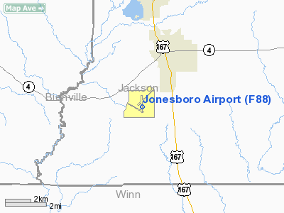
Jonesboro Airport (FAA LID: F88) is a city-owned public-use airport located three nautical miles (6 km) south of the central business district of Jonesboro, a city in Jackson Parish, Louisiana, United States.
Facilities and aircraft
Jonesboro Airport covers an area of 140 acres (57 ha) at an elevation of 256 feet (78 m) above mean sea level. It has one asphalt paved runway designated 17/35 which measures 3,203 by 75 feet (976 x 23 m). For the 12-month period ending April 16, 2009, the airport had 24,000 general aviation aircraft operations, an average of 65 per day.
The above content comes from Wikipedia and is published under free licenses – click here to read more.
Location &
QuickFacts
|
FAA
Information Effective: |
2008-09-25 |
|
Airport
Identifier: |
F88 |
|
Airport
Status: |
Operational |
|
Longitude/Latitude: |
092-43-58.5490W/32-12-07.1650N
-92.732930/32.201990 (Estimated) |
|
Elevation: |
256 ft / 78.03 m (Surveyed) |
|
Land: |
140 acres |
|
From
nearest city: |
3 nautical miles S of Jonesboro, LA |
|
Location: |
Jackson Parish, LA |
|
Magnetic Variation: |
04E (1990) |
Owner & Manager
|
Ownership: |
Publicly owned |
|
Owner: |
City Of Jonesboro |
|
Address: |
128 Allen Ave
Jonesboro, LA 71251 |
|
Phone number: |
318-259-2385 |
|
Manager: |
Henry Woods |
|
Address: |
340 Cedar St
Jonesboro, LA 71251 |
|
Phone number: |
318-259-2385 |
Airport
Operations and Facilities
|
Airport
Use: |
Open to public |
|
Wind
indicator: |
Yes |
|
Segmented Circle: |
No |
|
Control
Tower: |
No |
|
Lighting
Schedule: |
DUSK-DAWN
MIRL RY 17/35 PRESET LOW INTST; TO INCR INTST AND ACTVT REIL RY 17 -
122.8. |
|
Beacon
Color: |
Clear-Green (lighted land airport) |
|
Landing
fee charge: |
No |
|
Sectional chart: |
Memphis |
|
Region: |
ASW - Southwest |
|
Boundary
ARTCC: |
ZFW - Fort Worth |
|
Tie-in
FSS: |
DRI - De Ridder |
|
FSS on
Airport: |
No |
|
FSS Toll
Free: |
1-800-WX-BRIEF |
|
NOTAMs
Facility: |
DRI (NOTAM-d service avaliable) |
|
Federal Agreements: |
NGY |
Airport Communications
Airport Services
|
Airframe
Repair: |
NONE |
|
Power
Plant Repair: |
NONE |
|
Bottled
Oxygen: |
NONE |
|
Bulk
Oxygen: |
NONE |
|
Runway Information
Runway 17/35
|
Dimension: |
3203 x 75 ft / 976.3 x 22.9 m |
|
Surface: |
ASPH, Good Condition |
|
Weight Limit: |
Single wheel: 28000 lbs. |
|
Edge Lights: |
Medium |
|
|
Runway 17
|
Runway 35
|
|
Longitude: |
092-43-58.8110W |
092-43-58.2800W |
|
Latitude: |
32-12-23.0510N |
32-11-51.3570N |
|
Elevation: |
249.00 ft |
256.00 ft |
|
Alignment: |
127 |
127 |
|
Traffic
Pattern: |
Left |
Left |
|
Markings: |
Non-precision instrument, Good Condition |
Non-precision instrument, Good Condition |
|
Crossing
Height: |
20.00 ft |
20.00 ft |
|
VASI: |
2-box SAVASI on left side |
2-box SAVASI on left side |
|
Visual
Glide Angle: |
3.50° |
3.50° |
|
Runway End
Identifier: |
Yes |
|
|
Radio Navigation Aids
|
ID |
Type |
Name |
Ch |
Freq |
Var |
Dist |
|
JBL |
NDB |
Hodge |
|
256.00 |
04E |
0.4 nm |
|
TUF |
NDB |
Stuckey |
|
350.00 |
03E |
14.4 nm |
|
IFJ |
NDB |
Winnfield |
|
402.00 |
04E |
14.9 nm |
|
ROQ |
NDB |
Ruston |
|
368.00 |
03E |
25.5 nm |
|
IE |
NDB |
Campi |
|
407.00 |
04E |
37.2 nm |
|
HMQ |
NDB |
Homer |
|
212.00 |
02E |
37.9 nm |
|
MNE |
NDB |
Minden |
|
201.00 |
04E |
39.1 nm |
|
SWB |
VOR/DME |
Sawmill |
84Y |
113.75 |
02E |
14.0 nm |
|
MLU |
VORTAC |
Monroe |
119X |
117.20 |
03E |
40.1 nm |
|
EMG |
VORTAC |
Elm Grove |
049X |
111.20 |
07E |
45.4 nm |
Remarks
-
RY 35 HAS 20 FT
TALL RISE WITHIN 150 FT RIGHT OF RY CNTRLN EXTENDING 750 FT DOWN THE SIDE OF
THE RY.
-
MAY BE EXEMPT
UNDER GRANDFATHER CLAUSE.
Operational Statistics
Time Period: 2007-05-02 - 2008-04-30
|
Aircraft
Operations: |
66/Day |
|
General
Aviation Local: |
83.3% |
|
General
Aviation Itinerant: |
16.7% |
Jonesboro Airport
Address:
Jackson Parish, LA
Tel:
318-259-2385
Images
and information placed above are from
http://www.airport-data.com/airport/F88/
We
thank them for the data!
|
General Info |
| Country |
United
States |
| State |
LOUISIANA |
| FAA ID |
F88
|
| Latitude |
32-12-07.165N |
|
Longitude |
092-43-58.549W |
|
Elevation |
256 feet
|
| Near
City |
JONESBORO |
We don't guarantee the information is fresh and accurate. The data may
be wrong or outdated.
For more up-to-date information please refer to other sources.
|
|


