 |
|
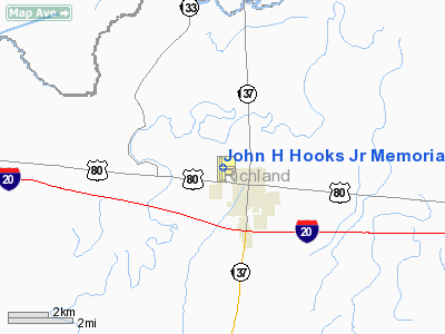
John H Hooks Jr Memorial Airport |
|
|
Location &
QuickFacts
|
FAA
Information Effective: |
2008-09-25 |
|
Airport
Identifier: |
M79 |
|
Airport
Status: |
Operational |
|
Longitude/Latitude: |
091-46-15.8390W/32-29-07.5110N
-91.771066/32.485420 (Estimated) |
|
Elevation: |
83 ft / 25.30 m (Surveyed) |
|
Land: |
100 acres |
|
From
nearest city: |
1 nautical miles NW of Rayville, LA |
|
Location: |
Richland Parish, LA |
|
Magnetic Variation: |
02E (2000) |
Owner & Manager
|
Ownership: |
Publicly owned |
|
Owner: |
City Of Rayville |
|
Address: |
Po Box 878
Rayville, LA 71269 |
|
Phone number: |
318-728-2011 |
|
Manager: |
Robert Adams |
|
Address: |
127 Ashey Ave
Rayville, LA 71269 |
|
Phone number: |
318-728-2108 |
Airport
Operations and Facilities
|
Airport
Use: |
Open to public |
|
Wind
indicator: |
Yes |
|
Segmented Circle: |
No |
|
Control
Tower: |
No |
|
Lighting
Schedule: |
DUSK-DAWN
MIRL RY 18/36 PRESET LOW INTST; TO INCR INTST & ACTVT REIL RYS 18 & 36
- CTAF |
|
Beacon
Color: |
Clear-Green (lighted land airport) |
|
Landing
fee charge: |
No |
|
Sectional chart: |
Memphis |
|
Region: |
ASW - Southwest |
|
Boundary
ARTCC: |
ZFW - Fort Worth |
|
Tie-in
FSS: |
DRI - De Ridder |
|
FSS on
Airport: |
No |
|
FSS Toll
Free: |
1-800-WX-BRIEF |
|
NOTAMs
Facility: |
DRI (NOTAM-d service avaliable) |
|
Federal Agreements: |
NGY |
Airport Communications
|
CTAF: |
122.800 |
|
Unicom: |
122.800 |
Airport Services
|
Fuel
available: |
100LLA |
|
Airframe
Repair: |
MAJOR |
|
Power
Plant Repair: |
MAJOR |
|
Bottled
Oxygen: |
NONE |
|
Bulk
Oxygen: |
NONE |
|
Runway Information
Runway 09/27
|
Dimension: |
2224 x 100 ft / 677.9 x 30.5 m |
|
Surface: |
TURF, Fair Condition |
|
|
Runway 09
|
Runway 27
|
|
Longitude: |
091-46-20.4542W |
091-45-54.4976W |
|
Latitude: |
32-29-08.1831N |
32-29-07.9700N |
|
Elevation: |
82.00 ft |
82.00 ft |
|
Alignment: |
91 |
127 |
|
Traffic
Pattern: |
Left |
Left |
|
Obstruction: |
60 ft trees, 365.0 ft from runway, 110 ft left of
centerline, 6:1 slope to clear |
30 ft pline, 100.0 ft from runway, 3:1 slope to clear |
|
Runway 18/36
|
Dimension: |
3998 x 75 ft / 1218.6 x 22.9 m |
|
Surface: |
ASPH, Good Condition |
|
Weight Limit: |
Single wheel: 12000 lbs. |
|
Edge Lights: |
Medium |
|
|
Runway 18
|
Runway 36
|
|
Longitude: |
091-46-19.7324W |
091-46-21.2501W |
|
Latitude: |
32-29-26.9634N |
32-28-47.4295N |
|
Elevation: |
82.00 ft |
81.00 ft |
|
Alignment: |
127 |
2 |
|
Traffic
Pattern: |
Left |
Left |
|
Markings: |
Non-precision instrument, Good Condition |
Non-precision instrument, Good Condition
DSPLCD THLD MARKINGS NSTD - YELLOW. |
|
Crossing
Height: |
58.00 ft |
58.00 ft |
|
Displaced
threshold: |
0.00 ft
THLD DSPLCD 1200 FT INDEFLY. |
291.00 ft |
|
VASI: |
2-light PAPI on left side |
2-light PAPI on left side |
|
Visual
Glide Angle: |
3.50° |
3.50° |
|
Runway End
Identifier: |
Yes |
Yes |
|
Obstruction: |
60 ft trees, 909.0 ft from runway, 331 ft left of
centerline, 11:1 slope to clear |
50 ft trees, 531.0 ft from runway, 231 ft right of
centerline, 6:1 slope to clear
APCH SLOPE 16:1 TO DSPLCD THLD. |
|
Radio Navigation Aids
|
ID |
Type |
Name |
Ch |
Freq |
Var |
Dist |
|
MRK |
NDB |
Molly Ridge |
|
338.00 |
02E |
4.7 nm |
|
BQP |
NDB |
Bastrop |
|
329.00 |
03E |
17.2 nm |
|
BLE |
NDB |
Lake Providence |
|
278.00 |
03E |
36.0 nm |
|
TV |
NDB |
Savry |
|
344.00 |
02E |
40.5 nm |
|
TUF |
NDB |
Stuckey |
|
350.00 |
03E |
41.8 nm |
|
ROQ |
NDB |
Ruston |
|
368.00 |
03E |
42.1 nm |
|
VKS |
NDB |
Vicksburg |
|
382.00 |
03E |
45.5 nm |
|
MLU |
VORTAC |
Monroe |
119X |
117.20 |
03E |
13.6 nm |
Remarks
-
ROAD 367 FT & RR
TRACK 467 FT FM APCH END RY 36.
-
RY 18/36 40-60 FT
TREES WEST SIDE OF RY PENETRATE TRANSITION SLOPE.
-
PRE-DATES THE ACT.
Based Aircraft
|
Aircraft based
on field: |
28 |
|
Single Engine
Airplanes: |
25 |
|
Multi Engine
Airplanes: |
3 |
Operational Statistics
Time Period: 2006-10-17 - 2007-10-16
|
Aircraft
Operations: |
50/Day |
|
General
Aviation Local: |
66.7% |
|
General
Aviation Itinerant: |
33.3% |
John H Hooks Jr Memorial Airport
Address:
Richland Parish, LA
Tel:
318-728-2011, 318-728-2108
Images
and information placed above are from
http://www.airport-data.com/airport/M79/
We
thank them for the data!
|
General Info |
| Country |
United
States |
| State |
LOUISIANA |
| FAA ID |
M79
|
| Latitude |
32-29-10.810N |
|
Longitude |
091-46-15.151W |
|
Elevation |
83 feet
|
| Near
City |
RAYVILLE
|
We don't guarantee the information is fresh and accurate. The data may
be wrong or outdated.
For more up-to-date information please refer to other sources.
|
|


