 |
|
|
|
|
|
Location &
QuickFacts
|
FAA
Information Effective: |
2008-09-25 |
|
Airport
Identifier: |
1R1 |
|
Airport
Status: |
Operational |
|
Longitude/Latitude: |
092-09-27.2300W/31-40-02.4700N
-92.157564/31.667353 (Estimated) |
|
Elevation: |
212 ft / 64.62 m (Surveyed) |
|
Land: |
93 acres |
|
From
nearest city: |
2 nautical miles SW of Jena, LA |
|
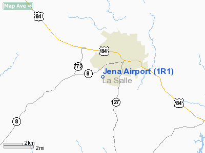
Location: |
La Salle Parish, LA |
|
Magnetic Variation: |
04E (1985) |
Owner & Manager
|
Ownership: |
Publicly owned |
|
Owner: |
La Salle Parish |
|
Address: |
Po Box 1288
Jena, LA 71342 |
|
Phone number: |
318-992-2101 |
|
Manager: |
Ms. Kary Howe |
|
Address: |
401 Minden St.
Ruston, LA 71270 |
|
Phone number: |
318-257-5478 |
Airport
Operations and Facilities
|
Airport
Use: |
Open to public |
|
Wind
indicator: |
Yes |
|
Segmented Circle: |
No |
|
Control
Tower: |
No |
|
Lighting
Schedule: |
DUSK-DAWN
ACTVT MIRL RY 17/35 & REIL RY 35 - 122.8. |
|
Beacon
Color: |
Clear-Green (lighted land airport)
ROTG BCN OTS INDEFLY. |
|
Landing
fee charge: |
No |
|
Sectional chart: |
Houston |
|
Region: |
ASW - Southwest |
|
Boundary
ARTCC: |
ZHU - Houston |
|
Tie-in
FSS: |
DRI - De Ridder |
|
FSS on
Airport: |
No |
|
FSS Toll
Free: |
1-800-WX-BRIEF |
|
NOTAMs
Facility: |
DRI (NOTAM-d service avaliable) |
|
Federal Agreements: |
NGY |
Airport Communications
|
Runway Information
Runway 17/35
|
Dimension: |
3805 x 75 ft / 1159.8 x 22.9 m |
|
Surface: |
ASPH, |
|
Weight Limit: |
Single wheel: 12000 lbs. |
|
Edge Lights: |
Medium |
|
|
Runway 17
|
Runway 35
|
|
Longitude: |
092-09-27.4800W |
092-09-26.9800W |
|
Latitude: |
31-40-21.2900N |
31-39-43.6500N |
|
Traffic
Pattern: |
Left |
Left |
|
Markings: |
Non-precision instrument, Good Condition |
Non-precision instrument, Good Condition |
|
Crossing
Height: |
21.00 ft |
26.00 ft |
|
VASI: |
2-box SAVASI on left side
SAVASI OTS INDEFLY. |
2-box SAVASI on left side
SAVASI OTS INDEFLY. |
|
Visual
Glide Angle: |
4.00° |
4.60° |
|
Runway End
Identifier: |
|
Yes
REIL OTS INDEFLY. |
|
Obstruction: |
75 ft trees, 1475.0 ft from runway, 200 ft left of
centerline, 17:1 slope to clear |
27 ft trees, 280.0 ft from runway, 140 ft right of
centerline, 2:1 slope to clear
+25 FT TREE 125 FT R OF CNTRLN 150 FT END OF RY. |
|
Radio Navigation Aids
|
ID |
Type |
Name |
Ch |
Freq |
Var |
Dist |
|
IFJ |
NDB |
Winnfield |
|
402.00 |
04E |
31.1 nm |
|
MKV |
NDB |
Marksville |
|
347.00 |
02E |
34.7 nm |
|
JBL |
NDB |
Hodge |
|
256.00 |
04E |
43.3 nm |
|
HAH |
NDB |
Natchez-adams County |
|
388.00 |
03E |
44.2 nm |
|
IE |
NDB |
Campi |
|
407.00 |
04E |
47.1 nm |
|
BWK |
NDB |
Bunkie |
|
397.00 |
03E |
48.4 nm |
|
MRK |
NDB |
Molly Ridge |
|
338.00 |
02E |
48.6 nm |
|
TUF |
NDB |
Stuckey |
|
350.00 |
03E |
49.7 nm |
|
SWB |
VOR/DME |
Sawmill |
84Y |
113.75 |
02E |
32.3 nm |
|
HEZ |
VOR/DME |
Natchez |
037X |
110.00 |
03E |
44.0 nm |
|
AEX |
VORTAC |
Alexandria |
108X |
116.10 |
03E |
30.3 nm |
Based Aircraft
|
Aircraft based
on field: |
5 |
|
Single Engine
Airplanes: |
1 |
|
Multi Engine
Airplanes: |
2 |
|
Helicopters: |
1 |
|
Ultralights: |
1 |
Operational Statistics
Time Period: 2007-02-21 - 2008-02-20
|
Aircraft
Operations: |
289/Week |
|
General
Aviation Local: |
66.7% |
|
General
Aviation Itinerant: |
33.3% |
Jena Airport
Address:
La Salle Parish, LA
Tel:
318-992-2101, 318-257-5478
Images
and information placed above are from
http://www.airport-data.com/airport/1R1/
We
thank them for the data!
|
General Info |
| Country |
United
States |
| State |
LOUISIANA |
| FAA ID |
1R1
|
| Latitude |
31-39-24.870N |
|
Longitude |
092-09-26.980W |
|
Elevation |
212 feet
|
| Near
City |
JENA
|
We don't guarantee the information is fresh and accurate. The data may
be wrong or outdated.
For more up-to-date information please refer to other sources.
|
|


