 |
|
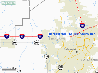
Industrial Helicopters Incorporated Airport |
Location &
QuickFacts
|
FAA
Information Effective: |
2008-09-25 |
|
Airport
Identifier: |
10LA |
|
Airport
Status: |
Operational |
|
Longitude/Latitude: |
092-05-45.4410W/30-14-50.7230N
-92.095956/30.247423 (Estimated) |
|
Elevation: |
35 ft / 10.67 m (Estimated) |
|
Land: |
0 acres |
|
From
nearest city: |
1 nautical miles N of Scott, LA |
|
Location: |
Lafayette Parish, LA |
|
Magnetic Variation: |
04E (1985) |
Owner & Manager
|
Ownership: |
Privately owned |
|
Owner: |
Industrial Helicopters Inc. |
|
Address: |
Po Box 90210
Lafayette, LA 70509 |
|
Phone number: |
318-233-3356 |
|
Manager: |
J.o. Richard |
|
Address: |
Po Box 90210
Lafayette, LA 70509 |
|
Phone number: |
318-233-3356 |
Airport Operations and Facilities
|
Airport Use: |
Private |
|
Wind indicator: |
Yes |
|
Segmented Circle: |
No |
|
Control Tower: |
No |
|
Landing fee charge: |
No |
|
Sectional chart: |
Houston |
|
Region: |
ASW - Southwest |
|
Boundary ARTCC: |
ZHU - Houston |
|
Tie-in FSS: |
DRI - De Ridder |
|
FSS on Airport: |
No |
|
FSS Toll Free: |
1-800-WX-BRIEF |
Airport
Communications
Airport Services
|
Runway Information
Runway 18/36
|
Dimension: |
2144 x 150 ft / 653.5 x 45.7 m
LNDG & TKOFF 1800' X 200'. |
|
Surface: |
TURF, |
|
|
Runway 18
|
Runway 36
|
|
Traffic
Pattern: |
Left |
Left |
|
Obstruction: |
100 ft pline, 800.0 ft from runway |
45 ft sign, 75.0 ft from runway |
|
Helipad H1
|
Dimension: |
50 x 50 ft / 15.2 x 15.2 m
LNDG & TKOFF 1800' X 200'. |
|
Surface: |
TURF, |
|
|
Runway H1
|
Runway
|
|
Traffic
Pattern: |
Left |
Left |
|
Radio Navigation Aids
|
ID |
Type |
Name |
Ch |
Freq |
Var |
Dist |
|
AR |
NDB |
Acadi |
|
269.00 |
03E |
21.3 nm |
|
OPL |
NDB |
St Landry |
|
335.00 |
04E |
24.5 nm |
|
ECY |
NDB |
Eunice |
|
263.00 |
02E |
26.2 nm |
|
BWK |
NDB |
Bunkie |
|
397.00 |
03E |
37.8 nm |
|
LRR |
NDB |
Allen Parish |
|
379.00 |
03E |
38.8 nm |
|
HZ |
NDB |
Hazer |
|
356.00 |
04E |
39.1 nm |
|
LLA |
VOR/DME |
White Lake |
041X |
110.40 |
04E |
38.0 nm |
|
LFT |
VORTAC |
Lafayette |
035X |
109.80 |
03E |
6.3 nm |
|
BTR |
VORTAC |
Baton Rouge |
112X |
116.50 |
06E |
44.0 nm |
Remarks
-
VFR ONLY; PRVDD
LINES LCTD AT NORTH END RWY MKD WITH ORANGE WARNING BALLS.
Based Aircraft
|
Aircraft based
on field: |
4 |
|
Helicopters: |
4 |
Industrial Helicopters Incorporated
Airport
Address:
Lafayette Parish, LA
Tel:
318-233-3356
Images
and information placed above are from
http://www.airport-data.com/airport/10LA/
We
thank them for the data!
|
General Info |
| Country |
United
States |
| State |
LOUISIANA |
| FAA ID |
10LA
|
| Latitude |
30-14-50.723N |
|
Longitude |
092-05-45.441W |
|
Elevation |
35 feet
|
| Near
City |
SCOTT
|
We don't guarantee the information is fresh and accurate. The data may
be wrong or outdated.
For more up-to-date information please refer to other sources.
|
|


