 |
|
|
|
Location &
QuickFacts
|
FAA
Information Effective: |
2008-09-25 |
|
Airport
Identifier: |
L87 |
|
Airport
Status: |
Operational |
|
Longitude/Latitude: |
093-53-35.6440W/33-00-15.4840N
-93.893234/33.004301 (Estimated) |
|
Elevation: |
286 ft / 87.17 m (Estimated) |
|
Land: |
1 acres |
|
From
nearest city: |
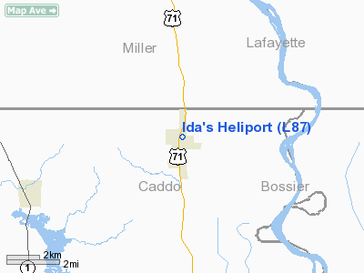
0 nautical miles N of Ida, LA |
|
Location: |
Caddo Parish, LA |
|
Magnetic Variation: |
05E (1990) |
Owner & Manager
|
Ownership: |
Publicly owned |
|
Owner: |
The Village Of Ida |
|
Address: |
Po Box 299
Ida, LA 71044 |
|
Phone number: |
318-284-3231 |
|
Manager: |
Clyde H. Maddox, Mayor |
|
Address: |
Po Box 299
Ida, LA 71044 |
|
Phone number: |
318-284-3273 |
Airport
Operations and Facilities
|
Airport
Use: |
Open to public |
|
Wind
indicator: |
Yes |
|
Segmented Circle: |
No |
|
Control
Tower: |
No |
|
Lighting
Schedule: |
PHONE REQ
FOR PERIMETER LGTS CALL 318-284-3273. |
|
Sectional chart: |
Memphis |
|
Region: |
ASW - Southwest |
|
Boundary
ARTCC: |
ZFW - Fort Worth |
|
Tie-in
FSS: |
DRI - De Ridder |
|
FSS on
Airport: |
No |
|
FSS Toll
Free: |
1-800-WX-BRIEF |
|
NOTAMs
Facility: |
DRI (NOTAM-d service avaliable) |
Airport
Communications
|
Runway Information
Helipad H1
|
Dimension: |
40 x 40 ft / 12.2 x 12.2 m |
|
Surface: |
CONC, Good Condition |
|
|
Runway H1
|
Runway
|
|
Traffic
Pattern: |
Left |
Left |
|
Markings: |
Basic, Good Condition
HELIPAD MARKINGS FADED. |
,
HELIPAD MARKINGS FADED. |
|
Radio Navigation Aids
|
ID |
Type |
Name |
Ch |
Freq |
Var |
Dist |
|
VIV |
NDB |
Vivian |
|
284.00 |
06E |
10.5 nm |
|
ATA |
NDB |
Atlanta |
|
347.00 |
04E |
16.1 nm |
|
SPH |
NDB |
Springhill |
|
375.00 |
05E |
24.9 nm |
|
AGO |
NDB |
Magnolia |
|
266.00 |
04E |
36.7 nm |
|
MNE |
NDB |
Minden |
|
201.00 |
04E |
37.0 nm |
|
LST |
NDB |
Lone Star |
|
305.00 |
05E |
43.1 nm |
|
HPC |
NDB |
Hope |
|
362.00 |
03E |
44.6 nm |
|
HMQ |
NDB |
Homer |
|
212.00 |
02E |
46.8 nm |
|
BAD |
TACAN |
Barksdale |
105X |
|
05E |
32.2 nm |
|
DTN |
VOR |
Downtown |
|
108.60 |
07E |
29.0 nm |
|
EIC |
VORTAC |
Belcher |
121X |
117.40 |
07E |
14.6 nm |
|
TXK |
VORTAC |
Texarkana |
110X |
116.30 |
07E |
31.9 nm |
|
EMG |
VORTAC |
Elm Grove |
049X |
111.20 |
07E |
39.3 nm |
|
SHV |
VOT |
Shreveport Regional |
|
108.20 |
|
23.6 nm |
Operational Statistics
Time Period: 2007-05-22 - 2008-05-20
|
Aircraft
Operations: |
2/Month |
|
General
Aviation Itinerant: |
100.0% |
Ida's Heliport
Address:
Caddo Parish, LA
Tel:
318-284-3231, 318-284-3273
Images
and information placed above are from
http://www.airport-data.com/airport/L87/
We
thank them for the data!
|
General Info |
| Country |
United
States |
| State |
LOUISIANA |
| FAA ID |
L87
|
| Latitude |
33-00-15.484N |
|
Longitude |
093-53-35.644W |
|
Elevation |
286 feet
|
| Near
City |
IDA
|
We don't guarantee the information is fresh and accurate. The data may
be wrong or outdated.
For more up-to-date information please refer to other sources.
|
|


