 |
|
|
|
|
|
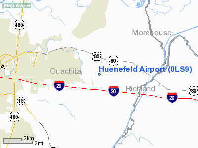
Location &
QuickFacts
|
FAA
Information Effective: |
2008-09-25 |
|
Airport
Identifier: |
0LS9 |
|
Airport
Status: |
Operational |
|
Longitude/Latitude: |
091-58-55.4710W/32-30-15.5150N
-91.982075/32.504310 (Estimated) |
|
Elevation: |
72 ft / 21.95 m (Estimated) |
|
Land: |
5 acres |
|
From
nearest city: |
3 nautical miles E of Monroe, LA |
|
Location: |
Ouachita Parish, LA |
|
Magnetic Variation: |
04E (1985) |
Owner & Manager
|
Ownership: |
Privately owned |
|
Owner: |
Frederick Huenefeld Iii
MILLHAVEN PLANTATION, LLC. |
|
Address: |
140 Huenefeld Rd
Monroe, LA 71203 |
|
Phone
number: |
318-345-3153 |
|
Manager: |
Bruce Brooks |
|
Address: |
Route 1 Box 522-a
Calhoun, LA 71225 |
|
Phone number: |
318-644-2808 |
Airport Operations and Facilities
|
Airport Use: |
Private |
|
Wind indicator: |
Yes |
|
Segmented Circle: |
No |
|
Control Tower: |
No |
|
Landing fee charge: |
No |
|
Sectional chart: |
Memphis |
|
Region: |
ASW - Southwest |
|
Boundary ARTCC: |
ZFW - Fort Worth |
|
Tie-in FSS: |
DRI - De Ridder |
|
FSS on Airport: |
No |
|
FSS Toll Free: |
1-800-WX-BRIEF |
Airport Services
|
Airframe
Repair: |
NONE |
|
Power
Plant Repair: |
NONE |
|
Bottled
Oxygen: |
NONE |
|
Bulk
Oxygen: |
NONE |
|
Runway Information
Runway 18/36
|
Dimension: |
1530 x 75 ft / 466.3 x 22.9 m |
|
Surface: |
TURF-GRVL, Poor Condition
WEST HALF OF RY HAS LARGE LOOSE GRVL WITH GRASS GROWING THRU. |
|
|
Runway 18
|
Runway 36
|
|
Traffic
Pattern: |
Left |
Left |
|
Obstruction: |
60 ft pline, 1340.0 ft from runway, 23:1 slope to clear |
, 50:1 slope to clear |
|
Radio Navigation Aids
|
ID |
Type |
Name |
Ch |
Freq |
Var |
Dist |
|
MRK |
NDB |
Molly Ridge |
|
338.00 |
02E |
12.1 nm |
|
BQP |
NDB |
Bastrop |
|
329.00 |
03E |
15.9 nm |
|
TUF |
NDB |
Stuckey |
|
350.00 |
03E |
31.3 nm |
|
ROQ |
NDB |
Ruston |
|
368.00 |
03E |
31.3 nm |
|
JBL |
NDB |
Hodge |
|
256.00 |
04E |
41.9 nm |
|
BLE |
NDB |
Lake Providence |
|
278.00 |
03E |
44.6 nm |
|
IFJ |
NDB |
Winnfield |
|
402.00 |
04E |
47.3 nm |
|
SWB |
VOR/DME |
Sawmill |
84Y |
113.75 |
02E |
47.6 nm |
|
MLU |
VORTAC |
Monroe |
119X |
117.20 |
03E |
2.8 nm |
Remarks
-
BE ALERT FOR FARM
EQUIP INVOF RY 18/36.
-
RY 18/36 HAS A
800 FT BY 20 FT ASPH TWY ON N END.
-
PREDATES THE ACT.
Based Aircraft
|
Aircraft based
on field: |
1 |
|
Single Engine
Airplanes: |
1 |
Operational Statistics
Time Period: 1997-06-25 - 1998-06-24
|
Aircraft
Operations: |
20/Week |
|
General
Aviation Local: |
60.0% |
|
General
Aviation Itinerant: |
40.0% |
Huenefeld Airport
Address:
Ouachita Parish, LA
Tel:
318-345-3153,
318-644-2808
Images
and information placed above are from
http://www.airport-data.com/airport/0LS9/
We
thank them for the data!
|
General Info |
| Country |
United
States |
| State |
LOUISIANA |
| FAA ID |
0LS9
|
| Latitude |
32-30-15.515N |
|
Longitude |
091-58-55.471W |
|
Elevation |
72 feet
|
| Near
City |
MONROE
|
We don't guarantee the information is fresh and accurate. The data may
be wrong or outdated.
For more up-to-date information please refer to other sources.
|
|


