|
|
| Houma-Terrebonne Airport |
| IATA: HUM â ICAO: KHUM â FAA LID: HUM |
| Summary |
| Airport type |
Public |
| Owner |
Houma-Terrebonne Airport Commission |
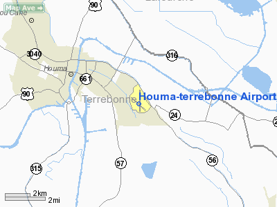
| Serves |
Houma, Louisiana |
| Elevation AMSL |
10 ft / 3 m |
| Coordinates |
29°33â²59â³N 090°39â²38â³W / 29.56639°N 90.66056°W / 29.56639; -90.66056 |
| Website |
www.houma-airport.com |
| Runways |
| Direction |
Length |
Surface |
| ft |
m |
| 18/36 |
6,508 |
1,984 |
Concrete |
| 12/30 |
5,000 |
1,524 |
Concrete |
| Statistics (2005) |
| Aircraft operations |
91,030 |
| Based aircraft |
109 |
| Sources: airport web site and FAA |
Houma-Terrebonne Airport (IATA: HUM, ICAO: KHUM, FAA LID: HUM) is a public airport located three miles (5 km) southeast of the central business district of Houma, a city in Terrebonne Parish, Louisiana, United States. It is owned by the Houma-Terrebonne Airport Commission.
Facilities and aircraft
Houma-Terrebonne Airport covers an area of 1,813 acres (734 ha) and has two concrete paved runways. The north-south runway 18/36 is 6,508 by 150 ft (1,984 by 46 m) with a full instrument landing system (ILS). The crosswind runway 12/30 is 5,000 by 200 ft (1,524 by 61 m) with a non-precision approach.
The airport has two fixed base operators (FBOs): Houma Jet Center and Butler Aviation.
For the 12-month period ending December 30, 2005, the airport had 91,030 aircraft operations, an average of 249 per day: 61% air taxi, 38% general aviation and 1% military. At that time there were 109 aircraft based at this airport: 20% single-engine, 21% multi-engine, 2% jet and 57% helicopter.
The above content comes from Wikipedia and is published under free licenses – click here to read more.
|
 |
(Click on the photo to enlarge) |
Location &
QuickFacts
|
FAA
Information Effective: |
2008-09-25 |
|
Airport
Identifier: |
HUM |
|
Airport
Status: |
Operational |
|
Longitude/Latitude: |
090-39-37.5000W/29-33-59.4000N
-90.660417/29.566500 (Estimated) |
|
Elevation: |
10 ft / 3.05 m (Surveyed) |
|
Land: |
1813 acres |
|
From
nearest city: |
3 nautical miles SE of Houma, LA |
|
Location: |
Terrebonne Parish, LA |
|
Magnetic Variation: |
02E (1995) |
Owner & Manager
|
Ownership: |
Publicly owned |
|
Owner: |
Houma-terrebonne Airport Cmsn
CITY OF HOUMA AND TERREBONNE PARISH |
|
Address: |
10264 East Main St
Houma, LA 70363 |
|
Phone
number: |
985-872-4646 |
|
Manager: |
Earl Hicks |
|
Address: |
10264 East Main St
Houma, LA 70363 |
|
Phone number: |
985-872-4646 |
Airport Operations and Facilities
|
Airport
Use: |
Open to public |
|
Wind
indicator: |
Yes |
|
Segmented Circle: |
No |
|
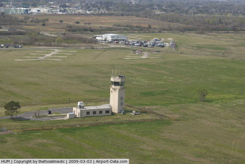
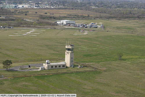
Control
Tower: |
Yes |
|
Lighting
Schedule: |
DUSK-DAWN
ACTVT HIRL RYS 12/30 & 18/36; MALSR RY 18 AND REIL RYS 12, 30 & 36 -
CTAF. |
|
Beacon
Color: |
Clear-Green (lighted land airport) |
|
Landing
fee charge: |
No |
|
Sectional chart: |
New Orleans |
|
Region: |
ASW - Southwest |
|
Traffic
Pattern Alt: |
1000 ft |
|
Boundary
ARTCC: |
ZHU - Houston |
|
Tie-in
FSS: |
DRI - De Ridder |
|
FSS on
Airport: |
No |
|
FSS Toll
Free: |
1-800-WX-BRIEF |
|
NOTAMs
Facility: |
HUM (NOTAM-d service avaliable) |
|
Federal Agreements: |
NGPY |
Airport Communications
|
CTAF: |
125.300 |
|
Unicom: |
122.950 |
Airport Services
|
Fuel
available: |
100LLA |
|
Airframe
Repair: |
MAJOR |
|
Power
Plant Repair: |
MAJOR |
|
Bottled
Oxygen: |
HIGH/LOW |
|
Bulk
Oxygen: |
HIGH/LOW |
|
Runway Information
Runway 12/30
|
Dimension: |
4999 x 200 ft / 1523.7 x 61.0 m |
|
Surface: |
CONC, Good Condition |
|
Weight Limit: |
Single wheel: 50000 lbs.
Dual wheel: 70000 lbs.
Dual tandem wheel: 137000 lbs. |
|
Edge Lights: |
High |
|
|
Runway 12
|
Runway 30
|
|
Longitude: |
090-40-01.1657W |
090-39-14.9820W |
|
Latitude: |
29-34-15.9777N |
29-33-47.3590N |
|
Elevation: |
6.00 ft |
9.00 ft |
|
Alignment: |
125 |
127 |
|
Traffic
Pattern: |
Left |
Left |
|
Markings: |
Non-precision instrument, Good Condition |
Non-precision instrument, Good Condition |
|
VASI: |
2-light PAPI on left side |
2-light PAPI on left side |
|
Runway End
Identifier: |
Yes |
Yes |
|
Obstruction: |
9 ft trees, 500.0 ft from runway, 200 ft right of
centerline, 34:1 slope to clear |
13 ft trees, 650.0 ft from runway, 34:1 slope to clear |
|
Runway 18/36
|
Dimension: |
6508 x 150 ft / 1983.6 x 45.7 m |
|
Surface: |
CONC, |
|
Surface
Treatment: |
Saw-cut or plastic Grooved |
|
Weight Limit: |
Single wheel: 50000 lbs.
Dual wheel: 70000 lbs.
Dual tandem wheel: 137000 lbs. |
|
Edge Lights: |
High |
|
|
Runway 18
|
Runway 36
|
|
Longitude: |
090-39-36.9087W |
090-39-37.3371W |
|
Latitude: |
29-34-29.8840N |
29-33-25.4575N |
|
Elevation: |
8.00 ft |
6.00 ft |
|
Alignment: |
127 |
0 |
|
ILS Type: |
ILS |
|
|
Traffic
Pattern: |
Left |
Left |
|
Markings: |
Precision instrument, Good Condition |
Precision instrument, Good Condition |
|
VASI: |
2-light PAPI on left side |
2-light PAPI on left side |
|
Approach
lights: |
MALSR |
|
|
Runway End
Identifier: |
|
Yes |
|
Obstruction: |
90 ft trees, 3300.0 ft from runway, 34:1 slope to clear |
83 ft trees, 3050.0 ft from runway, 34:1 slope to clear |
|
Radio Navigation Aids
|
ID |
Type |
Name |
Ch |
Freq |
Var |
Dist |
|
MS |
NDB |
Kinte |
|
338.00 |
03E |
30.7 nm |
|
PTN |
NDB |
Patterson |
|
245.00 |
01E |
36.4 nm |
|
RQR |
VOR/DME |
Reserve |
045X |
110.80 |
02E |
31.5 nm |
|
TBD |
VORTAC |
Tibby |
057X |
112.00 |
02E |
10.6 nm |
|
LEV |
VORTAC |
Leeville |
082X |
113.50 |
02E |
37.5 nm |
|
HRV |
VORTAC |
Harvey |
088X |
114.10 |
02E |
38.3 nm |
|
NEW |
VOT |
New Orleans Lakefront |
|
111.00 |
|
43.6 nm |
Remarks
-
BIRDS ON & INVOF
ARPT. NUMEROUS BIRDS 500 FT AGL & BLO 2.8 NM SSW AER 36; AVOIDANCE ADVISED.
-
RYS 12/30 SFC
SKID RESISTANCE FAIR WHEN WET.
-
EXTENSIVE
HELICOPTER OPNS SOUTH THRU WEST OF ARPT.
Based Aircraft
|
Aircraft based
on field: |
49 |
|
Single Engine
Airplanes: |
13 |
|
Multi Engine
Airplanes: |
17 |
|
Jet Engine
Airplanes: |
3 |
|
Helicopters: |
16 |
Operational Statistics
Time Period: 2006-01-01 - 2006-12-31
|
Aircraft
Operations: |
250/Day |
|
Air Taxi: |
60.8% |
|
General
Aviation Local: |
14.7% |
|
General
Aviation Itinerant: |
23.2% |
|
Military: |
1.4% |
Houma-terrebonne Airport
Address:
Terrebonne Parish, LA
Tel:
985-872-4646
Images
and information placed above are from
http://www.airport-data.com/airport/HUM/
We
thank them for the data!
|
General Info |
| Country |
United
States |
| State |
LOUISIANA |
| FAA ID |
HUM
|
| Latitude |
29-33-59.400N |
|
Longitude |
090-39-37.500W |
|
Elevation |
10 feet
|
| Near
City |
HOUMA
|
We don't guarantee the information is fresh and accurate. The data may
be wrong or outdated.
For more up-to-date information please refer to other sources.
|
|