 |
|
|
|
|
|
Location &
QuickFacts
|
FAA
Information Effective: |
2008-09-25 |
|
Airport
Identifier: |
5F4 |
|
Airport
Status: |
Operational |
|
Longitude/Latitude: |
093-00-13.1790W/32-47-18.6290N
-93.003661/32.788508 (Estimated) |
|
Elevation: |
244 ft / 74.37 m (Surveyed) |
|
Land: |
59 acres |
|
From
nearest city: |
3 nautical miles E of Homer, LA |
|
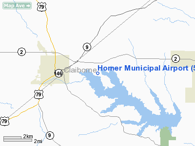
Location: |
Claiborne Parish, LA |
|
Magnetic Variation: |
02E (2005) |
Owner & Manager
|
Ownership: |
Publicly owned |
|
Owner: |
City Of Homer |
|
Address: |
400 East Main
Homer, LA 71040 |
|
Phone number: |
318-927-3555 |
|
Manager: |
Rita L. Mitchell |
|
Address: |
, Fire Station |
|
Phone number: |
318-927-5383 |
Airport
Operations and Facilities
|
Airport
Use: |
Open to public |
|
Wind
indicator: |
Yes |
|
Segmented Circle: |
Yes |
|
Control
Tower: |
No |
|
Lighting
Schedule: |
DUSK-DAWN
ACTVT MIRL RY 12/30 - 122.8. |
|
Beacon
Color: |
Clear-Green (lighted land airport)
ROTG BCN OTS INDEFLY. |
|
Landing
fee charge: |
No |
|
Sectional chart: |
Memphis |
|
Region: |
ASW - Southwest |
|
Boundary
ARTCC: |
ZFW - Fort Worth |
|
Tie-in
FSS: |
DRI - De Ridder |
|
FSS on
Airport: |
No |
|
FSS Toll
Free: |
1-800-WX-BRIEF |
|
NOTAMs
Facility: |
DRI (NOTAM-d service avaliable) |
|
Federal Agreements: |
NGY |
Airport Communications
|
Runway Information
Runway 12/30
|
Dimension: |
3199 x 60 ft / 975.1 x 18.3 m |
|
Surface: |
ASPH, Fair Condition |
|
Weight Limit: |
Single wheel: 12000 lbs. |
|
Edge Lights: |
Medium
MIRL OTS INDEFLY. |
|
|
Runway 12
|
Runway 30
|
|
Longitude: |
093-00-28.9360W |
092-59-57.3260W |
|
Latitude: |
32-47-27.1360N |
32-47-10.1320N |
|
Elevation: |
244.00 ft |
229.00 ft |
|
Alignment: |
122 |
127 |
|
Traffic
Pattern: |
Left |
Left |
|
Markings: |
Basic, Good Condition |
Basic, Good Condition |
|
Obstruction: |
60 ft trees, 800.0 ft from runway, 200 ft right of
centerline, 10:1 slope to clear |
60 ft trees, 205.0 ft from runway, 195 ft left of
centerline
60 FT TREES 165 FT RIGHT; 60 FT TREES 195 FT LEFT FM CNTRLN. |
|
Radio Navigation Aids
|
ID |
Type |
Name |
Ch |
Freq |
Var |
Dist |
|
HMQ |
NDB |
Homer |
|
212.00 |
02E |
0.2 nm |
|
MNE |
NDB |
Minden |
|
201.00 |
04E |
17.5 nm |
|
SPH |
NDB |
Springhill |
|
375.00 |
05E |
22.0 nm |
|
ROQ |
NDB |
Ruston |
|
368.00 |
03E |
23.6 nm |
|
AGO |
NDB |
Magnolia |
|
266.00 |
04E |
28.4 nm |
|
TUF |
NDB |
Stuckey |
|
350.00 |
03E |
31.0 nm |
|
JBL |
NDB |
Hodge |
|
256.00 |
04E |
38.0 nm |
|
BAD |
TACAN |
Barksdale |
105X |
|
05E |
37.7 nm |
|
DTN |
VOR |
Downtown |
|
108.60 |
07E |
40.2 nm |
|
ELD |
VORTAC |
El Dorado |
102X |
115.50 |
07E |
31.0 nm |
|
EMG |
VORTAC |
Elm Grove |
049X |
111.20 |
07E |
38.0 nm |
|
EIC |
VORTAC |
Belcher |
121X |
117.40 |
07E |
40.8 nm |
|
SHV |
VOT |
Shreveport Regional |
|
108.20 |
|
43.4 nm |
Operational Statistics
Time Period: 2007-05-23 - 2008-05-21
|
Aircraft
Operations: |
20/Week |
|
General
Aviation Local: |
50.0% |
|
General
Aviation Itinerant: |
50.0% |
Homer Municipal Airport
Address:
Claiborne Parish, LA
Tel:
318-927-3555, 318-927-5383
Images
and information placed above are from
http://www.airport-data.com/airport/5F4/
We
thank them for the data!
|
General Info |
| Country |
United
States |
| State |
LOUISIANA |
| FAA ID |
5F4
|
| Latitude |
32-47-18.629N |
|
Longitude |
093-00-13.179W |
|
Elevation |
244 feet
|
| Near
City |
HOMER
|
We don't guarantee the information is fresh and accurate. The data may
be wrong or outdated.
For more up-to-date information please refer to other sources.
|
|


