 |
|
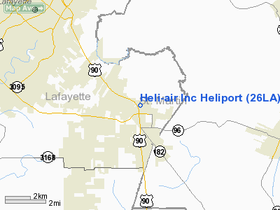
Heli-air Incorporated Heliport |
Location &
QuickFacts
|
FAA
Information Effective: |
2008-09-25 |
|
Airport
Identifier: |
26LA |
|
Airport
Status: |
Operational |
|
Longitude/Latitude: |
091-56-39.0000W/30-08-48.0000N
-91.944167/30.146667 (Estimated) |
|
Elevation: |
40 ft / 12.19 m (Estimated) |
|
Land: |
0 acres |
|
From
nearest city: |
5 nautical miles E of Broussard, LA |
|
Location: |
Lafayette Parish, LA |
|
Magnetic Variation: |
04E (1990) |
Owner & Manager
|
Ownership: |
Privately owned |
|
Owner: |
Heli-air Inc |
|
Address: |
119 Ida Rd.
Broussard, LA 70518 |
|
Phone number: |
318-837-9502 |
|
Manager: |
Cyril Guidry |
|
Address: |
119 Ida Rd.
Broussard, LA 70518 |
|
Phone number: |
318-837-9502 |
Airport
Operations and Facilities
|
Airport
Use: |
Private |
|
Segmented Circle: |
No |
|
Control
Tower: |
No |
|
Sectional chart: |
Houston |
|
Region: |
ASW - Southwest |
|
Boundary
ARTCC: |
ZHU - Houston |
|
Tie-in
FSS: |
DRI - De Ridder |
|
FSS on
Airport: |
No |
|
FSS Toll
Free: |
1-800-WX-BRIEF |
|
Runway Information
Helipad H1
|
Dimension: |
100 x 100 ft / 30.5 x 30.5 m |
|
Surface: |
TURF, |
|
|
Runway H1
|
Runway
|
|
Traffic
Pattern: |
Left |
Left |
|
Radio Navigation Aids
|
ID |
Type |
Name |
Ch |
Freq |
Var |
Dist |
|
AR |
NDB |
Acadi |
|
269.00 |
03E |
12.2 nm |
|
OPL |
NDB |
St Landry |
|
335.00 |
04E |
31.6 nm |
|
ECY |
NDB |
Eunice |
|
263.00 |
02E |
36.1 nm |
|
HZ |
NDB |
Hazer |
|
356.00 |
04E |
37.6 nm |
|
PTN |
NDB |
Patterson |
|
245.00 |
01E |
40.9 nm |
|
BWK |
NDB |
Bunkie |
|
397.00 |
03E |
45.7 nm |
|
LRR |
NDB |
Allen Parish |
|
379.00 |
03E |
48.7 nm |
|
LLA |
VOR/DME |
White Lake |
041X |
110.40 |
04E |
36.7 nm |
|
LFT |
VORTAC |
Lafayette |
035X |
109.80 |
03E |
3.8 nm |
|
BTR |
VORTAC |
Baton Rouge |
112X |
116.50 |
06E |
39.4 nm |
Remarks
-
PRVDD VFR; LGTD
WIND INDICATOR MAINTAINED; INGRESS/EGRESS RTS TO & FM E/SE; LTR OF AGREEMENT
BTN HELI & ATCT CONT; SAFETY BARRIER PLACED AROUND HELIPAD; & SIGN PLACED NEAR
ENTRANCE WARNING OF HEL OPNS.
Heli-air Incorporated Heliport
Address:
Lafayette Parish, LA
Tel:
318-837-9502
Images
and information placed above are from
http://www.airport-data.com/airport/26LA/
We
thank them for the data!
|
General Info |
| Country |
United
States |
| State |
LOUISIANA |
| FAA ID |
26LA
|
| Latitude |
30-08-48.000N |
|
Longitude |
091-56-39.000W |
|
Elevation |
40 feet
|
| Near
City |
BROUSSARD |
We don't guarantee the information is fresh and accurate. The data may
be wrong or outdated.
For more up-to-date information please refer to other sources.
|
|


