 |
|
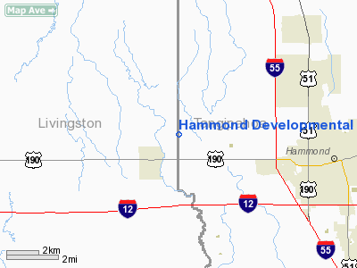
Hammond Developmental Center Heliport |
|
|
Location &
QuickFacts
|
FAA
Information Effective: |
2008-09-25 |
|
Airport
Identifier: |
LA02 |
|
Airport
Status: |
Operational |
|
Longitude/Latitude: |
090-33-59.2280W/30-31-06.0860N
-90.566452/30.518357 (Estimated) |
|
Elevation: |
42 ft / 12.80 m (Estimated) |
|
Land: |
0 acres |
|
From
nearest city: |
6 nautical miles W of Hammond, LA |
|
Location: |
Tangipahoa Parish, LA |
|
Magnetic Variation: |
02E (2000) |
Owner & Manager
|
Ownership: |
Publicly owned |
|
Owner: |
La Dept Of Health & Hospitals |
|
Address: |
45439 Live Oak Dr
Hammond, LA 70401-9420 |
|
Phone
number: |
504-567-3111 |
|
Manager: |
Rono Whiddon
MAINTENANCE MANAGER. OTHER CONTACT IS GUY PUMA 504-567-3111 |
|
Address: |
45439 Live Oak Dr
Hammond, LA 70401-9420 |
|
Phone number: |
504-567-3111
EXTENSION 383. |
Airport Operations and Facilities
|
Airport
Use: |
Private
MEDICAL. |
|
Wind
indicator: |
Yes |
|
Segmented Circle: |
No |
|
Control
Tower: |
No |
|
Lighting
Schedule: |
24 HRS
FOR PERIMETER LGTS CALL 504-567-3111 EXTN 383. |
|
Beacon
Color: |
Clear-Green-Yellow (heliport) |
|
Sectional chart: |
New Orleans |
|
Region: |
ASW - Southwest |
|
Boundary
ARTCC: |
ZHU - Houston |
|
Tie-in
FSS: |
DRI - De Ridder |
|
FSS on
Airport: |
No |
|
FSS Toll
Free: |
1-800-WX-BRIEF |
|
Runway Information
Helipad H1
|
Dimension: |
40 x 40 ft / 12.2 x 12.2 m |
|
Surface: |
CONC, |
|
|
Runway H1 |
Runway |
|
Traffic
Pattern: |
Left |
Left |
|
Radio Navigation Aids
|
ID |
Type |
Name |
Ch |
Freq |
Var |
Dist |
|
MS |
NDB |
Kinte |
|
338.00 |
03E |
30.9 nm |
|
FNA |
NDB |
Florenville |
|
371.00 |
03E |
39.2 nm |
|
DEF |
NDB |
Slidell |
|
256.00 |
03E |
40.2 nm |
|
BX |
NDB |
Carma |
|
353.00 |
02E |
42.4 nm |
|
MC |
NDB |
Ferni |
|
413.00 |
03E |
44.3 nm |
|
MJD |
NDB |
Picayune |
|
276.00 |
01E |
47.3 nm |
|
HZ |
NDB |
Hazer |
|
356.00 |
04E |
48.3 nm |
|
HMU |
VOR |
Hammond |
|
109.60 |
03E |
7.7 nm |
|
RQR |
VOR/DME |
Reserve |
045X |
110.80 |
02E |
25.9 nm |
|
PCU |
VOR/DME |
Picayune |
059X |
112.20 |
05E |
43.4 nm |
|
BTR |
VORTAC |
Baton Rouge |
112X |
116.50 |
06E |
37.7 nm |
|
HRV |
VORTAC |
Harvey |
088X |
114.10 |
02E |
49.7 nm |
|
MCB |
VORTAC |
Mc Comb |
114X |
116.70 |
03E |
49.9 nm |
|
NEW |
VOT |
New Orleans Lakefront |
|
111.00 |
|
40.2 nm |
Based Aircraft
|
Aircraft based
on field: |
1 |
|
Helicopters: |
1 |
Hammond Developmental Center Heliport
Address:
Tangipahoa Parish, LA
Tel:
504-567-3111
Images
and information placed above are from
http://www.airport-data.com/airport/LA02/
We
thank them for the data!
|
General Info |
| Country |
United
States |
| State |
LOUISIANA |
| FAA ID |
LA02
|
| Latitude |
30-31-06.086N |
|
Longitude |
090-33-59.228W |
|
Elevation |
42 feet
|
| Near
City |
HAMMOND
|
We don't guarantee the information is fresh and accurate. The data may
be wrong or outdated.
For more up-to-date information please refer to other sources.
|
|


