 |
|
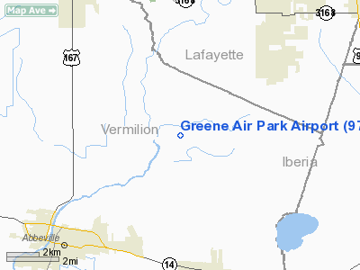
Location &
QuickFacts
|
FAA
Information Effective: |
2008-09-25 |
|
Airport
Identifier: |
97LA |
|
Airport
Status: |
Operational |
|
Longitude/Latitude: |
092-03-18.7400W/30-02-01.7300N
-92.055206/30.033814 (Estimated) |
|
Elevation: |
50 ft / 15.24 m (Estimated) |
|
Land: |
10 acres |
|
From
nearest city: |
5 nautical miles S of Milton, LA |
|
Location: |
Vermilion Parish, LA |
|
Magnetic Variation: |
03E (1995) |
Owner & Manager
|
Ownership: |
Privately owned |
|
Owner: |
Greene Air Park Assn |
|
Address: |
113 St Thomas St
Lafayette, LA 70506 |
|
Phone
number: |
337-233-9454 |
|
Manager: |
James Thibodeaux |
|
Address: |
614 E. Kaliste Saloom Rd
Lafayette, LA 70506 |
|
Phone number: |
337-247-1042 |
Airport Operations and Facilities
|
Airport Use: |
Private |
|
Wind indicator: |
Yes |
|
Segmented Circle: |
No |
|
Control Tower: |
No |
|
Sectional chart: |
Houston |
|
Region: |
ASW - Southwest |
|
Boundary ARTCC: |
ZHU - Houston |
|
Tie-in FSS: |
DRI - De Ridder |
|
FSS on Airport: |
No |
|
FSS Toll Free: |
1-800-WX-BRIEF |
Airport
Communications
|
Runway Information
Runway 09/27
|
Dimension: |
2400 x 10 ft / 731.5 x 3.0 m |
|
Surface: |
TURF, |
|
|
Runway 09
|
Runway 27
|
|
Traffic
Pattern: |
Left |
Left |
|
Displaced
threshold: |
200.00 ft |
0.00 ft |
|
Obstruction: |
23 ft tank, 300.0 ft from runway |
|
|
Radio Navigation Aids
|
ID |
Type |
Name |
Ch |
Freq |
Var |
Dist |
|
AR |
NDB |
Acadi |
|
269.00 |
03E |
11.0 nm |
|
OPL |
NDB |
St Landry |
|
335.00 |
04E |
37.4 nm |
|
ECY |
NDB |
Eunice |
|
263.00 |
02E |
37.6 nm |
|
PTN |
NDB |
Patterson |
|
245.00 |
01E |
42.1 nm |
|
HZ |
NDB |
Hazer |
|
356.00 |
04E |
46.5 nm |
|
LRR |
NDB |
Allen Parish |
|
379.00 |
03E |
49.1 nm |
|
LLA |
VOR/DME |
White Lake |
041X |
110.40 |
04E |
27.8 nm |
|
LFT |
VORTAC |
Lafayette |
035X |
109.80 |
03E |
10.2 nm |
|
BTR |
VORTAC |
Baton Rouge |
112X |
116.50 |
06E |
47.9 nm |
Remarks
-
PRVDD RY LNDG
THLD LCTD OR DSPLCD 20:1 TO PRVD CLEARANCE OVER OBSTN IN RY APCH AREAS; 40:1
DEP SLOPE; MAINTAIN RY PROTECTION ZONE FOR PR RD AT MIN 15 FT ABOVE HIGHEST
MOBILE OBJECT USING RD INCLUDING WARNING SIGNS.
Based Aircraft
|
Aircraft based
on field: |
5 |
|
Single Engine
Airplanes: |
3 |
|
Ultralights: |
2 |
Greene Air Park Airport
Address:
Vermilion Parish, LA
Tel:
337-233-9454,
337-247-1042
Images
and information placed above are from
http://www.airport-data.com/airport/97LA/
We
thank them for the data!
|
General Info |
| Country |
United
States |
| State |
LOUISIANA |
| FAA ID |
97LA
|
| Latitude |
30-02-01.730N |
|
Longitude |
092-03-18.740W |
|
Elevation |
50 feet
|
| Near
City |
MILTON
|
We don't guarantee the information is fresh and accurate. The data may
be wrong or outdated.
For more up-to-date information please refer to other sources.
|
|


