 |
|
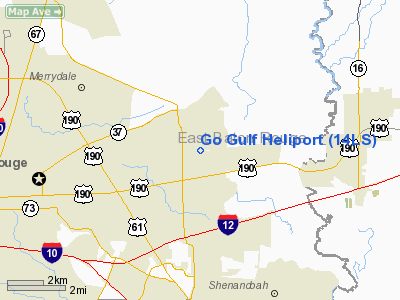
Location &
QuickFacts
|
FAA
Information Effective: |
2008-09-25 |
|
Airport
Identifier: |
14LS |
|
Airport
Status: |
Operational |
|
Longitude/Latitude: |
091-02-51.8000W/30-28-23.8000N
-91.047722/30.473278 (Estimated) |
|
Elevation: |
50 ft / 15.24 m (Estimated) |
|
Land: |
0 acres |
|
From
nearest city: |
1 nautical miles SW of Baton Rouge, LA |
|
Location: |
East Baton Rouge Parish, LA |
|
Magnetic
Variation: |
() |
Owner & Manager
|
Ownership: |
Privately owned |
|
Owner: |
Roger B. Hooper |
|
Address: |
11910 Richcroft Ave
Baton Rouge, LA 70814 |
|
Phone
number: |
225-274-1083 |
|
Manager: |
Roger B. Hooper |
|
Address: |
11950 Richcroft Ave
Baton Rouge, LA 70814 |
|
Phone number: |
225-274-1083 |
Airport Operations and Facilities
|
Airport
Use: |
Private |
|
Control
Tower: |
No |
|
Sectional chart: |
Houston |
|
Region: |
ASW - Southwest |
|
Boundary
ARTCC: |
ZHU - Houston |
|
Tie-in
FSS: |
DRI - De Ridder |
|
FSS Toll
Free: |
1-800-WX-BRIEF |
|
Runway Information
Helipad H1
|
Dimension: |
400 x 150 ft / 121.9 x 45.7 m |
|
Surface: |
TURF, |
|
|
Runway H1
|
Runway
|
|
Traffic
Pattern: |
Left |
Left |
|
Radio Navigation Aids
|
ID |
Type |
Name |
Ch |
Freq |
Var |
Dist |
|
HZ |
NDB |
Hazer |
|
356.00 |
04E |
24.8 nm |
|
MS |
NDB |
Kinte |
|
338.00 |
03E |
43.1 nm |
|
PTN |
NDB |
Patterson |
|
245.00 |
01E |
48.0 nm |
|
HMU |
VOR |
Hammond |
|
109.60 |
03E |
32.8 nm |
|
RQR |
VOR/DME |
Reserve |
045X |
110.80 |
02E |
33.2 nm |
|
BTR |
VORTAC |
Baton Rouge |
112X |
116.50 |
06E |
12.8 nm |
|
TBD |
VORTAC |
Tibby |
057X |
112.00 |
02E |
49.9 nm |
Go Gulf Heliport
Address:
East Baton Rouge Parish, LA
Tel:
225-274-1083
We don't guarantee the information is fresh and accurate. The data may
be wrong or outdated.
For more up-to-date information please refer to other sources.
|
|


