 |
|
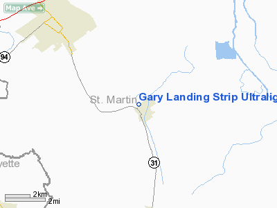
Gary Landing Strip Ultralight |
Location &
QuickFacts
|
FAA
Information Effective: |
2008-09-25 |
|
Airport
Identifier: |
LA91 |
|
Airport
Status: |
Operational |
|
Longitude/Latitude: |
091-50-00.4150W/30-13-16.7170N
-91.833449/30.221310 (Estimated) |
|
Elevation: |
21 ft / 6.40 m (Estimated) |
|
Land: |
0 acres |
|
From
nearest city: |
1 nautical miles N of Parks, LA |
|
Location: |
St Martin Parish, LA |
|
Magnetic Variation: |
04E (1985) |
Owner & Manager
|
Ownership: |
Privately owned |
|
Owner: |
Louis Gary |
|
Address: |
P.o. Box 2638 Hwy 31
Parks, LA 70582 |
|
Phone
number: |
318-845-4744 |
|
Manager: |
Michael Gary |
|
Address: |
4973 Main Highway
St Martinville, LA 70582 |
|
Phone number: |
337-332-2508 |
Airport Operations and Facilities
|
Airport
Use: |
Private |
|
Wind
indicator: |
Yes |
|
Segmented Circle: |
No |
|
Control
Tower: |
No |
|
Sectional chart: |
Houston |
|
Region: |
ASW - Southwest |
|
Boundary
ARTCC: |
ZHU - Houston |
|
Tie-in
FSS: |
DRI - De Ridder |
|
FSS on
Airport: |
No |
|
FSS Toll
Free: |
1-800-WX-BRIEF |
|
Runway Information
Runway 05/23
|
Dimension: |
2700 x 80 ft / 823.0 x 24.4 m |
|
Surface: |
TURF, |
|
|
Runway 05
|
Runway 23
|
|
Traffic
Pattern: |
Left |
Left |
|
Radio Navigation Aids
|
ID |
Type |
Name |
Ch |
Freq |
Var |
Dist |
|
AR |
NDB |
Acadi |
|
269.00 |
03E |
16.0 nm |
|
OPL |
NDB |
St Landry |
|
335.00 |
04E |
29.5 nm |
|
HZ |
NDB |
Hazer |
|
356.00 |
04E |
30.5 nm |
|
ECY |
NDB |
Eunice |
|
263.00 |
02E |
37.8 nm |
|
PTN |
NDB |
Patterson |
|
245.00 |
01E |
40.0 nm |
|
BWK |
NDB |
Bunkie |
|
397.00 |
03E |
43.9 nm |
|
LLA |
VOR/DME |
White Lake |
041X |
110.40 |
04E |
43.8 nm |
|
LFT |
VORTAC |
Lafayette |
035X |
109.80 |
03E |
8.4 nm |
|
BTR |
VORTAC |
Baton Rouge |
112X |
116.50 |
06E |
32.2 nm |
Based Aircraft
|
Aircraft based
on field: |
1 |
|
Ultralights: |
1 |
Gary Landing Strip Ultralight
Address:
St Martin Parish, LA
Tel:
318-845-4744,
337-332-2508
Images
and information placed above are from
http://www.airport-data.com/airport/LA91/
We
thank them for the data!
|
General Info |
| Country |
United
States |
| State |
LOUISIANA |
| FAA ID |
LA91
|
| Latitude |
30-13-16.717N |
|
Longitude |
091-50-00.415W |
|
Elevation |
21 feet
|
| Near
City |
PARKS
|
We don't guarantee the information is fresh and accurate. The data may
be wrong or outdated.
For more up-to-date information please refer to other sources.
|
|


