 |
|
|
|
|
|
Location &
QuickFacts
|
FAA
Information Effective: |
2008-09-25 |
|
Airport
Identifier: |
2R7 |
|
Airport
Status: |
Operational |
|
Longitude/Latitude: |
090-06-45.0000W/30-49-10.0000N
-90.112500/30.819444 (Estimated) |
|
Elevation: |
175 ft / 53.34 m (Estimated) |
|
Land: |
31 acres |
|
From
nearest city: |
3 nautical miles SE of Franklinton, LA |
|
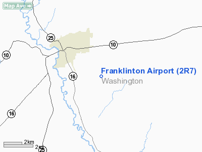
Location: |
Washington Parish, LA |
|
Magnetic Variation: |
03E (1985) |
Owner & Manager
|
Ownership: |
Publicly owned |
|
Owner: |
Town Of Franklinton |
|
Address: |
301 11th Ave
Franklinton, LA 70438 |
|
Phone number: |
985-839-3569 |
|
Manager: |
Tom Shedd |
|
Address: |
2023 Longleaf St.
Franklinton, LA 70438 |
|
Phone number: |
985-839-9155 |
Airport
Operations and Facilities
|
Airport
Use: |
Open to public |
|
Wind
indicator: |
Yes |
|
Segmented Circle: |
No |
|
Control
Tower: |
No |
|
Lighting
Schedule: |
DUSK-DAWN
MIRL RY 13/31 PRESET LOW INTST; TO INCR INTST ACTVT - 122.8. |
|
Beacon
Color: |
Clear-Green (lighted land airport) |
|
Landing
fee charge: |
No |
|
Sectional chart: |
New Orleans |
|
Region: |
ASW - Southwest |
|
Boundary
ARTCC: |
ZHU - Houston |
|
Tie-in
FSS: |
DRI - De Ridder |
|
FSS on
Airport: |
No |
|
FSS Toll
Free: |
1-800-WX-BRIEF |
|
NOTAMs
Facility: |
DRI (NOTAM-d service avaliable) |
Airport Communications
Airport Services
|
Airframe
Repair: |
MAJOR
FOR AIRFRAME/POWER PLANT REPAIRS CALL 504-839-9155. |
|
Power
Plant Repair: |
MAJOR |
|
Bottled
Oxygen: |
NONE |
|
Bulk
Oxygen: |
NONE |
|
Runway Information
Runway 13/31
|
Dimension: |
3000 x 75 ft / 914.4 x 22.9 m |
|
Surface: |
ASPH, Good Condition |
|
Weight Limit: |
Single wheel: 20000 lbs. |
|
Edge Lights: |
Medium |
|
|
Runway 13
|
Runway 31
|
|
Traffic
Pattern: |
Left |
Left |
|
Markings: |
Non-precision instrument, Good Condition |
Non-precision instrument, Good Condition |
|
Crossing
Height: |
24.00 ft |
27.00 ft |
|
VASI: |
2-box SAVASI on left side
& 31 SAVASI OTS INDEFLY. |
2-box SAVASI on left side |
|
Visual
Glide Angle: |
4.40° |
5.00° |
|
Obstruction: |
78 ft trees, 900.0 ft from runway, 140 ft left of
centerline, 9:1 slope to clear |
45 ft trees, 1000.0 ft from runway, 125 ft right of
centerline, 17:1 slope to clear |
|
Radio Navigation Aids
|
ID |
Type |
Name |
Ch |
Freq |
Var |
Dist |
|
BX |
NDB |
Carma |
|
353.00 |
02E |
13.4 nm |
|
FNA |
NDB |
Florenville |
|
371.00 |
03E |
28.6 nm |
|
MJD |
NDB |
Picayune |
|
276.00 |
01E |
30.7 nm |
|
FOH |
NDB |
Foxworth |
|
331.00 |
05E |
32.4 nm |
|
MC |
NDB |
Ferni |
|
413.00 |
03E |
33.2 nm |
|
DEF |
NDB |
Slidell |
|
256.00 |
03E |
34.6 nm |
|
HS |
NDB |
Hanco |
|
221.00 |
01E |
40.6 nm |
|
AYI |
NDB |
Hanco |
|
221.00 |
03E |
40.6 nm |
|
BVV |
NDB |
Brookhaven |
|
407.00 |
03E |
49.8 nm |
|
HMU |
VOR |
Hammond |
|
109.60 |
03E |
24.0 nm |
|
PCU |
VOR/DME |
Picayune |
059X |
112.20 |
05E |
25.1 nm |
|
MCB |
VORTAC |
Mc Comb |
114X |
116.70 |
03E |
30.1 nm |
|
NEW |
VOT |
New Orleans Lakefront |
|
111.00 |
|
47.1 nm |
Based Aircraft
|
Aircraft based
on field: |
3 |
|
Single Engine
Airplanes: |
3 |
Operational Statistics
Time Period: 2007-03-12 - 2008-03-10
|
Aircraft
Operations: |
250/Week |
|
General
Aviation Local: |
61.5% |
|
General
Aviation Itinerant: |
38.5% |
Franklinton Airport
Address:
Washington Parish, LA
Tel:
985-839-3569, 985-839-9155
Images
and information placed above are from
http://www.airport-data.com/airport/2R7/
We
thank them for the data!
|
General Info |
| Country |
United
States |
| State |
LOUISIANA |
| FAA ID |
2R7
|
| Latitude |
30-49-10.000N |
|
Longitude |
090-06-45.000W |
|
Elevation |
175 feet
|
| Near
City |
FRANKLINTON |
We don't guarantee the information is fresh and accurate. The data may
be wrong or outdated.
For more up-to-date information please refer to other sources.
|
|


