 |
|
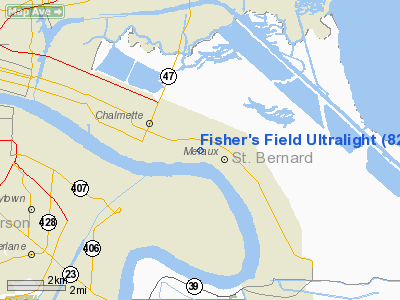
Fisher's Field Ultralight |
Location &
QuickFacts
|
FAA
Information Effective: |
2008-09-25 |
|
Airport
Identifier: |
82LA |
|
Airport
Status: |
Operational |
|
Longitude/Latitude: |
089-55-58.2420W/29-55-56.7330N
-89.932845/29.932426 (Estimated) |
|
Elevation: |
5 ft / 1.52 m (Estimated) |
|
Land: |
6 acres |
|
From
nearest city: |
2 nautical miles W of Chalmette, LA |
|
Location: |
St Bernard Parish, LA |
|
Magnetic Variation: |
03E (1985) |
Owner & Manager
|
Ownership: |
Privately owned |
|
Owner: |
Michael Fisher |
|
Address: |
P O Box 1838
Meraux, LA 70075 |
|
Phone number: |
504-271-2982 |
|
Address: |
|
Airport Operations and Facilities
|
Airport
Use: |
Private |
|
Segmented Circle: |
No |
|
Control
Tower: |
No |
|
Sectional chart: |
New Orleans |
|
Region: |
ASW - Southwest |
|
Boundary
ARTCC: |
ZHU - Houston |
|
Tie-in
FSS: |
DRI - De Ridder |
|
FSS Toll
Free: |
1-800-WX-BRIEF |
|
Runway Information
Runway NE/SW
|
Dimension: |
1200 x 200 ft / 365.8 x 61.0 m |
|
Surface: |
TURF, |
|
|
Runway NE
|
Runway SW
|
|
Traffic
Pattern: |
Left |
Left |
|
Obstruction: |
50 ft trees, 10.0 ft from runway |
50 ft trees, 10.0 ft from runway |
|
Radio Navigation Aids
|
ID |
Type |
Name |
Ch |
Freq |
Var |
Dist |
|
DEF |
NDB |
Slidell |
|
256.00 |
03E |
22.5 nm |
|
MS |
NDB |
Kinte |
|
338.00 |
03E |
24.9 nm |
|
FNA |
NDB |
Florenville |
|
371.00 |
03E |
29.6 nm |
|
MJD |
NDB |
Picayune |
|
276.00 |
01E |
36.8 nm |
|
AYI |
NDB |
Hanco |
|
221.00 |
03E |
39.8 nm |
|
HS |
NDB |
Hanco |
|
221.00 |
01E |
39.8 nm |
|
HMU |
VOR |
Hammond |
|
109.60 |
03E |
43.3 nm |
|
RQR |
VOR/DME |
Reserve |
045X |
110.80 |
02E |
35.4 nm |
|
PCU |
VOR/DME |
Picayune |
059X |
112.20 |
05E |
39.2 nm |
|
HRV |
VORTAC |
Harvey |
088X |
114.10 |
02E |
6.1 nm |
|
LEV |
VORTAC |
Leeville |
082X |
113.50 |
02E |
46.4 nm |
|
TBD |
VORTAC |
Tibby |
057X |
112.00 |
02E |
49.4 nm |
|
NEW |
VOT |
New Orleans Lakefront |
|
111.00 |
|
8.1 nm |
Fisher's Field Ultralight
Address:
St Bernard Parish, LA
Tel:
504-271-2982
Images
and information placed above are from
http://www.airport-data.com/airport/82LA/
We
thank them for the data!
|
General Info |
| Country |
United
States |
| State |
LOUISIANA |
| FAA ID |
82LA
|
| Latitude |
29-55-56.733N |
|
Longitude |
089-55-58.242W |
|
Elevation |
5 feet
|
| Near
City |
CHALMETTE |
We don't guarantee the information is fresh and accurate. The data may
be wrong or outdated.
For more up-to-date information please refer to other sources.
|
|


