 |
|
False River Regional Airport |
| False River Regional Airport |
| IATA: HZR â ICAO: KHZR â FAA LID: HZR |
| Summary |
| Airport type |
Public |
| Owner |
New Roads & Pointe Coupee Parish |
| Serves |
New Roads, Louisiana |
| Elevation AMSL |
40 ft / 12 m |
| Coordinates |
30°43â²06â³N 091°28â²43â³W / 30.71833°N 91.47861°W / 30.71833; -91.47861 |
| Website |
FalseRiverRegionalAirport.com |
| Runways |
| Direction |
Length |
Surface |
| ft |
m |
| 18/36 |
5,003 |
1,525 |
Asphalt |
| Statistics (2009) |
| Aircraft operations |
50,125 |
| Based aircraft |
26 |
| Source: Federal Aviation Administration |
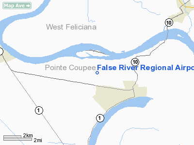
False River Regional Airport (IATA: HZR, ICAO: KHZR, FAA LID: HZR) is a public use airport located two nautical miles (3.7 km) northwest of the central business district of New Roads, a city in Pointe Coupee Parish, Louisiana, United States. The airport is owned by New Roads and Pointe Coupee Parish. According to the FAA's National Plan of Integrated Airport Systems for 2009â2013, it was classified as a general aviation airport.
Facilities and aircraft
False River Regional Airport covers an area of 103 acres (42 ha) at an elevation of 40 feet (12 m) above mean sea level. It has one runway designated 18/36 with an asphalt surface measuring 5,003 by 75 feet (1,525 x 23 m).
The airport has a terminal building, three corporate hangars, six T-hangars, and two privately owned hangars. An additional seven T-hangars are under construction. The services and facilities include: flight training, airport management, aircraft parking (ramp/tie down), flight planning, computerized weather, a pilots lounge, restrooms, ground transportation, and rental cars.
For the 12-month period ending January 28, 2009, the airport had 50,125 aircraft operations, an average of 137 per day: 99.8% general aviation and 0.2% military. At that time there were 26 aircraft based at this airport: 81% single-engine, 8% multi-engine, 8% helicopter and 4% glider.
The above content comes from Wikipedia and is published under free licenses – click here to read more.
Location &
QuickFacts
|
FAA
Information Effective: |
2008-09-25 |
|
Airport
Identifier: |
HZR |
|
Airport
Status: |
Operational |
|
Longitude/Latitude: |
091-28-43.2000W/30-43-05.9000N
-91.478667/30.718306 (Estimated) |
|
Elevation: |
40 ft / 12.19 m (Surveyed) |
|
Land: |
110 acres |
|
From
nearest city: |
2 nautical miles NW of New Roads, LA |
|
Location: |
Pointe Coupee Parish, LA |
|
Magnetic Variation: |
04E (1985) |
Owner & Manager
|
Ownership: |
Publicly owned |
|
Owner: |
New Rds-pointe Coupee Parish |
|
Address: |
Po Box 97
New Roads, LA 70760 |
|
Phone
number: |
225-638-3192 |
|
Manager: |
Yvonne Chennevert |
|
Address: |
Po Box 97
New Roads, LA 70760 |
|
Phone number: |
225-638-3192 |
Airport Operations and Facilities
|
Airport
Use: |
Open to public |
|
Wind
indicator: |
Yes |
|
Segmented Circle: |
No |
|
Control
Tower: |
No |
|
Lighting
Schedule: |
DUSK-DAWN
MIRL RY 18/36 & ODALS RY 36 PRESET LOW INTST; TO INCR INTST & ACTVT
REIL RYS 18 & 36 - CTAF. |
|
Beacon
Color: |
Clear-Green (lighted land airport) |
|
Landing
fee charge: |
No |
|
Sectional chart: |
Houston |
|
Region: |
ASW - Southwest |
|
Traffic
Pattern Alt: |
834 ft |
|
Boundary
ARTCC: |
ZHU - Houston |
|
Tie-in
FSS: |
DRI - De Ridder |
|
FSS on
Airport: |
No |
|
FSS Toll
Free: |
1-800-WX-BRIEF |
|
NOTAMs
Facility: |
DRI (NOTAM-d service avaliable) |
|
Federal Agreements: |
NGY |
Airport Communications
|
CTAF: |
122.800 |
|
Unicom: |
122.800 |
Airport Services
|
Fuel
available: |
100LL
SELF-SERVICE FUEL AVBL 24 HRS. |
|
Runway Information
Runway 18/36
|
Dimension: |
5003 x 75 ft / 1524.9 x 22.9 m |
|
Surface: |
ASPH, Good Condition |
|
Weight Limit: |
Single wheel: 14000 lbs. |
|
Edge Lights: |
Medium |
|
|
Runway 18
|
Runway 36
|
|
Longitude: |
091-28-41.0296W |
091-28-45.3317W |
|
Latitude: |
30-43-30.6337N |
30-42-41.2592N |
|
Elevation: |
40.00 ft |
33.00 ft |
|
Alignment: |
127 |
4 |
|
ILS Type: |
|
LOCALIZER |
|
Traffic
Pattern: |
Left |
Left |
|
Markings: |
Non-precision instrument, Good Condition |
Non-precision instrument, Good Condition |
|
Crossing
Height: |
62.00 ft |
50.00 ft |
|
VASI: |
2-light PAPI on left side |
2-light PAPI on left side |
|
Visual
Glide Angle: |
3.25° |
3.00° |
|
Approach
lights: |
|
ODALS |
|
Runway End
Identifier: |
Yes |
Yes |
|
Obstruction: |
70 ft trees, 1160.0 ft from runway, 225 ft left of
centerline, 13:1 slope to clear |
, 50:1 slope to clear |
|
Radio Navigation Aids
|
ID |
Type |
Name |
Ch |
Freq |
Var |
Dist |
|
HZ |
NDB |
Hazer |
|
356.00 |
04E |
5.1 nm |
|
OPL |
NDB |
St Landry |
|
335.00 |
04E |
32.3 nm |
|
MKV |
NDB |
Marksville |
|
347.00 |
02E |
38.1 nm |
|
BWK |
NDB |
Bunkie |
|
397.00 |
03E |
40.0 nm |
|
AR |
NDB |
Acadi |
|
269.00 |
03E |
50.0 nm |
|
BTR |
VORTAC |
Baton Rouge |
112X |
116.50 |
06E |
17.0 nm |
|
LFT |
VORTAC |
Lafayette |
035X |
109.80 |
03E |
41.3 nm |
Remarks
-
GCO AVBL ON FREQ
135.075 THRU DRI AFSS.
-
PAEW ON ARPT.
Based Aircraft
|
Aircraft based
on field: |
26 |
|
Single Engine
Airplanes: |
21 |
|
Multi Engine
Airplanes: |
2 |
|
Helicopters: |
2 |
|
Gliders: |
1 |
Operational Statistics
Time Period: 2007-01-24 - 2008-01-23
|
Aircraft
Operations: |
138/Day |
|
General
Aviation Local: |
69.8% |
|
General
Aviation Itinerant: |
29.9% |
|
Military: |
0.2% |
False River Regional Airport
Address:
Pointe Coupee Parish, LA
Tel:
225-638-3192
Images
and information placed above are from
http://www.airport-data.com/airport/HZR/
We
thank them for the data!
|
General Info |
| Country |
United
States |
| State |
LOUISIANA |
| FAA ID |
HZR
|
| Latitude |
30-43-05.964N |
|
Longitude |
091-28-43.211W |
|
Elevation |
39 feet
|
| Near
City |
NEW
ROADS |
We don't guarantee the information is fresh and accurate. The data may
be wrong or outdated.
For more up-to-date information please refer to other sources.
|
|


