 |
|
|
|
|
|
Location &
QuickFacts
|
FAA
Information Effective: |
2008-09-25 |
|
Airport
Identifier: |
0LA7 |
|
Airport
Status: |
Operational |
|
Longitude/Latitude: |
089-58-03.2580W/29-15-20.8180N
-89.967572/29.255783 (Estimated) |
|
Elevation: |
6 ft / 1.83 m (Estimated) |
|
Land: |
0 acres |
|
From
nearest city: |
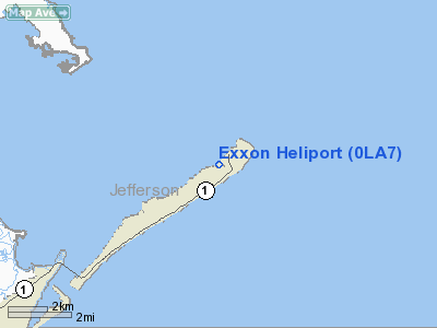
1 nautical miles NE of Grand Isle, LA |
|
Location: |
Jefferson Parish, LA |
|
Magnetic Variation: |
03E (1985) |
Owner & Manager
|
Ownership: |
Privately owned |
|
Owner: |
Exxon Mobil |
|
Address: |
396 West Greens Rd Corp-wgr-520
Houston, TX 77067 |
|
Phone
number: |
713-431-1273 |
|
Manager: |
Tom Suhrhoff |
|
Address: |
396 Westgreens Rd, Corp-wgr-520
Houston, TX 77067
EXXON, PO BOX 100, GRAND ISLE, LA 70358.
504-787-5331. |
|
Phone
number: |
713-431-1273 |
Airport
Operations and Facilities
|
Airport
Use: |
Private |
|
Wind
indicator: |
Yes |
|
Segmented Circle: |
No |
|
Control
Tower: |
No |
|
Lighting
Schedule: |
PHONE REQ
FOR PERIMETER LGTS, PHONE 504-561-4314. |
|
Landing fee charge: |
No |
|
Sectional chart: |
New Orleans |
|
Region: |
ASW - Southwest |
|
Boundary ARTCC: |
ZHU - Houston |
|
Tie-in FSS: |
DRI - De Ridder |
|
FSS on Airport: |
No |
|
FSS Toll Free: |
1-800-WX-BRIEF |
Airport Services
|
Fuel
available: |
A |
|
Airframe
Repair: |
NONE |
|
Power
Plant Repair: |
NONE |
|
Runway Information
Helipad H1
|
Dimension: |
750 x 25 ft / 228.6 x 7.6 m |
|
Surface: |
ASPH, |
|
|
Runway H1
|
Runway
|
|
Traffic
Pattern: |
Left |
Left |
|
Radio Navigation Aids
|
ID |
Type |
Name |
Ch |
Freq |
Var |
Dist |
|
LEV |
VORTAC |
Leeville |
082X |
113.50 |
02E |
8.6 nm |
|
HRV |
VORTAC |
Harvey |
088X |
114.10 |
02E |
35.8 nm |
|
NEW |
VOT |
New Orleans Lakefront |
|
111.00 |
|
47.2 nm |
Based Aircraft
|
Aircraft based
on field: |
5 |
|
Helicopters: |
5 |
Exxon Heliport
Address:
Jefferson Parish, LA
Tel:
713-431-1273
Images
and information placed above are from
http://www.airport-data.com/airport/0LA7/
We
thank them for the data!
|
General Info |
| Country |
United
States |
| State |
LOUISIANA |
| FAA ID |
0LA7
|
| Latitude |
29-15-20.818N |
|
Longitude |
089-58-03.258W |
|
Elevation |
6 feet
|
| Near
City |
GRAND
ISLE |
We don't guarantee the information is fresh and accurate. The data may
be wrong or outdated.
For more up-to-date information please refer to other sources.
|
|


