 |
|
|
|
|
|
Location &
QuickFacts
|
FAA
Information Effective: |
2008-09-25 |
|
Airport
Identifier: |
4R7 |
|
Airport
Status: |
Operational |
|
Longitude/Latitude: |
092-25-25.6770W/30-27-58.6220N
-92.423799/30.466284 (Estimated) |
|
Elevation: |
42 ft / 12.80 m (Surveyed) |
|
Land: |
74 acres |
|
From
nearest city: |
2 nautical miles S of Eunice, LA |
|
Location: |
Acadia Parish, LA |
|
Magnetic Variation: |
02E (2005) |
Owner & Manager
|
Ownership: |
Publicly owned |
|
Owner: |
City Of Eunice |
|
Address: |
Po Box 1106
Eunice, LA 70535 |
|
Phone number: |
337-457-7389 |
|
Manager: |
Drew Miller |
|
Address: |
252 Airport Road
Eunice, LA 70535 |
|
Phone number: |
337-457-6585 |
Airport
Operations and Facilities
|
Airport
Use: |
Open to public |
|
Wind
indicator: |
Yes |
|
Segmented Circle: |
Yes |
|
Control
Tower: |
No |
|
Lighting
Schedule: |
DUSK-DAWN
MIRL RY 16/34 & REIL RYS 16 & 34 PRESET LOW INTST; TO INCR INTST ACTVT
- CTAF. |
|
Beacon
Color: |
Clear-Green (lighted land airport) |
|
Landing
fee charge: |
No |
|
Sectional chart: |
Houston |
|
Region: |
ASW - Southwest |
|
Boundary
ARTCC: |
ZHU - Houston |
|
Tie-in
FSS: |
DRI - De Ridder |
|
FSS on
Airport: |
No |
|
FSS Toll
Free: |
1-800-WX-BRIEF |
|
NOTAMs
Facility: |
DRI (NOTAM-d service avaliable) |
|
Federal Agreements: |
NGY |
Airport Communications
|
CTAF: |
122.800 |
|
Unicom: |
122.800 |
Airport Services
|
Fuel
available: |
100LLA MOGAS
FOR FUEL AFT HRS CALL 337-457-6585. |
|
Airframe
Repair: |
MINOR |
|
Power
Plant Repair: |
MINOR |
|
Bottled
Oxygen: |
NONE |
|
Bulk
Oxygen: |
NONE |
|
Runway Information
Runway 16/34
|
Dimension: |
5001 x 75 ft / 1524.3 x 22.9 m |
|
Surface: |
ASPH, Good Condition |
|
Weight Limit: |
Single wheel: 21000 lbs. |
|
Edge Lights: |
Medium |
|
|
Runway 16
|
Runway 34
|
|
Longitude: |
092-25-32.6760W |
092-25-18.7640W |
|
Latitude: |
30-28-22.6550N |
30-27-34.6410N |
|
Elevation: |
39.00 ft |
42.00 ft |
|
Alignment: |
127 |
127 |
|
Traffic
Pattern: |
Left |
Left |
|
Markings: |
Non-precision instrument, Good Condition |
Non-precision instrument, Good Condition |
|
Crossing
Height: |
52.00 ft |
50.00 ft |
|
VASI: |
2-light PAPI on left side |
2-light PAPI on left side |
|
Visual
Glide Angle: |
3.00° |
3.00° |
|
Runway End
Identifier: |
Yes |
Yes |
|
Obstruction: |
60 ft trees, 1500.0 ft from runway, 21:1 slope to clear |
25 ft trees, 912.0 ft from runway, 28:1 slope to clear |
|
Radio Navigation Aids
|
ID |
Type |
Name |
Ch |
Freq |
Var |
Dist |
|
POE |
FAN MARKER |
South |
|
|
07E |
49.1 nm |
|
ECY |
NDB |
Eunice |
|
263.00 |
02E |
5.8 nm |
|
LRR |
NDB |
Allen Parish |
|
379.00 |
03E |
17.3 nm |
|
OPL |
NDB |
St Landry |
|
335.00 |
04E |
20.3 nm |
|
BWK |
NDB |
Bunkie |
|
397.00 |
03E |
25.9 nm |
|
MKV |
NDB |
Marksville |
|
347.00 |
02E |
41.9 nm |
|
AR |
NDB |
Acadi |
|
269.00 |
03E |
42.3 nm |
|
HZ |
NDB |
Hazer |
|
356.00 |
04E |
49.4 nm |
|
LLA |
VOR/DME |
White Lake |
041X |
110.40 |
04E |
48.3 nm |
|
LFT |
VORTAC |
Lafayette |
035X |
109.80 |
03E |
27.7 nm |
|
LCH |
VORTAC |
Lake Charles |
081X |
113.40 |
07E |
40.4 nm |
|
AEX |
VORTAC |
Alexandria |
108X |
116.10 |
03E |
47.7 nm |
Remarks
-
GCO AVBL ON FREQ
135.075 THRU LAFAYETTE APCH & DRI AFSS.
Based Aircraft
|
Aircraft based
on field: |
18 |
|
Single Engine
Airplanes: |
15 |
|
Multi Engine
Airplanes: |
2 |
|
Ultralights: |
1 |
Operational Statistics
Time Period: 2006-09-19 - 2007-09-18
|
Aircraft
Operations: |
289/Week |
|
General
Aviation Local: |
66.7% |
|
General
Aviation Itinerant: |
33.3% |
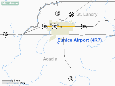
Eunice Airport
Address:
Acadia Parish, LA
Tel:
337-457-7389, 337-457-6585
Images
and information placed above are from
http://www.airport-data.com/airport/4R7/
We
thank them for the data!
|
General Info |
| Country |
United
States |
| State |
LOUISIANA |
| FAA ID |
4R7
|
| Latitude |
30-27-58.622N |
|
Longitude |
092-25-25.677W |
|
Elevation |
42 feet
|
| Near
City |
EUNICE
|
We don't guarantee the information is fresh and accurate. The data may
be wrong or outdated.
For more up-to-date information please refer to other sources.
|
|


